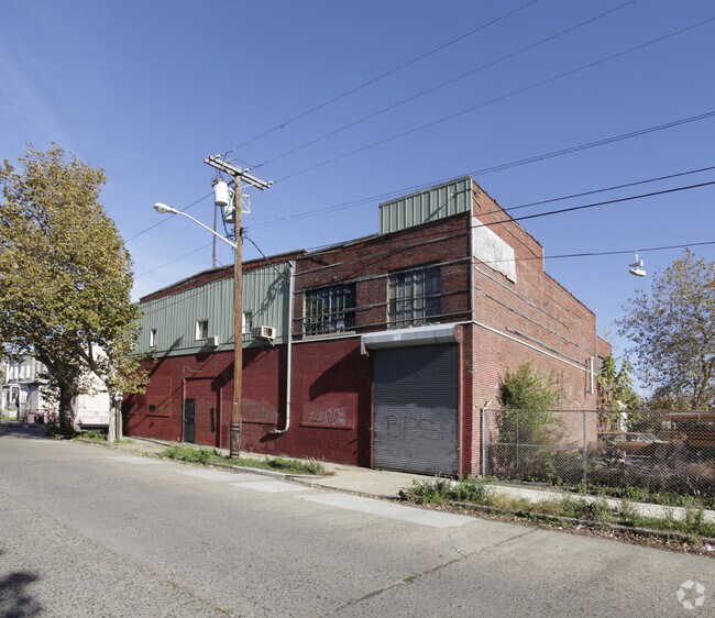
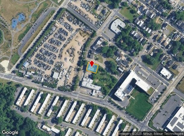
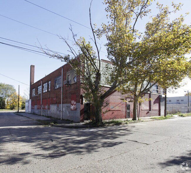
Property Record
1590 Pierce Ave, Camden, NJ 08105

NEARBY LISTINGS FOR SALE OR LEASE
Property Detail
1590 Pierce Ave
Philadelphia-Camden-Wilmington, PA-NJ-DE-MD
Romar Realty Co
08-00818-0000-00049
INCL BLK 1297 LOT 27 BLK 818 LOTS 49 27 28
Commercialnec
Camden
AE
New Jersey
34007C0028F
49
2024
0.18 AC
2025
Camden County
600900
Philadelphia
DEMOGRAPHICS near 1590 Pierce Ave
1 Mile
3 Mile
5 Mile
2024 Total Population
18,992
239,807
805,596
2029 Population
19,156
238,407
792,068
Pop Growth 2024-2029
+ 0.86%
(0.58%)
(1.68%)
Average Age
35
37
37
2024 Total Households
6,094
99,443
333,950
HH Growth 2024-2029
+ 0.87%
(0.93%)
(1.94%)
Median Household Inc
$29,616
$69,700
$61,451
Avg Household Size
2.90
2.30
2.30
2024 Avg HH Vehicles
1.00
1.00
1.00
Median Home Value
$128,264
$272,214
$262,379
Median Year Built
1949
1950
1948
Nearby Places
Map Layers
Map Styles
 Street
 Aerial
- Restaurants
- Banks
- Shops
- Fitness
- Groceries
PUBLIC TRANSPORTATION
COMMUTER RAIL
DRIVE
WALK
Distance
7 min
3.5 mi
Market East (R1 - Southeastern Pennsylvania Transportation Authority Regional Rail (SEPTA Regional Rail), R2 - Southeastern Pennsylvania Transportation Authority Regional Rail (SEPTA Regional Rail), R3 - Southeastern Pennsylvania Transportation Authority Regional Rail (SEPTA Regional Rail), R5 - Southeastern Pennsylvania Transportation Authority Regional Rail (SEPTA Regional Rail), R6 - Southeastern Pennsylvania Transportation Authority Regional Rail (SEPTA Regional Rail), R7 - Southeastern Pennsylvania Transportation Authority Regional Rail (SEPTA Regional Rail), R8 - Southeastern Pennsylvania Transportation Authority Regional Rail (SEPTA Regional Rail))
DRIVE
WALK
Distance
Market East (R1 - Southeastern Pennsylvania Transportation Authority Regional Rail (SEPTA Regional Rail), R2 - Southeastern Pennsylvania Transportation Authority Regional Rail (SEPTA Regional Rail), R3 - Southeastern Pennsylvania Transportation Authority Regional Rail (SEPTA Regional Rail), R5 - Southeastern Pennsylvania Transportation Authority Regional Rail (SEPTA Regional Rail), R6 - Southeastern Pennsylvania Transportation Authority Regional Rail (SEPTA Regional Rail), R7 - Southeastern Pennsylvania Transportation Authority Regional Rail (SEPTA Regional Rail), R8 - Southeastern Pennsylvania Transportation Authority Regional Rail (SEPTA Regional Rail))
9 min
3.8 mi
AIRPORT
Philadelphia International
DRIVE
WALK
Distance
Philadelphia International
26 min
14.9 mi
Trenton Mercer
DRIVE
WALK
Distance
Trenton Mercer
52 min
35.9 mi
Nearby Properties
Address
Land Use
TOTAL SIZE
Lot Size
Zoning
Address
Land Use
TOTAL SIZE
Lot Size
Zoning
880,950 SF
27.71 AC
SPENT
Address
Land Use
TOTAL SIZE
Lot Size
Zoning
1.17 AC
Address
Land Use
TOTAL SIZE
Lot Size
Zoning
7.17 AC
Address
Land Use
TOTAL SIZE
Lot Size
Zoning
1,102,992 SF
2.14 AC
CMX5
Address
Land Use
TOTAL SIZE
Lot Size
Zoning
665,742 SF
0.98 AC
CMX4
Address
Land Use
TOTAL SIZE
Lot Size
Zoning
124.13 AC
Address
Land Use
TOTAL SIZE
Lot Size
Zoning
1,011,079 SF
5.82 AC
CMX5
Address
Land Use
TOTAL SIZE
Lot Size
Zoning
63,402 SF
0.71 AC
CMX4
Address
Land Use
TOTAL SIZE
Lot Size
Zoning
804,000 SF
4.29 AC
CMX3
Address
Land Use
TOTAL SIZE
Lot Size
Zoning
747,200 SF
0.69 AC
CMX5
Address
Land Use
TOTAL SIZE
Lot Size
Zoning
12.53 AC
Address
Land Use
TOTAL SIZE
Lot Size
Zoning
139,992 SF
5.64 AC
SPPOA
Address
Land Use
TOTAL SIZE
Lot Size
Zoning
322,000 SF
7.44 AC
CMX3
Address
Land Use
TOTAL SIZE
Lot Size
Zoning
816,208 SF
2.98 AC
CMX4
Address
Land Use
TOTAL SIZE
Lot Size
Zoning
213,823 SF
2.01 AC
CMX5
Address
Land Use
TOTAL SIZE
Lot Size
Zoning
728,244 SF
5.57 AC
CMX4
Address
Land Use
TOTAL SIZE
Lot Size
Zoning
1.62 AC
Address
Land Use
TOTAL SIZE
Lot Size
Zoning
332,444 SF
1.32 AC
CMX3
Address
Land Use
TOTAL SIZE
Lot Size
Zoning
169,220 SF
2.01 AC
SPINS
Address
Land Use
TOTAL SIZE
Lot Size
Zoning
256,688 SF
1.46 AC
RMX3
Address
Land Use
TOTAL SIZE
Lot Size
Zoning
447,070 SF
0.78 AC
CMX5
Address
Land Use
TOTAL SIZE
Lot Size
Zoning
693,000 SF
1.28 AC
CMX5
Address
Land Use
TOTAL SIZE
Lot Size
Zoning
986,960 SF
1.61 AC
CMX4
Address
Land Use
TOTAL SIZE
Lot Size
Zoning
Address
Land Use
TOTAL SIZE
Lot Size
Zoning
845,230 SF
3.20 AC
CMX5
Address
Land Use
TOTAL SIZE
Lot Size
Zoning
380,040 SF
1.22 AC
ICMX
Address
Land Use
TOTAL SIZE
Lot Size
Zoning
257,040 SF
1.23 AC
CMX5
Address
Land Use
TOTAL SIZE
Lot Size
Zoning
11.06 AC
CMX3
Address
Land Use
TOTAL SIZE
Lot Size
Zoning
289,664 SF
0.22 AC
CMX3
Address
Land Use
TOTAL SIZE
Lot Size
Zoning
289,664 SF
0.22 AC
CMX3
The World's #1 Commercial Real Estate Marketplace
Connect with us
© 2025 CoStar Group
The information above has been obtained from sources believed reliable. While we do not doubt its accuracy we have not verified it and make no guarantee, warranty or representation about it. It is your responsibility to independently confirm its accuracy and completeness. Any projections, opinions, assumptions, or estimates used are for example only and do not represent the current or future performance of the property. The value of this transaction to you depends on tax and other factors which should be evaluated by your tax, financial, and legal advisors. You and your advisors should conduct a careful, independent investigation of the property to determine to your satisfaction the suitability of the property for your needs.