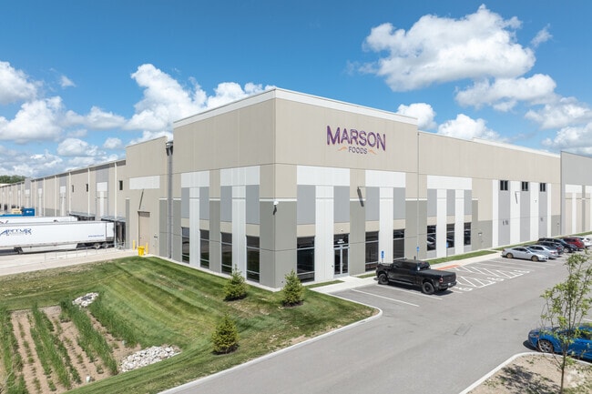
Property Record
1590 Tradeport Dr, Hazelwood, MO 63042
Current Lease Availabilities
NEARBY LISTINGS FOR SALE OR LEASE
Property Detail
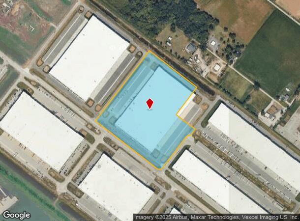
1590 Tradeport Dr
St. Louis
Hazelwood Tradeport Plat Five
St. Louis, MO-IL
HAZELWOOD TRADEPORT PLAT FIVE LOT PT 10 CHAPTER 100 ABATEMENT
08M-54-0115
St. Louis
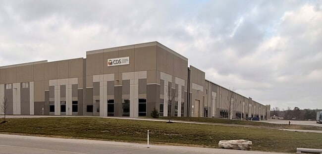
Warehouse
Missouri
2024
10
2025
22.20 AC
211401
North County
DEMOGRAPHICS near 1590 Tradeport Dr
1 Mile
3 Mile
5 Mile
2024 Total Population
1,347
29,827
109,224
2029 Population
1,320
29,109
107,939
Pop Growth 2024-2029
(2.00%)
(2.41%)
(1.18%)
Average Age
42
40
40
2024 Total Households
626
12,671
45,069
HH Growth 2024-2029
(1.92%)
(2.47%)
(1.16%)
Median Household Inc
$50,246
$60,005
$58,445
Avg Household Size
2.10
2.30
2.30
2024 Avg HH Vehicles
2.00
2.00
2.00
Median Home Value
$180,605
$153,129
$153,607
Median Year Built
1973
1968
1965
Nearby Places
- Restaurants
- Banks
- Shops
- Fitness
- Groceries
PUBLIC TRANSPORTATION
AIRPORT
St Louis Lambert International
DRIVE
WALK
Distance
St Louis Lambert International
17 min
7.6 mi
Freight Ports
Port Milwaukee
DRIVE
WALK
Distance
Port Milwaukee
436 min
380.7 mi
Nearby Properties
Address
Land Use
TOTAL SIZE
Lot Size
Zoning
Address
Land Use
TOTAL SIZE
Lot Size
Zoning
4,416 SF
54.81 AC
80B
Address
Land Use
TOTAL SIZE
Lot Size
Zoning
833,525 SF
25.53 AC
R1
Address
Land Use
TOTAL SIZE
Lot Size
Zoning
893,188 SF
71.88 AC
G
Address
Land Use
TOTAL SIZE
Lot Size
Zoning
528,000 SF
21.10 AC
80I
Address
Land Use
TOTAL SIZE
Lot Size
Zoning
662,199 SF
26.58 AC
10M-1
Address
Land Use
TOTAL SIZE
Lot Size
Zoning
491,800 SF
18.69 AC
80AG
Address
Land Use
TOTAL SIZE
Lot Size
Zoning
406,000 SF
18.82 AC
80CA
Address
Land Use
TOTAL SIZE
Lot Size
Zoning
445,715 SF
28.16 AC
80I
Address
Land Use
TOTAL SIZE
Lot Size
Zoning
343,900 SF
19.62 AC
80AG
Address
Land Use
TOTAL SIZE
Lot Size
Zoning
335,294 SF
33.83 AC
24MFD
Address
Land Use
TOTAL SIZE
Lot Size
Zoning
6.88 AC
H
Address
Land Use
TOTAL SIZE
Lot Size
Zoning
293,622 SF
28.06 AC
H
Address
Land Use
TOTAL SIZE
Lot Size
Zoning
269,258 SF
89.80 AC
80F
Address
Land Use
TOTAL SIZE
Lot Size
Zoning
534,068 SF
39.76 AC
M1
Address
Land Use
TOTAL SIZE
Lot Size
Zoning
216,000 SF
16.42 AC
80AG
Address
Land Use
TOTAL SIZE
Lot Size
Zoning
135,721 SF
5.40 AC
80F
Address
Land Use
TOTAL SIZE
Lot Size
Zoning
387,158 SF
34.19 AC
R6
Address
Land Use
TOTAL SIZE
Lot Size
Zoning
780,115 SF
17.91 AC
PD
Address
Land Use
TOTAL SIZE
Lot Size
Zoning
36.40 AC
80I
Address
Land Use
TOTAL SIZE
Lot Size
Zoning
203,240 SF
8.50 AC
80H
Address
Land Use
TOTAL SIZE
Lot Size
Zoning
213,100 SF
11.28 AC
80AG
Address
Land Use
TOTAL SIZE
Lot Size
Zoning
382,000 SF
28.06 AC
80I
Address
Land Use
TOTAL SIZE
Lot Size
Zoning
1,599,101 SF
69.43 AC
M1
Address
Land Use
TOTAL SIZE
Lot Size
Zoning
999 SF
21.20 AC
R
Address
Land Use
TOTAL SIZE
Lot Size
Zoning
78,460 SF
4.13 AC
G
Address
Land Use
TOTAL SIZE
Lot Size
Zoning
6.20 AC
24R4
Address
Land Use
TOTAL SIZE
Lot Size
Zoning
198,000 SF
8.79 AC
M1
Address
Land Use
TOTAL SIZE
Lot Size
Zoning
677,868 SF
38.75 AC
M1
Address
Land Use
TOTAL SIZE
Lot Size
Zoning
87,049 SF
7.57 AC
80AG
Address
Land Use
TOTAL SIZE
Lot Size
Zoning
236,362 SF
23.95 AC
R6
The World's #1 Commercial Real Estate Marketplace
Connect with us
© 2025 CoStar Group
The information above has been obtained from sources believed reliable. While we do not doubt its accuracy we have not verified it and make no guarantee, warranty or representation about it. It is your responsibility to independently confirm its accuracy and completeness. Any projections, opinions, assumptions, or estimates used are for example only and do not represent the current or future performance of the property. The value of this transaction to you depends on tax and other factors which should be evaluated by your tax, financial, and legal advisors. You and your advisors should conduct a careful, independent investigation of the property to determine to your satisfaction the suitability of the property for your needs.