Property Record
1590 W Youngs Ditch Rd, Bay City, MI 48708

NEARBY LISTINGS FOR SALE OR LEASE
Property Detail
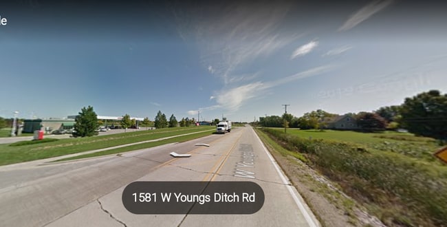
1590 W Youngs Ditch Rd
09-070-026-400-045-00
S 10 A. OF THAT PART OF THE W 25 A OF E 1/2 OF SE 1/4 LYG E OF BELT LI RR. ROW EX S 48 FT THRF. SEC 26 T14N R5E
Commercialacreage
Bay
X
Michigan
26145C0100E
9.56 AC
2025
Midland/Flint
2025
Other Market Areas
285300
Bay City, MI
DEMOGRAPHICS near 1590 W Youngs Ditch Rd
1 Mile
3 Mile
5 Mile
2024 Total Population
2,997
33,493
59,278
2029 Population
3,045
33,284
58,697
Pop Growth 2024-2029
+ 1.60%
(0.62%)
(0.98%)
Average Age
48
42
42
2024 Total Households
1,680
14,845
26,245
HH Growth 2024-2029
+ 1.90%
(0.57%)
(0.99%)
Median Household Inc
$33,208
$46,128
$50,365
Avg Household Size
1.60
2.20
2.20
2024 Avg HH Vehicles
1.00
2.00
2.00
Median Home Value
$125,752
$86,749
$89,657
Median Year Built
1972
1951
1954
Nearby Places
Map Layers
Map Styles
 Street
 Aerial
- Restaurants
- Banks
- Shops
- Fitness
- Groceries
PUBLIC TRANSPORTATION
AIRPORT
MBS International
DRIVE
WALK
Distance
MBS International
30 min
18.3 mi
Freight Ports
Port of Toledo
DRIVE
WALK
Distance
Port of Toledo
188 min
157.8 mi
SALE & LEASE HISTORY
LISTING DATE
SALE/LEASE

Nov 13, 2019
For Sale
Dec 05, 2019
For Sale
Nearby Properties
Address
Land Use
TOTAL SIZE
Lot Size
Zoning
Address
Land Use
TOTAL SIZE
Lot Size
Zoning
97,304 SF
3.61 AC
C-3 CTRL B
Address
Land Use
TOTAL SIZE
Lot Size
Zoning
167,100 SF
35.59 AC
M-2 GEN IN
Address
Land Use
TOTAL SIZE
Lot Size
Zoning
60,200 SF
9.50 AC
C-3 CTRL B
Address
Land Use
TOTAL SIZE
Lot Size
Zoning
32,759 SF
1.20 AC
Address
Land Use
TOTAL SIZE
Lot Size
Zoning
50.79 AC
Address
Land Use
TOTAL SIZE
Lot Size
Zoning
1.87 AC
C-3 CTRL B
Address
Land Use
TOTAL SIZE
Lot Size
Zoning
57,000 SF
1.09 AC
C-3 CTRL B
Address
Land Use
TOTAL SIZE
Lot Size
Zoning
50,965 SF
0.83 AC
C-3 CTRL B
Address
Land Use
TOTAL SIZE
Lot Size
Zoning
Address
Land Use
TOTAL SIZE
Lot Size
Zoning
39,417 SF
0.23 AC
C-3 CTRL B
Address
Land Use
TOTAL SIZE
Lot Size
Zoning
63,200 SF
1.97 AC
C-3 CTRL B
Address
Land Use
TOTAL SIZE
Lot Size
Zoning
C-3 CTRL B
Address
Land Use
TOTAL SIZE
Lot Size
Zoning
7,200 SF
0.69 AC
C-3 CTRL B
Address
Land Use
TOTAL SIZE
Lot Size
Zoning
139,237 SF
5.47 AC
C-3 CTRL B
Address
Land Use
TOTAL SIZE
Lot Size
Zoning
14.45 AC
Address
Land Use
TOTAL SIZE
Lot Size
Zoning
32,767 SF
12.28 AC
Address
Land Use
TOTAL SIZE
Lot Size
Zoning
6.89 AC
Address
Land Use
TOTAL SIZE
Lot Size
Zoning
Address
Land Use
TOTAL SIZE
Lot Size
Zoning
Address
Land Use
TOTAL SIZE
Lot Size
Zoning
Address
Land Use
TOTAL SIZE
Lot Size
Zoning
1.91 AC
Address
Land Use
TOTAL SIZE
Lot Size
Zoning
16.90 AC
Address
Land Use
TOTAL SIZE
Lot Size
Zoning
10.40 AC
Address
Land Use
TOTAL SIZE
Lot Size
Zoning
60,889 SF
Address
Land Use
TOTAL SIZE
Lot Size
Zoning
3.42 AC
Address
Land Use
TOTAL SIZE
Lot Size
Zoning
48.55 AC
M-2 GEN IN
Address
Land Use
TOTAL SIZE
Lot Size
Zoning
Address
Land Use
TOTAL SIZE
Lot Size
Zoning
125,948 SF
24.53 AC
I-2
Address
Land Use
TOTAL SIZE
Lot Size
Zoning
0.26 AC
C-3 CTRL B
Address
Land Use
TOTAL SIZE
Lot Size
Zoning
13.96 AC
The World's #1 Commercial Real Estate Marketplace
Connect with us
© 2025 CoStar Group
The information above has been obtained from sources believed reliable. While we do not doubt its accuracy we have not verified it and make no guarantee, warranty or representation about it. It is your responsibility to independently confirm its accuracy and completeness. Any projections, opinions, assumptions, or estimates used are for example only and do not represent the current or future performance of the property. The value of this transaction to you depends on tax and other factors which should be evaluated by your tax, financial, and legal advisors. You and your advisors should conduct a careful, independent investigation of the property to determine to your satisfaction the suitability of the property for your needs.