Property Record
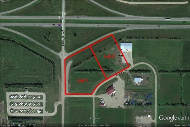
15900 Andre Loop, Menoken, ND 58558

Property Detail
15900 Andre Loop
Bismarck, ND
TWN: 139 RNG: 78 SUB: 331397864 BLK: 02 ANDRE INDUSTRIES IND PARK BLOCK 02 L1 533085
33-139-78-64-02-010
BURLEIGH
Vacantlandnec
North Dakota
B and X Area of moderate flood hazard, usually the area between the limits of the 100-year and 500-year floods.
01
2025
3.02 AC
2025
Bismarck
011400
Other Market Areas
NEARBY LISTINGS FOR SALE OR LEASE
-
-
View all Menoken listings for sale on LoopNet.com
DEMOGRAPHICS near 15900 Andre Loop
1 mile
3 mile
5 mile
2025 Total Population
17
351
1,113
2030 Population
18
370
1,173
Pop Growth 2025-2030
+ 5.88%
+ 5.41%
+ 5.39%
Average Age
40
43
43
2025 Total Households
6
129
410
HH Growth 2025-2030
+ 16.67%
+ 6.20%
+ 5.85%
Median Household Inc
$149,999
$115,624
$117,105
Avg Household Size
2.70
2.70
2.70
2025 Avg HH Vehicles
3.00
3.00
3.00
Median Home Value
$399,999
$414,000
$415,000
Median Year Built
1979
2000
2000
Nearby Places
Map Layers
Map Styles
 Street
 Aerial
Transit
 Traffic
 Biking
Places
Listings with unknown addresses are not visible on the map
- Restaurants
- Banks
- Shops
- Fitness
- Groceries
PUBLIC TRANSPORTATION
AIRPORT
Bismarck Municipal
Drive
Walk
Distance
Bismarck Municipal
26 min
14.5 mi
Freight Ports
Port Milwaukee
Drive
Walk
Distance
Port Milwaukee
809 min
752.4 mi
Nearby Properties
Address
Land Use
TOTAL SIZE
Lot Size
Zoning
Address
Land Use
TOTAL SIZE
Lot Size
Zoning
12,800 SF
Address
Land Use
TOTAL SIZE
Lot Size
Zoning
1,400 SF
53.45 AC
Address
Land Use
TOTAL SIZE
Lot Size
Zoning
7,140 SF
2.77 AC
Address
Land Use
TOTAL SIZE
Lot Size
Zoning
11,300 SF
2.42 AC
Address
Land Use
TOTAL SIZE
Lot Size
Zoning
8.33 AC
Address
Land Use
TOTAL SIZE
Lot Size
Zoning
5,000 SF
2.18 AC
Address
Land Use
TOTAL SIZE
Lot Size
Zoning
575 SF
2.46 AC
Address
Land Use
TOTAL SIZE
Lot Size
Zoning
5,200 SF
2.01 AC
Address
Land Use
TOTAL SIZE
Lot Size
Zoning
18,000 SF
4.31 AC
Address
Land Use
TOTAL SIZE
Lot Size
Zoning
5,200 SF
2.01 AC
Address
Land Use
TOTAL SIZE
Lot Size
Zoning
3,804 SF
2.38 AC
Address
Land Use
TOTAL SIZE
Lot Size
Zoning
38.25 AC
Address
Land Use
TOTAL SIZE
Lot Size
Zoning
Address
Land Use
TOTAL SIZE
Lot Size
Zoning
Address
Land Use
TOTAL SIZE
Lot Size
Zoning
Address
Land Use
TOTAL SIZE
Lot Size
Zoning
Address
Land Use
TOTAL SIZE
Lot Size
Zoning
1,508 SF
51.30 AC
Address
Land Use
TOTAL SIZE
Lot Size
Zoning
3.15 AC
Address
Land Use
TOTAL SIZE
Lot Size
Zoning
Address
Land Use
TOTAL SIZE
Lot Size
Zoning
3.12 AC
Address
Land Use
TOTAL SIZE
Lot Size
Zoning
Address
Land Use
TOTAL SIZE
Lot Size
Zoning
Address
Land Use
TOTAL SIZE
Lot Size
Zoning
Address
Land Use
TOTAL SIZE
Lot Size
Zoning
152.12 AC
Address
Land Use
TOTAL SIZE
Lot Size
Zoning
Address
Land Use
TOTAL SIZE
Lot Size
Zoning
Address
Land Use
TOTAL SIZE
Lot Size
Zoning
2.18 AC
Address
Land Use
TOTAL SIZE
Lot Size
Zoning
2.18 AC
Address
Land Use
TOTAL SIZE
Lot Size
Zoning
2.13 AC
The World's #1 Commercial Real Estate Marketplace
Connect with us
© 2026 CoStar Group
The information above has been obtained from sources believed reliable. While we do not doubt its accuracy we have not verified it and make no guarantee, warranty or representation about it. It is your responsibility to independently confirm its accuracy and completeness. Any projections, opinions, assumptions, or estimates used are for example only and do not represent the current or future performance of the property. The value of this transaction to you depends on tax and other factors which should be evaluated by your tax, financial, and legal advisors. You and your advisors should conduct a careful, independent investigation of the property to determine to your satisfaction the suitability of the property for your needs.