Property Record
1591 Nw 29Th Rd, Gainesville, FL 32605
This Property Is For Sale
NEARBY LISTINGS FOR SALE OR LEASE
Property Detail
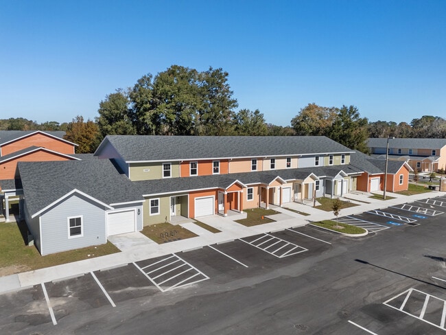
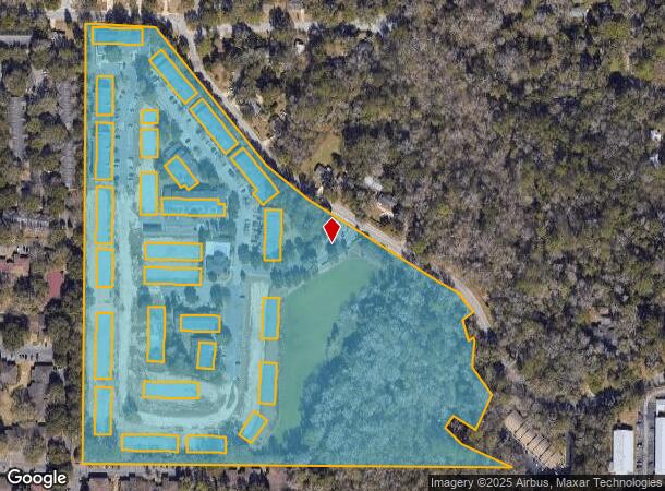
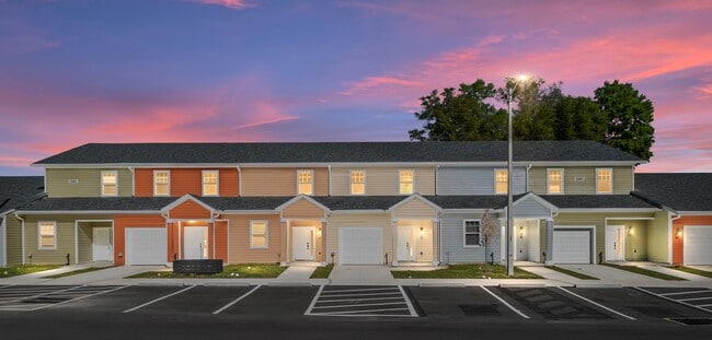
1591 Nw 29Th Rd
Other Market Areas
Eagle Trace Townhomes
Gainesville, FL
Alachua
09000-001-265
Florida
Condominium
0.03 AC
A
Northwest Gainesville
12001C0311D
DEMOGRAPHICS near 1591 Nw 29Th Rd
1 Mile
3 Mile
5 Mile
2024 Total Population
10,874
78,438
162,893
2029 Population
11,588
81,454
169,501
Pop Growth 2024-2029
+ 6.57%
+ 3.85%
+ 4.06%
Average Age
38
35
34
2024 Total Households
5,105
31,376
66,527
HH Growth 2024-2029
+ 6.74%
+ 4.16%
+ 4.16%
Median Household Inc
$59,309
$45,978
$44,045
Avg Household Size
2.10
2.10
2.10
2024 Avg HH Vehicles
2.00
2.00
2.00
Median Home Value
$184,667
$211,774
$211,049
Median Year Built
1979
1977
1983
Nearby Places
- Restaurants
- Banks
- Shops
- Fitness
- Groceries
PUBLIC TRANSPORTATION
AIRPORT
Gainesville Regional
DRIVE
WALK
Distance
Gainesville Regional
14 min
5.7 mi
Freight Ports
Jacksonville Port
DRIVE
WALK
Distance
Jacksonville Port
100 min
75.5 mi
Nearby Properties
Address
Land Use
TOTAL SIZE
Lot Size
Zoning
Address
Land Use
TOTAL SIZE
Lot Size
Zoning
3,617,778 SF
276.74 AC
ED
Address
Land Use
TOTAL SIZE
Lot Size
Zoning
698,640 SF
24.04 AC
U9
Address
Land Use
TOTAL SIZE
Lot Size
Zoning
108,640 SF
20 AC
ED
Address
Land Use
TOTAL SIZE
Lot Size
Zoning
17.87 AC
ED
Address
Land Use
TOTAL SIZE
Lot Size
Zoning
430,590 SF
16.95 AC
ED
Address
Land Use
TOTAL SIZE
Lot Size
Zoning
682,400 SF
20 AC
ED
Address
Land Use
TOTAL SIZE
Lot Size
Zoning
959,910 SF
2.50 AC
PD
Address
Land Use
TOTAL SIZE
Lot Size
Zoning
399,130 SF
18.13 AC
ED
Address
Land Use
TOTAL SIZE
Lot Size
Zoning
20.95 AC
MD
Address
Land Use
TOTAL SIZE
Lot Size
Zoning
416,200 SF
20 AC
ED
Address
Land Use
TOTAL SIZE
Lot Size
Zoning
334,819 SF
1.79 AC
U9
Address
Land Use
TOTAL SIZE
Lot Size
Zoning
325,519 SF
1.25 AC
U8
Address
Land Use
TOTAL SIZE
Lot Size
Zoning
582,311 SF
20 AC
ED
Address
Land Use
TOTAL SIZE
Lot Size
Zoning
348,458 SF
81.44 AC
ED
Address
Land Use
TOTAL SIZE
Lot Size
Zoning
372,990 SF
20 AC
ED
Address
Land Use
TOTAL SIZE
Lot Size
Zoning
357,020 SF
20 AC
ED
Address
Land Use
TOTAL SIZE
Lot Size
Zoning
594,946 SF
4.47 AC
DT
Address
Land Use
TOTAL SIZE
Lot Size
Zoning
271,079 SF
0.94 AC
PD
Address
Land Use
TOTAL SIZE
Lot Size
Zoning
279,647 SF
1.66 AC
PD
Address
Land Use
TOTAL SIZE
Lot Size
Zoning
117,563 SF
1.61 AC
U8
Address
Land Use
TOTAL SIZE
Lot Size
Zoning
362,539 SF
2.11 AC
U8
Address
Land Use
TOTAL SIZE
Lot Size
Zoning
414,780 SF
1.99 AC
PD
Address
Land Use
TOTAL SIZE
Lot Size
Zoning
299,737 SF
1.14 AC
DT
Address
Land Use
TOTAL SIZE
Lot Size
Zoning
94,156 SF
3.65 AC
U9
Address
Land Use
TOTAL SIZE
Lot Size
Zoning
295,990 SF
20 AC
ED
Address
Land Use
TOTAL SIZE
Lot Size
Zoning
280,840 SF
20 AC
ED
Address
Land Use
TOTAL SIZE
Lot Size
Zoning
404,722 SF
2.82 AC
U6
Address
Land Use
TOTAL SIZE
Lot Size
Zoning
444,350 SF
4.38 AC
DT
Address
Land Use
TOTAL SIZE
Lot Size
Zoning
1,331,605 SF
32.61 AC
ED
Address
Land Use
TOTAL SIZE
Lot Size
Zoning
395,561 SF
19.11 AC
PD
The World's #1 Commercial Real Estate Marketplace
Connect with us
© 2025 CoStar Group
The information above has been obtained from sources believed reliable. While we do not doubt its accuracy we have not verified it and make no guarantee, warranty or representation about it. It is your responsibility to independently confirm its accuracy and completeness. Any projections, opinions, assumptions, or estimates used are for example only and do not represent the current or future performance of the property. The value of this transaction to you depends on tax and other factors which should be evaluated by your tax, financial, and legal advisors. You and your advisors should conduct a careful, independent investigation of the property to determine to your satisfaction the suitability of the property for your needs.