Property Record
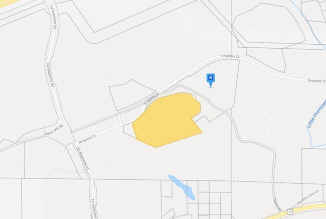
15911 Progress Dr, Cottondale, AL 35453

Property Detail
15911 Progress Dr
29-07-25-0-001-003.004
COM SE COR S25 T21S R8W TH W 581.4; N 1002 TO POB TH NW 340.6; NE 223.9; N 183.8; WLY 1550(S); SW 74.7; SE 286.6; SE 376.1; N
Manufacturinglight
Tuscaloosa
B and X Area of moderate flood hazard, usually the area between the limits of the 100-year and 500-year floods.
Alabama
2025
21.41 AC
2025
Tuscaloosa
010706
Birmingham
307,460 SF
Tuscaloosa, AL
NEARBY LISTINGS FOR SALE OR LEASE
DEMOGRAPHICS near 15911 Progress Dr
1 mile
3 mile
5 mile
2025 Total Population
243
3,847
8,591
2030 Population
244
3,878
8,673
Pop Growth 2025-2030
+ 0.41%
+ 0.81%
+ 0.95%
Average Age
39
39
39
2025 Total Households
94
1,429
3,220
HH Growth 2025-2030
+ 1.06%
+ 1.05%
+ 1.21%
Median Household Inc
$73,124
$81,405
$78,430
Avg Household Size
2.60
2.70
2.70
2025 Avg HH Vehicles
2.00
2.00
2.00
Median Home Value
$187,499
$197,014
$197,371
Median Year Built
1986
1994
1996
Nearby Places
Map Layers
Map Styles
 Street
 Aerial
Layers
 Traffic
 Biking
Places
Listings with unknown addresses are not visible on the map
- Restaurants
- Banks
- Shops
- Fitness
- Groceries
SALE & LEASE HISTORY
LISTING DATE
SALE/LEASE

May 21, 2020
For Sale
Nearby Properties
Address
Land Use
TOTAL SIZE
Lot Size
Zoning
Address
Land Use
TOTAL SIZE
Lot Size
Zoning
602,080 SF
90 AC
Address
Land Use
TOTAL SIZE
Lot Size
Zoning
98,040 SF
14 AC
R1
Address
Land Use
TOTAL SIZE
Lot Size
Zoning
400,000 SF
26.80 AC
Address
Land Use
TOTAL SIZE
Lot Size
Zoning
200,000 SF
11.10 AC
Address
Land Use
TOTAL SIZE
Lot Size
Zoning
10,000 SF
18 AC
Address
Land Use
TOTAL SIZE
Lot Size
Zoning
7,417 SF
15 AC
Address
Land Use
TOTAL SIZE
Lot Size
Zoning
122,500 SF
9.70 AC
Address
Land Use
TOTAL SIZE
Lot Size
Zoning
120,400 SF
5.69 AC
Address
Land Use
TOTAL SIZE
Lot Size
Zoning
122,500 SF
6.30 AC
Address
Land Use
TOTAL SIZE
Lot Size
Zoning
87,500 SF
4.10 AC
Address
Land Use
TOTAL SIZE
Lot Size
Zoning
5,200 SF
3.52 AC
Address
Land Use
TOTAL SIZE
Lot Size
Zoning
10,656 SF
1.21 AC
Address
Land Use
TOTAL SIZE
Lot Size
Zoning
20,000 SF
0.65 AC
Address
Land Use
TOTAL SIZE
Lot Size
Zoning
Address
Land Use
TOTAL SIZE
Lot Size
Zoning
11,352 SF
27.49 AC
Address
Land Use
TOTAL SIZE
Lot Size
Zoning
507 AC
Address
Land Use
TOTAL SIZE
Lot Size
Zoning
6,840 SF
1.81 AC
Address
Land Use
TOTAL SIZE
Lot Size
Zoning
3,600 SF
1.49 AC
Address
Land Use
TOTAL SIZE
Lot Size
Zoning
10,000 SF
4.47 AC
Address
Land Use
TOTAL SIZE
Lot Size
Zoning
3,200 SF
6 AC
Address
Land Use
TOTAL SIZE
Lot Size
Zoning
5,500 SF
2.70 AC
Address
Land Use
TOTAL SIZE
Lot Size
Zoning
7,000 SF
3.10 AC
Address
Land Use
TOTAL SIZE
Lot Size
Zoning
6,000 SF
1.40 AC
Address
Land Use
TOTAL SIZE
Lot Size
Zoning
3,000 SF
2.10 AC
Address
Land Use
TOTAL SIZE
Lot Size
Zoning
60.60 AC
I
Address
Land Use
TOTAL SIZE
Lot Size
Zoning
10,000 SF
16 AC
Address
Land Use
TOTAL SIZE
Lot Size
Zoning
5,625 SF
1.52 AC
Address
Land Use
TOTAL SIZE
Lot Size
Zoning
343 AC
Address
Land Use
TOTAL SIZE
Lot Size
Zoning
2,800 SF
4.20 AC
The World's #1 Commercial Real Estate Marketplace
Connect with us
© 2026 CoStar Group
The information above has been obtained from sources believed reliable. While we do not doubt its accuracy we have not verified it and make no guarantee, warranty or representation about it. It is your responsibility to independently confirm its accuracy and completeness. Any projections, opinions, assumptions, or estimates used are for example only and do not represent the current or future performance of the property. The value of this transaction to you depends on tax and other factors which should be evaluated by your tax, financial, and legal advisors. You and your advisors should conduct a careful, independent investigation of the property to determine to your satisfaction the suitability of the property for your needs.