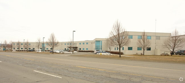
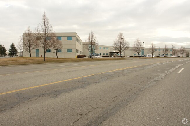
Property Record
15913 E Euclid Ave, Spokane Valley, WA 99216
NEARBY LISTINGS FOR SALE OR LEASE
Property Detail
15913 E Euclid Ave
45122.9149
Altered Spokane Cnty Binding S
Industrialgeneral
12-25-44 TR 4 OF BSP #88-22 AUDITORS #9407010343 BK 1 PG 65 BEING A PTN OF NW1/4
X
Spokane
53063C0590D
Washington
2025
2.77 AC
2025
Valley
011400
Spokane
24,525 SF
Spokane-Spokane Valley, WA
DEMOGRAPHICS near 15913 E Euclid Ave
1 Mile
3 Mile
5 Mile
2024 Total Population
812
55,288
121,577
2029 Population
871
59,642
130,000
Pop Growth 2024-2029
+ 7.27%
+ 7.88%
+ 6.93%
Average Age
41
39
40
2024 Total Households
332
23,077
48,493
HH Growth 2024-2029
+ 7.53%
+ 7.99%
+ 7.09%
Median Household Inc
$57,692
$58,572
$67,810
Avg Household Size
2.40
2.30
2.40
2024 Avg HH Vehicles
2.00
2.00
2.00
Median Home Value
$303,623
$332,500
$359,282
Median Year Built
1976
1993
1986
Nearby Places
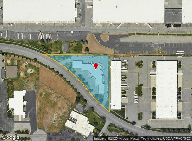
Map Layers
Map Styles
 Street
 Aerial
- Restaurants
- Banks
- Shops
- Fitness
- Groceries
PUBLIC TRANSPORTATION
AIRPORT
Spokane International
DRIVE
WALK
Distance
Spokane International
27 min
18.4 mi
Freight Ports
Port of Everett
DRIVE
WALK
Distance
Port of Everett
355 min
314.0 mi
Nearby Properties
Address
Land Use
TOTAL SIZE
Lot Size
Zoning
Address
Land Use
TOTAL SIZE
Lot Size
Zoning
2,818,475 SF
466.05 AC
I-2
Address
Land Use
TOTAL SIZE
Lot Size
Zoning
1,326,772 SF
85.91 AC
I-2
Address
Land Use
TOTAL SIZE
Lot Size
Zoning
373,111 SF
12.44 AC
MUC
Address
Land Use
TOTAL SIZE
Lot Size
Zoning
130,380 SF
11.10 AC
MUC
Address
Land Use
TOTAL SIZE
Lot Size
Zoning
237,094 SF
58.56 AC
R-3
Address
Land Use
TOTAL SIZE
Lot Size
Zoning
3,688,247 SF
244.85 AC
I-2
Address
Land Use
TOTAL SIZE
Lot Size
Zoning
296,760 SF
37.61 AC
I-1
Address
Land Use
TOTAL SIZE
Lot Size
Zoning
169,003 SF
5.18 AC
MUC
Address
Land Use
TOTAL SIZE
Lot Size
Zoning
270,453 SF
28.62 AC
Address
Land Use
TOTAL SIZE
Lot Size
Zoning
259,169 SF
13.42 AC
MF-2
Address
Land Use
TOTAL SIZE
Lot Size
Zoning
216,965 SF
10.70 AC
MUC
Address
Land Use
TOTAL SIZE
Lot Size
Zoning
227,044 SF
7.20 AC
MUC
Address
Land Use
TOTAL SIZE
Lot Size
Zoning
318,756 SF
13.64 AC
MF-2
Address
Land Use
TOTAL SIZE
Lot Size
Zoning
98,088 SF
13.94 AC
SAP
Address
Land Use
TOTAL SIZE
Lot Size
Zoning
323,993 SF
10.97 AC
MUC
Address
Land Use
TOTAL SIZE
Lot Size
Zoning
197,868 SF
7.15 AC
MUC
Address
Land Use
TOTAL SIZE
Lot Size
Zoning
192,698 SF
9.55 AC
MUC
Address
Land Use
TOTAL SIZE
Lot Size
Zoning
346,589 SF
16.28 AC
MF-2
Address
Land Use
TOTAL SIZE
Lot Size
Zoning
204,730 SF
8.60 AC
MUC
Address
Land Use
TOTAL SIZE
Lot Size
Zoning
161,130 SF
6.45 AC
GO
Address
Land Use
TOTAL SIZE
Lot Size
Zoning
240,663 SF
8.90 AC
MF-2
Address
Land Use
TOTAL SIZE
Lot Size
Zoning
123,400 SF
4.50 AC
MUC
Address
Land Use
TOTAL SIZE
Lot Size
Zoning
84,600 SF
17.95 AC
MF-1
Address
Land Use
TOTAL SIZE
Lot Size
Zoning
136,518 SF
7.96 AC
O
Address
Land Use
TOTAL SIZE
Lot Size
Zoning
211,011 SF
8.81 AC
CMU
Address
Land Use
TOTAL SIZE
Lot Size
Zoning
175,936 SF
12.16 AC
MF-2
Address
Land Use
TOTAL SIZE
Lot Size
Zoning
139,122 SF
6.17 AC
MUC
Address
Land Use
TOTAL SIZE
Lot Size
Zoning
138,379 SF
17.39 AC
RC
Address
Land Use
TOTAL SIZE
Lot Size
Zoning
68,928 SF
10.96 AC
R-3
Address
Land Use
TOTAL SIZE
Lot Size
Zoning
87,848 SF
7.36 AC
MF-2
The World's #1 Commercial Real Estate Marketplace
Connect with us
© 2025 CoStar Group
The information above has been obtained from sources believed reliable. While we do not doubt its accuracy we have not verified it and make no guarantee, warranty or representation about it. It is your responsibility to independently confirm its accuracy and completeness. Any projections, opinions, assumptions, or estimates used are for example only and do not represent the current or future performance of the property. The value of this transaction to you depends on tax and other factors which should be evaluated by your tax, financial, and legal advisors. You and your advisors should conduct a careful, independent investigation of the property to determine to your satisfaction the suitability of the property for your needs.