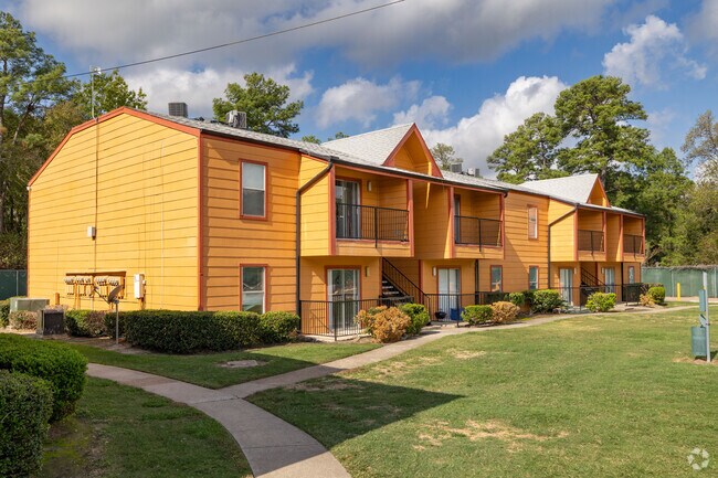
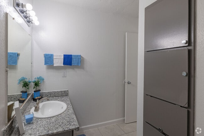
Property Record
15915 Kuykendahl Rd, Houston, TX 77068

NEARBY LISTINGS FOR SALE OR LEASE
-
-
No Photo
-
View all Houston listings for sale on LoopNet.com
Property Detail
15915 Kuykendahl Rd
0420880000071
Abst 229 G H Delesdernier
Apartment
TRS 16H & 16H-1 ABST 229 G H DELESDERNIER
X
Harris
48339C0700F
Texas
2024
18.36 AC
2025
Outlying Harris County
553002
Houston
350,072 SF
Houston-Pasadena-The Woodlands, TX
DEMOGRAPHICS near 15915 Kuykendahl Rd
1 Mile
3 Mile
5 Mile
2024 Total Population
13,560
125,371
310,129
2029 Population
13,816
127,933
315,363
Pop Growth 2024-2029
+ 1.89%
+ 2.04%
+ 1.69%
Average Age
35
35
36
2024 Total Households
5,018
44,823
106,318
HH Growth 2024-2029
+ 1.77%
+ 2.13%
+ 1.75%
Median Household Inc
$54,672
$54,680
$62,808
Avg Household Size
2.60
2.70
2.80
2024 Avg HH Vehicles
2.00
2.00
2.00
Median Home Value
$234,300
$229,298
$220,822
Median Year Built
1983
1988
1989
Nearby Places
Map Layers
Map Styles
 Street
 Aerial
- Restaurants
- Banks
- Shops
- Fitness
- Groceries
PUBLIC TRANSPORTATION
AIRPORT
George Bush Intcntl/Houston
DRIVE
WALK
Distance
George Bush Intcntl/Houston
21 min
13.5 mi
William P Hobby
DRIVE
WALK
Distance
William P Hobby
51 min
32.5 mi
Freight Ports
Port of Houston
DRIVE
WALK
Distance
Port of Houston
43 min
28.0 mi
Nearby Properties
Address
Land Use
TOTAL SIZE
Lot Size
Zoning
Address
Land Use
TOTAL SIZE
Lot Size
Zoning
734,137 SF
11.37 AC
Address
Land Use
TOTAL SIZE
Lot Size
Zoning
180,249 SF
13.35 AC
Address
Land Use
TOTAL SIZE
Lot Size
Zoning
304,096 SF
14.80 AC
Address
Land Use
TOTAL SIZE
Lot Size
Zoning
286,090 SF
13.25 AC
Address
Land Use
TOTAL SIZE
Lot Size
Zoning
417,597 SF
16.98 AC
Address
Land Use
TOTAL SIZE
Lot Size
Zoning
366,954 SF
18.88 AC
Address
Land Use
TOTAL SIZE
Lot Size
Zoning
362,720 SF
20.23 AC
Address
Land Use
TOTAL SIZE
Lot Size
Zoning
378,316 SF
17.34 AC
Address
Land Use
TOTAL SIZE
Lot Size
Zoning
335,106 SF
13.27 AC
Address
Land Use
TOTAL SIZE
Lot Size
Zoning
472,399 SF
20.63 AC
Address
Land Use
TOTAL SIZE
Lot Size
Zoning
304,518 SF
15 AC
Address
Land Use
TOTAL SIZE
Lot Size
Zoning
326,920 SF
22.26 AC
Address
Land Use
TOTAL SIZE
Lot Size
Zoning
297,961 SF
18.04 AC
Address
Land Use
TOTAL SIZE
Lot Size
Zoning
291,504 SF
17.17 AC
Address
Land Use
TOTAL SIZE
Lot Size
Zoning
173,371 SF
5.17 AC
Address
Land Use
TOTAL SIZE
Lot Size
Zoning
280,318 SF
14.66 AC
Address
Land Use
TOTAL SIZE
Lot Size
Zoning
174,349 SF
9.95 AC
Address
Land Use
TOTAL SIZE
Lot Size
Zoning
463,081 SF
25.65 AC
Address
Land Use
TOTAL SIZE
Lot Size
Zoning
283,283 SF
15.14 AC
Address
Land Use
TOTAL SIZE
Lot Size
Zoning
255,901 SF
11.01 AC
Address
Land Use
TOTAL SIZE
Lot Size
Zoning
404,248 SF
16.31 AC
Address
Land Use
TOTAL SIZE
Lot Size
Zoning
237,292 SF
11.91 AC
Address
Land Use
TOTAL SIZE
Lot Size
Zoning
249,134 SF
11.85 AC
Address
Land Use
TOTAL SIZE
Lot Size
Zoning
339,804 SF
14.21 AC
Address
Land Use
TOTAL SIZE
Lot Size
Zoning
247,670 SF
13.38 AC
Address
Land Use
TOTAL SIZE
Lot Size
Zoning
365,298 SF
15.28 AC
Address
Land Use
TOTAL SIZE
Lot Size
Zoning
218,967 SF
14.11 AC
Address
Land Use
TOTAL SIZE
Lot Size
Zoning
227,196 SF
13.84 AC
Address
Land Use
TOTAL SIZE
Lot Size
Zoning
357,485 SF
19.38 AC
Address
Land Use
TOTAL SIZE
Lot Size
Zoning
268,232 SF
12.33 AC
The World's #1 Commercial Real Estate Marketplace
Connect with us
© 2026 CoStar Group
The information above has been obtained from sources believed reliable. While we do not doubt its accuracy we have not verified it and make no guarantee, warranty or representation about it. It is your responsibility to independently confirm its accuracy and completeness. Any projections, opinions, assumptions, or estimates used are for example only and do not represent the current or future performance of the property. The value of this transaction to you depends on tax and other factors which should be evaluated by your tax, financial, and legal advisors. You and your advisors should conduct a careful, independent investigation of the property to determine to your satisfaction the suitability of the property for your needs.