Property Record
15920 La Forge St, Whittier, CA 90603

Save to a Folder
{{folder.Name}}
{{folder.ListingIds.length}} Properties
{{folder.ListingIds.length}} Property
Create a New Folder
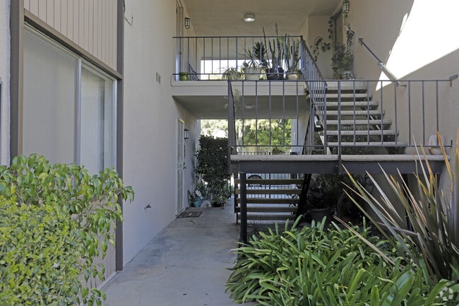
Property Detail
15920 La Forge St
8231-003-034
TRACT NO 24865 LOTS 7,8 AND LOT 9
Multifamilydwelling
Los Angeles
WHR4*
California
B and X Area of moderate flood hazard, usually the area between the limits of the 100-year and 500-year floods.
7,8,9
2025
0.85 AC
2025
East Whittier City
503401
Los Angeles
26,426 SF
Los Angeles-Long Beach-Glendale, CA
NEARBY LISTINGS FOR SALE OR LEASE
DEMOGRAPHICS near 15920 La Forge St
1 mile
3 mile
5 mile
2025 Total Population
21,988
162,512
389,171
2030 Population
21,758
161,185
385,416
Pop Growth 2025-2030
(1.05%)
(0.82%)
(0.96%)
Average Age
41
41
41
2025 Total Households
7,010
51,435
121,190
HH Growth 2025-2030
(1.26%)
(1.04%)
(1.20%)
Median Household Inc
$115,664
$106,806
$104,921
Avg Household Size
3.10
3.10
3.10
2025 Avg HH Vehicles
2.00
2.00
2.00
Median Home Value
$771,797
$777,307
$796,745
Median Year Built
1957
1960
1963
Nearby Places
Map Layers
Map Styles
 Street
 Aerial
Layers
 Traffic
 Biking
Places
Listings with unknown addresses are not visible on the map
- Restaurants
- Banks
- Shops
- Fitness
- Groceries
PUBLIC TRANSPORTATION
COMMUTER RAIL
Norwalk/Santa Fe Springs (91 Line - Southern California Regional Rail Authority (Metrolink), Orange County Line - Southern California Regional Rail Authority (Metrolink))
Drive
Walk
Distance
Norwalk/Santa Fe Springs (91 Line - Southern California Regional Rail Authority (Metrolink), Orange County Line - Southern California Regional Rail Authority (Metrolink))
11 min
5.2 mi
Buena Park (91 Line - Southern California Regional Rail Authority (Metrolink), Orange County Line - Southern California Regional Rail Authority (Metrolink))
Drive
Walk
Distance
Buena Park (91 Line - Southern California Regional Rail Authority (Metrolink), Orange County Line - Southern California Regional Rail Authority (Metrolink))
11 min
5.6 mi
AIRPORT
Long Beach (Daugherty Field)
Drive
Walk
Distance
Long Beach (Daugherty Field)
32 min
19.1 mi
John Wayne/Orange County
Drive
Walk
Distance
John Wayne/Orange County
33 min
24.6 mi
Ontario International
Drive
Walk
Distance
Ontario International
40 min
28.5 mi
Freight Ports
Port of Long Beach
Drive
Walk
Distance
Port of Long Beach
38 min
23.7 mi
Nearby Properties
Address
Land Use
TOTAL SIZE
Lot Size
Zoning
Address
Land Use
TOTAL SIZE
Lot Size
Zoning
10.49 AC
Address
Land Use
TOTAL SIZE
Lot Size
Zoning
128,481 SF
19.42 AC
LMR1*
Address
Land Use
TOTAL SIZE
Lot Size
Zoning
10.49 AC
Address
Land Use
TOTAL SIZE
Lot Size
Zoning
178,140 SF
10.88 AC
Address
Land Use
TOTAL SIZE
Lot Size
Zoning
89,514 SF
21.28 AC
WHC2*
Address
Land Use
TOTAL SIZE
Lot Size
Zoning
15.11 AC
Address
Land Use
TOTAL SIZE
Lot Size
Zoning
85,245 SF
7.44 AC
WHT*
Address
Land Use
TOTAL SIZE
Lot Size
Zoning
60,710 SF
8.77 AC
LCA1*
Address
Land Use
TOTAL SIZE
Lot Size
Zoning
Address
Land Use
TOTAL SIZE
Lot Size
Zoning
31.82 AC
Address
Land Use
TOTAL SIZE
Lot Size
Zoning
96,802 SF
4.93 AC
Address
Land Use
TOTAL SIZE
Lot Size
Zoning
41,430 SF
5.85 AC
Address
Land Use
TOTAL SIZE
Lot Size
Zoning
67,692 SF
2.34 AC
WHC2*
Address
Land Use
TOTAL SIZE
Lot Size
Zoning
14.86 AC
Address
Land Use
TOTAL SIZE
Lot Size
Zoning
13.60 AC
Address
Land Use
TOTAL SIZE
Lot Size
Zoning
192,740 SF
10.18 AC
Address
Land Use
TOTAL SIZE
Lot Size
Zoning
97,952 SF
4.18 AC
WHR3*
Address
Land Use
TOTAL SIZE
Lot Size
Zoning
408,784 SF
9.29 AC
Address
Land Use
TOTAL SIZE
Lot Size
Zoning
61,934 SF
2.37 AC
LCA1YY
Address
Land Use
TOTAL SIZE
Lot Size
Zoning
144,914 SF
1.88 AC
WHC2*
Address
Land Use
TOTAL SIZE
Lot Size
Zoning
142,430 SF
11.24 AC
Address
Land Use
TOTAL SIZE
Lot Size
Zoning
242,099 SF
3.64 AC
LMR1*
Address
Land Use
TOTAL SIZE
Lot Size
Zoning
82,769 SF
4.25 AC
LMR3*
Address
Land Use
TOTAL SIZE
Lot Size
Zoning
37.56 AC
Address
Land Use
TOTAL SIZE
Lot Size
Zoning
54,070 SF
2.51 AC
LCR330U*
Address
Land Use
TOTAL SIZE
Lot Size
Zoning
61,988 SF
1.29 AC
WHC2*
Address
Land Use
TOTAL SIZE
Lot Size
Zoning
59,060 SF
6.05 AC
LMPUD*
Address
Land Use
TOTAL SIZE
Lot Size
Zoning
103,962 SF
4.65 AC
LMR110000*
Address
Land Use
TOTAL SIZE
Lot Size
Zoning
14.32 AC
Address
Land Use
TOTAL SIZE
Lot Size
Zoning
82,778 SF
5.74 AC
The World's #1 Commercial Real Estate Marketplace
Connect with us
© 2026 CoStar Group
The information above has been obtained from sources believed reliable. While we do not doubt its accuracy we have not verified it and make no guarantee, warranty or representation about it. It is your responsibility to independently confirm its accuracy and completeness. Any projections, opinions, assumptions, or estimates used are for example only and do not represent the current or future performance of the property. The value of this transaction to you depends on tax and other factors which should be evaluated by your tax, financial, and legal advisors. You and your advisors should conduct a careful, independent investigation of the property to determine to your satisfaction the suitability of the property for your needs.