Property Record
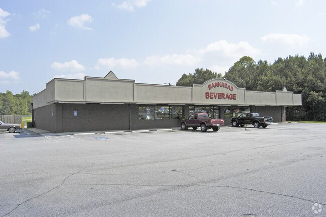
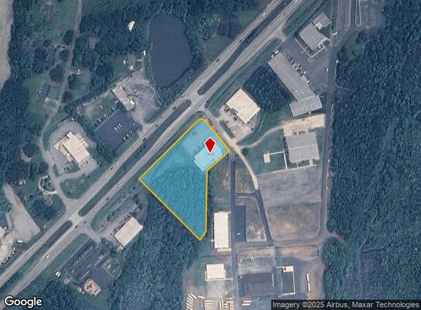
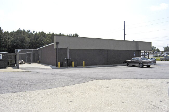
1595 Bankhead Hwy, Carrollton, GA 30116
NEARBY LISTINGS FOR SALE OR LEASE
Property Detail
1595 Bankhead Hwy
C05-0310023
Roger F Williams Surv
Storebuilding
COMM BLDG/2.578AC BANKHEAD HWY CTY131 CO131
X
Carroll
13045C0260D
Georgia
2025
2.58 AC
2025
Villa Rica/W Outlying
910705
Atlanta
9,946 SF
Atlanta-Sandy Springs-Roswell, GA
DEMOGRAPHICS near 1595 Bankhead Hwy
1 Mile
3 Mile
5 Mile
2024 Total Population
1,631
19,160
45,424
2029 Population
1,805
21,215
50,451
Pop Growth 2024-2029
+ 10.67%
+ 10.73%
+ 11.07%
Average Age
36
37
36
2024 Total Households
610
7,027
16,297
HH Growth 2024-2029
+ 10.82%
+ 10.79%
+ 11.24%
Median Household Inc
$46,602
$52,496
$48,267
Avg Household Size
2.60
2.60
2.60
2024 Avg HH Vehicles
2.00
2.00
2.00
Median Home Value
$146,875
$180,925
$210,651
Median Year Built
1985
1986
1987
Nearby Places
Map Layers
Map Styles
 Street
 Aerial
- Restaurants
- Banks
- Shops
- Fitness
- Groceries
PUBLIC TRANSPORTATION
AIRPORT
Hartsfield - Jackson Atlanta International
DRIVE
WALK
Distance
Hartsfield - Jackson Atlanta International
64 min
43.2 mi
Nearby Properties
Address
Land Use
TOTAL SIZE
Lot Size
Zoning
Address
Land Use
TOTAL SIZE
Lot Size
Zoning
152,962 SF
108.90 AC
OI
Address
Land Use
TOTAL SIZE
Lot Size
Zoning
73,900 SF
10.57 AC
C2
Address
Land Use
TOTAL SIZE
Lot Size
Zoning
56,458 SF
21.87 AC
R3
Address
Land Use
TOTAL SIZE
Lot Size
Zoning
56,288 SF
4.69 AC
C2
Address
Land Use
TOTAL SIZE
Lot Size
Zoning
163,568 SF
16.80 AC
C2
Address
Land Use
TOTAL SIZE
Lot Size
Zoning
42,905 SF
9.76 AC
002
Address
Land Use
TOTAL SIZE
Lot Size
Zoning
90,485 SF
10.35 AC
C2
Address
Land Use
TOTAL SIZE
Lot Size
Zoning
13,299 SF
226.96 AC
R20
Address
Land Use
TOTAL SIZE
Lot Size
Zoning
45,480 SF
62.18 AC
R20
Address
Land Use
TOTAL SIZE
Lot Size
Zoning
29,561 SF
5.89 AC
C2
Address
Land Use
TOTAL SIZE
Lot Size
Zoning
50,300 SF
6.48 AC
R2
Address
Land Use
TOTAL SIZE
Lot Size
Zoning
16,743 SF
10.92 AC
R2
Address
Land Use
TOTAL SIZE
Lot Size
Zoning
100.74 AC
PUD
Address
Land Use
TOTAL SIZE
Lot Size
Zoning
63,888 SF
8.40 AC
I
Address
Land Use
TOTAL SIZE
Lot Size
Zoning
96.23 AC
M1
Address
Land Use
TOTAL SIZE
Lot Size
Zoning
46,146 SF
5.74 AC
C
Address
Land Use
TOTAL SIZE
Lot Size
Zoning
39,147 SF
9 AC
R2
Address
Land Use
TOTAL SIZE
Lot Size
Zoning
27,572 SF
1.71 AC
C2
Address
Land Use
TOTAL SIZE
Lot Size
Zoning
22,580 SF
9.71 AC
R2
Address
Land Use
TOTAL SIZE
Lot Size
Zoning
32,390 SF
9.84 AC
R2
Address
Land Use
TOTAL SIZE
Lot Size
Zoning
22,800 SF
39.40 AC
M1
Address
Land Use
TOTAL SIZE
Lot Size
Zoning
13,632 SF
5 AC
R2
Address
Land Use
TOTAL SIZE
Lot Size
Zoning
34,158 SF
26.14 AC
A
Address
Land Use
TOTAL SIZE
Lot Size
Zoning
17,628 SF
7.08 AC
RESIDENTIA
Address
Land Use
TOTAL SIZE
Lot Size
Zoning
9,920 SF
1.17 AC
C2
Address
Land Use
TOTAL SIZE
Lot Size
Zoning
38,400 SF
4.77 AC
I
Address
Land Use
TOTAL SIZE
Lot Size
Zoning
38,182 SF
28.01 AC
C
Address
Land Use
TOTAL SIZE
Lot Size
Zoning
29,210 SF
9.06 AC
R2
Address
Land Use
TOTAL SIZE
Lot Size
Zoning
49,414 SF
8.80 AC
RM10
Address
Land Use
TOTAL SIZE
Lot Size
Zoning
36,747 SF
109.72 AC
R1
The World's #1 Commercial Real Estate Marketplace
Connect with us
© 2026 CoStar Group
The information above has been obtained from sources believed reliable. While we do not doubt its accuracy we have not verified it and make no guarantee, warranty or representation about it. It is your responsibility to independently confirm its accuracy and completeness. Any projections, opinions, assumptions, or estimates used are for example only and do not represent the current or future performance of the property. The value of this transaction to you depends on tax and other factors which should be evaluated by your tax, financial, and legal advisors. You and your advisors should conduct a careful, independent investigation of the property to determine to your satisfaction the suitability of the property for your needs.