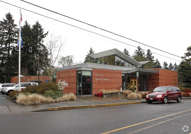
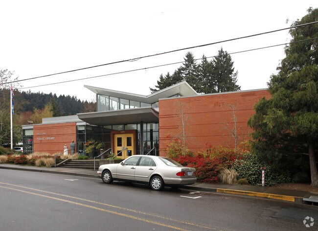
Property Record
1595 Burns St, West Linn, OR 97068

Property Detail
1595 Burns St
00565383
443 HOLLY GARDENS LTS 2&3
Commercialbuilding
Clackamas
OBC
Oregon
B and X Area of moderate flood hazard, usually the area between the limits of the 100-year and 500-year floods.
2,3
0
1 AC
2025
Lake Oswego/West Linn
020601
Portland
9,745 SF
Portland-Vancouver-Hillsboro, OR-WA
NEARBY LISTINGS FOR SALE OR LEASE
-
-
View all West Linn listings for sale on LoopNet.com
DEMOGRAPHICS near 1595 Burns St
1 mile
3 mile
5 mile
2025 Total Population
9,163
84,115
156,726
2030 Population
9,161
84,047
156,754
Pop Growth 2025-2030
(0.02%)
(0.08%)
+ 0.02%
Average Age
42
43
43
2025 Total Households
3,572
32,228
60,946
HH Growth 2025-2030
(0.03%)
(0.17%)
(0.01%)
Median Household Inc
$115,643
$103,300
$102,144
Avg Household Size
2.50
2.50
2.50
2025 Avg HH Vehicles
2.00
2.00
2.00
Median Home Value
$698,416
$629,391
$652,409
Median Year Built
1983
1979
1979
Nearby Places
Map Layers
Map Styles
 Street
 Aerial
Layers
 Traffic
 Biking
Places
Listings with unknown addresses are not visible on the map
- Restaurants
- Banks
- Shops
- Fitness
- Groceries
PUBLIC TRANSPORTATION
COMMUTER RAIL
Drive
Walk
Distance
5 min
2.0 mi
AIRPORT
Portland International
Drive
Walk
Distance
Portland International
29 min
19.1 mi
Freight Ports
Port of Portland
Drive
Walk
Distance
Port of Portland
31 min
15.8 mi
Nearby Properties
Address
Land Use
TOTAL SIZE
Lot Size
Zoning
Address
Land Use
TOTAL SIZE
Lot Size
Zoning
58 AC
MUE
Address
Land Use
TOTAL SIZE
Lot Size
Zoning
15.26 AC
GI
Address
Land Use
TOTAL SIZE
Lot Size
Zoning
9,233 SF
8.27 AC
MUE
Address
Land Use
TOTAL SIZE
Lot Size
Zoning
21.39 AC
CI
Address
Land Use
TOTAL SIZE
Lot Size
Zoning
3.11 AC
GC
Address
Land Use
TOTAL SIZE
Lot Size
Zoning
1,008 SF
10 AC
R3
Address
Land Use
TOTAL SIZE
Lot Size
Zoning
2,482 SF
5.14 AC
MR
Address
Land Use
TOTAL SIZE
Lot Size
Zoning
6 AC
OBC
Address
Land Use
TOTAL SIZE
Lot Size
Zoning
11 AC
MUD
Address
Land Use
TOTAL SIZE
Lot Size
Zoning
16.49 AC
MUD
Address
Land Use
TOTAL SIZE
Lot Size
Zoning
9.30 AC
C
Address
Land Use
TOTAL SIZE
Lot Size
Zoning
70.97 AC
OP
Address
Land Use
TOTAL SIZE
Lot Size
Zoning
3.18 AC
C3
Address
Land Use
TOTAL SIZE
Lot Size
Zoning
8.27 AC
MR
Address
Land Use
TOTAL SIZE
Lot Size
Zoning
Address
Land Use
TOTAL SIZE
Lot Size
Zoning
Address
Land Use
TOTAL SIZE
Lot Size
Zoning
9.21 AC
R3
Address
Land Use
TOTAL SIZE
Lot Size
Zoning
6 AC
OP
Address
Land Use
TOTAL SIZE
Lot Size
Zoning
980 SF
6.19 AC
GC
Address
Land Use
TOTAL SIZE
Lot Size
Zoning
Address
Land Use
TOTAL SIZE
Lot Size
Zoning
9.67 AC
C3
Address
Land Use
TOTAL SIZE
Lot Size
Zoning
4 AC
MUE
Address
Land Use
TOTAL SIZE
Lot Size
Zoning
6.16 AC
GC
Address
Land Use
TOTAL SIZE
Lot Size
Zoning
1,202 SF
3 AC
OBC
Address
Land Use
TOTAL SIZE
Lot Size
Zoning
6.14 AC
R2.1
Address
Land Use
TOTAL SIZE
Lot Size
Zoning
1.67 AC
MUE
Address
Land Use
TOTAL SIZE
Lot Size
Zoning
5.43 AC
SHD
Address
Land Use
TOTAL SIZE
Lot Size
Zoning
4.56 AC
MR
Address
Land Use
TOTAL SIZE
Lot Size
Zoning
9.07 AC
GI
Address
Land Use
TOTAL SIZE
Lot Size
Zoning
0.94 AC
MUD
The World's #1 Commercial Real Estate Marketplace
Connect with us
© 2026 CoStar Group
The information above has been obtained from sources believed reliable. While we do not doubt its accuracy we have not verified it and make no guarantee, warranty or representation about it. It is your responsibility to independently confirm its accuracy and completeness. Any projections, opinions, assumptions, or estimates used are for example only and do not represent the current or future performance of the property. The value of this transaction to you depends on tax and other factors which should be evaluated by your tax, financial, and legal advisors. You and your advisors should conduct a careful, independent investigation of the property to determine to your satisfaction the suitability of the property for your needs.