Property Record
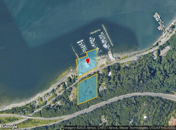
1595 Sw Bay St, Port Orchard, WA 98366


NEARBY LISTINGS FOR SALE OR LEASE
Property Detail
1595 Sw Bay St
332401-1-009-2007
PARCEL 1: THE EAST 170 FEET OF GOVERNMENT LOT 6, SECTION 33, TOWNSHIP 24 NORTH, RANGE 1 EAST, W.M.; EXCEPT STATE HIGHWAYS; EXCEPT THE SOUTH 30 FEET FOR COUNTY ROAD; AND EXCEPT PORTION LYING SOUTHERLY OF STATE HIGHWAY NO. 16; TOGETHER WITH TIDE LANDS
Marinafacility
Kitsap
AE
Washington
53035C0366F
6
2025
3.30 AC
2026
Port Orchard
092101
Bremerton/Silverdale
1,920 SF
Bremerton-Silverdale, WA
DEMOGRAPHICS near 1595 Sw Bay St
1 Mile
3 Mile
5 Mile
2024 Total Population
1,326
43,444
98,553
2029 Population
1,373
44,994
100,789
Pop Growth 2024-2029
+ 3.54%
+ 3.57%
+ 2.27%
Average Age
37
38
39
2024 Total Households
518
15,395
37,551
HH Growth 2024-2029
+ 3.86%
+ 4.11%
+ 2.44%
Median Household Inc
$85,080
$69,340
$69,687
Avg Household Size
2.50
2.40
2.40
2024 Avg HH Vehicles
2.00
2.00
2.00
Median Home Value
$385,643
$377,139
$404,960
Median Year Built
1991
1985
1979
Nearby Places
Map Layers
Map Styles
 Street
 Aerial
- Restaurants
- Banks
- Shops
- Fitness
- Groceries
SALE & LEASE HISTORY
LISTING DATE
SALE/LEASE

Jul 02, 2024
For Sale
Nearby Properties
Address
Land Use
TOTAL SIZE
Lot Size
Zoning
Address
Land Use
TOTAL SIZE
Lot Size
Zoning
552 SF
17.39 AC
CITY
Address
Land Use
TOTAL SIZE
Lot Size
Zoning
21,408 SF
8.26 AC
BVSAP
Address
Land Use
TOTAL SIZE
Lot Size
Zoning
143,022 SF
11.24 AC
R4
Address
Land Use
TOTAL SIZE
Lot Size
Zoning
127,853 SF
7.41 AC
R4
Address
Land Use
TOTAL SIZE
Lot Size
Zoning
135,371 SF
6.04 AC
R4
Address
Land Use
TOTAL SIZE
Lot Size
Zoning
112,847 SF
6.80 AC
UM
Address
Land Use
TOTAL SIZE
Lot Size
Zoning
25,973 SF
8.20 AC
CC
Address
Land Use
TOTAL SIZE
Lot Size
Zoning
110,994 SF
5.35 AC
R4
Address
Land Use
TOTAL SIZE
Lot Size
Zoning
1,092 SF
5.70 AC
CC
Address
Land Use
TOTAL SIZE
Lot Size
Zoning
110,778 SF
9.24 AC
CC
Address
Land Use
TOTAL SIZE
Lot Size
Zoning
Address
Land Use
TOTAL SIZE
Lot Size
Zoning
158,870 SF
14.62 AC
CC
Address
Land Use
TOTAL SIZE
Lot Size
Zoning
185,893 SF
17.89 AC
CC
Address
Land Use
TOTAL SIZE
Lot Size
Zoning
68,079 SF
2.16 AC
BVSAP
Address
Land Use
TOTAL SIZE
Lot Size
Zoning
62,642 SF
4.91 AC
UM
Address
Land Use
TOTAL SIZE
Lot Size
Zoning
73,931 SF
11.72 AC
FC
Address
Land Use
TOTAL SIZE
Lot Size
Zoning
43,944 SF
2.64 AC
FC
Address
Land Use
TOTAL SIZE
Lot Size
Zoning
45,682 SF
2.04 AC
GC
Address
Land Use
TOTAL SIZE
Lot Size
Zoning
75,225 SF
3.30 AC
R-10
Address
Land Use
TOTAL SIZE
Lot Size
Zoning
55,866 SF
8.48 AC
FC
Address
Land Use
TOTAL SIZE
Lot Size
Zoning
138,087 SF
14.24 AC
CC
Address
Land Use
TOTAL SIZE
Lot Size
Zoning
68,708 SF
7.89 AC
PF
Address
Land Use
TOTAL SIZE
Lot Size
Zoning
520 SF
7.79 AC
C
Address
Land Use
TOTAL SIZE
Lot Size
Zoning
42,665 SF
5.55 AC
FC
Address
Land Use
TOTAL SIZE
Lot Size
Zoning
39,800 SF
4.69 AC
CC
Address
Land Use
TOTAL SIZE
Lot Size
Zoning
51,933 SF
4.07 AC
C
Address
Land Use
TOTAL SIZE
Lot Size
Zoning
43,318 SF
2.54 AC
R4
Address
Land Use
TOTAL SIZE
Lot Size
Zoning
85,187 SF
4.30 AC
CC
Address
Land Use
TOTAL SIZE
Lot Size
Zoning
75,000 SF
3.61 AC
LI
Address
Land Use
TOTAL SIZE
Lot Size
Zoning
65,956 SF
5.32 AC
CC
The World's #1 Commercial Real Estate Marketplace
Connect with us
© 2025 CoStar Group
The information above has been obtained from sources believed reliable. While we do not doubt its accuracy we have not verified it and make no guarantee, warranty or representation about it. It is your responsibility to independently confirm its accuracy and completeness. Any projections, opinions, assumptions, or estimates used are for example only and do not represent the current or future performance of the property. The value of this transaction to you depends on tax and other factors which should be evaluated by your tax, financial, and legal advisors. You and your advisors should conduct a careful, independent investigation of the property to determine to your satisfaction the suitability of the property for your needs.