Property Record
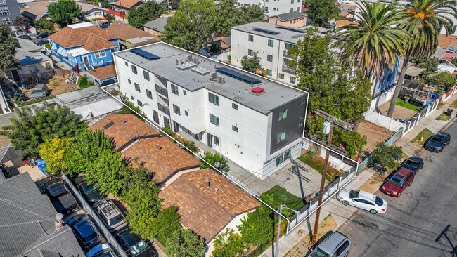
1597 W 37Th St, Los Angeles, CA 90018


This Property Is For Sale
NEARBY LISTINGS FOR SALE OR LEASE
Property Detail
1597 W 37Th St
Los Angeles-Long Beach-Glendale, CA
75
5041-021-013
Los Angeles
Duplex
California
X
0.13 AC
06037C1618G
South Central LA
1,264 SF
Los Angeles
DEMOGRAPHICS near 1597 W 37Th St
1 Mile
3 Mile
5 Mile
2024 Total Population
59,292
528,928
1,254,068
2029 Population
58,623
526,974
1,249,398
Pop Growth 2024-2029
(1.13%)
(0.37%)
(0.37%)
Average Age
38
38
39
2024 Total Households
18,143
176,380
449,279
HH Growth 2024-2029
(1.30%)
(0.31%)
(0.33%)
Median Household Inc
$57,723
$55,866
$63,682
Avg Household Size
3.10
2.80
2.60
2024 Avg HH Vehicles
2.00
1.00
1.00
Median Home Value
$802,545
$842,347
$868,802
Median Year Built
1948
1952
1956
Nearby Places
Map Layers
Map Styles
 Street
 Aerial
- Restaurants
- Banks
- Shops
- Fitness
- Groceries
PUBLIC TRANSPORTATION
TRANSIT/SUBWAY
Expo/Western (Expo Line - Los Angeles County Metropolitan Transportation Authority (Metro))
DRIVE
WALK
Distance
Expo/Western (Expo Line - Los Angeles County Metropolitan Transportation Authority (Metro))
1 min
7 min
0.4 mi
Expo/Vermont (Expo Line - Los Angeles County Metropolitan Transportation Authority (Metro))
DRIVE
WALK
Distance
Expo/Vermont (Expo Line - Los Angeles County Metropolitan Transportation Authority (Metro))
3 min
20 min
1.0 mi
COMMUTER RAIL
DRIVE
WALK
Distance
13 min
6.5 mi
Union Station (91 Line - Southern California Regional Rail Authority (Metrolink), Antelope Valley Line - Southern California Regional Rail Authority (Metrolink), Orange County Line - Southern California Regional Rail Authority (Metrolink), Riverside Line - Southern California Regional Rail Authority (Metrolink), San Bernardino Line - Southern California Regional Rail Authority (Metrolink), Ventura County Line - Southern California Regional Rail Authority (Metrolink))
DRIVE
WALK
Distance
Union Station (91 Line - Southern California Regional Rail Authority (Metrolink), Antelope Valley Line - Southern California Regional Rail Authority (Metrolink), Orange County Line - Southern California Regional Rail Authority (Metrolink), Riverside Line - Southern California Regional Rail Authority (Metrolink), San Bernardino Line - Southern California Regional Rail Authority (Metrolink), Ventura County Line - Southern California Regional Rail Authority (Metrolink))
15 min
6.7 mi
AIRPORT
Los Angeles International
DRIVE
WALK
Distance
Los Angeles International
21 min
9.9 mi
Bob Hope
DRIVE
WALK
Distance
Bob Hope
30 min
14.9 mi
Long Beach (Daugherty Field)
DRIVE
WALK
Distance
Long Beach (Daugherty Field)
31 min
21.5 mi
Freight Ports
Port of Long Beach
DRIVE
WALK
Distance
Port of Long Beach
35 min
23.5 mi
Nearby Properties
Address
Land Use
TOTAL SIZE
Lot Size
Zoning
Address
Land Use
TOTAL SIZE
Lot Size
Zoning
969,516 SF
14.75 AC
Address
Land Use
TOTAL SIZE
Lot Size
Zoning
108,464 SF
9.17 AC
LALASED
Address
Land Use
TOTAL SIZE
Lot Size
Zoning
200,811 SF
4.59 AC
LALASED
Address
Land Use
TOTAL SIZE
Lot Size
Zoning
1,178,786 SF
3.89 AC
LAC2
Address
Land Use
TOTAL SIZE
Lot Size
Zoning
764,804 SF
1.48 AC
Address
Land Use
TOTAL SIZE
Lot Size
Zoning
420,864 SF
63.07 AC
LAUSC-1A
Address
Land Use
TOTAL SIZE
Lot Size
Zoning
574,047 SF
1.70 AC
LAR5
Address
Land Use
TOTAL SIZE
Lot Size
Zoning
256,059 SF
Address
Land Use
TOTAL SIZE
Lot Size
Zoning
200,689 SF
5.79 AC
LAUSC-1A
Address
Land Use
TOTAL SIZE
Lot Size
Zoning
520,825 SF
2.13 AC
LAC2
Address
Land Use
TOTAL SIZE
Lot Size
Zoning
337,025 SF
14.59 AC
LAUSC-1A
Address
Land Use
TOTAL SIZE
Lot Size
Zoning
666,499 SF
10.63 AC
LAC2
Address
Land Use
TOTAL SIZE
Lot Size
Zoning
298,630 SF
4.64 AC
LAUSC-1B
Address
Land Use
TOTAL SIZE
Lot Size
Zoning
323,927 SF
0.85 AC
LALASED
Address
Land Use
TOTAL SIZE
Lot Size
Zoning
289,108 SF
0.57 AC
LAC2
Address
Land Use
TOTAL SIZE
Lot Size
Zoning
786,423 SF
11.74 AC
LAC2
Address
Land Use
TOTAL SIZE
Lot Size
Zoning
9.17 AC
LALASED
Address
Land Use
TOTAL SIZE
Lot Size
Zoning
448,914 SF
2.67 AC
LAC2
Address
Land Use
TOTAL SIZE
Lot Size
Zoning
311,717 SF
1.45 AC
LAR5
Address
Land Use
TOTAL SIZE
Lot Size
Zoning
216,433 SF
1.38 AC
LAR5
Address
Land Use
TOTAL SIZE
Lot Size
Zoning
274,675 SF
1.34 AC
LAR5
Address
Land Use
TOTAL SIZE
Lot Size
Zoning
1,027,870 SF
2.02 AC
LAC2
Address
Land Use
TOTAL SIZE
Lot Size
Zoning
310,063 SF
2.22 AC
LAC2
Address
Land Use
TOTAL SIZE
Lot Size
Zoning
93,785 SF
3.95 AC
LAR5
Address
Land Use
TOTAL SIZE
Lot Size
Zoning
377,946 SF
5.03 AC
LAUSC-1A
Address
Land Use
TOTAL SIZE
Lot Size
Zoning
269,786 SF
1.76 AC
LAR5
Address
Land Use
TOTAL SIZE
Lot Size
Zoning
236,423 SF
9.17 AC
LALASED
Address
Land Use
TOTAL SIZE
Lot Size
Zoning
279,351 SF
1.25 AC
LAC2
Address
Land Use
TOTAL SIZE
Lot Size
Zoning
235,687 SF
0.66 AC
LAR5
The World's #1 Commercial Real Estate Marketplace
Connect with us
© 2026 CoStar Group
The information above has been obtained from sources believed reliable. While we do not doubt its accuracy we have not verified it and make no guarantee, warranty or representation about it. It is your responsibility to independently confirm its accuracy and completeness. Any projections, opinions, assumptions, or estimates used are for example only and do not represent the current or future performance of the property. The value of this transaction to you depends on tax and other factors which should be evaluated by your tax, financial, and legal advisors. You and your advisors should conduct a careful, independent investigation of the property to determine to your satisfaction the suitability of the property for your needs.