Property Record
15984 Fm 3083 Rd, Conroe, TX 77302


Property Detail
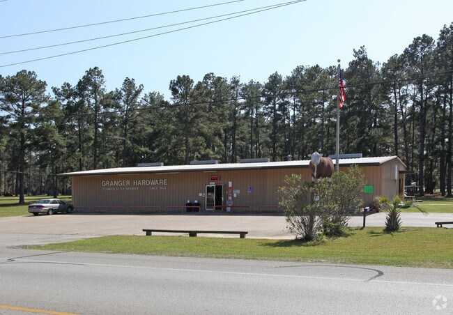
15984 Fm 3083 Rd
0734-00-00106
A0734 GRANGER C E, TRACT 1A-2, ACRES 1.148
Commercialnec
MONTGOMERY
1
Texas
AE The base floodplain where base flood elevations are provided. AE Zones are now used on new format FIRMs instead of A1-A30 Zones.
1.14 AC
2024
Montgomery County
2025
Houston
692201
Houston-Pasadena-The Woodlands, TX
10,000 SF
NEARBY LISTINGS FOR SALE OR LEASE
DEMOGRAPHICS near 15984 Fm 3083 Rd
1 mile
3 mile
5 mile
2025 Total Population
1,275
15,608
35,047
2030 Population
1,524
18,773
42,075
Pop Growth 2025-2030
+ 19.53%
+ 20.28%
+ 20.05%
Average Age
37
36
36
2025 Total Households
440
5,038
11,083
HH Growth 2025-2030
+ 20.00%
+ 20.68%
+ 20.55%
Median Household Inc
$76,500
$72,262
$74,294
Avg Household Size
2.90
3.00
3.10
2025 Avg HH Vehicles
2.00
2.00
2.00
Median Home Value
$165,533
$174,352
$194,990
Median Year Built
2004
2005
2006
Nearby Places
Map Layers
Map Styles
 Street
 Aerial
Layers
 Traffic
 Biking
Places
Listings with unknown addresses are not visible on the map
- Restaurants
- Banks
- Shops
- Fitness
- Groceries
PUBLIC TRANSPORTATION
AIRPORT
George Bush Intcntl/Houston
Drive
Walk
Distance
George Bush Intcntl/Houston
39 min
29.3 mi
Nearby Properties
Address
Land Use
TOTAL SIZE
Lot Size
Zoning
Address
Land Use
TOTAL SIZE
Lot Size
Zoning
305,900 SF
60.85 AC
1
Address
Land Use
TOTAL SIZE
Lot Size
Zoning
205,948 SF
23.14 AC
Address
Land Use
TOTAL SIZE
Lot Size
Zoning
149,817 SF
2 AC
1
Address
Land Use
TOTAL SIZE
Lot Size
Zoning
98,000 SF
18 AC
Address
Land Use
TOTAL SIZE
Lot Size
Zoning
61,000 SF
28.31 AC
Address
Land Use
TOTAL SIZE
Lot Size
Zoning
18,308 SF
2.68 AC
1
Address
Land Use
TOTAL SIZE
Lot Size
Zoning
61,000 SF
16.10 AC
1
Address
Land Use
TOTAL SIZE
Lot Size
Zoning
23,912 SF
53.69 AC
1
Address
Land Use
TOTAL SIZE
Lot Size
Zoning
32,009 SF
13.32 AC
1
Address
Land Use
TOTAL SIZE
Lot Size
Zoning
38,020 SF
28.47 AC
1
Address
Land Use
TOTAL SIZE
Lot Size
Zoning
6,286 SF
21.84 AC
Address
Land Use
TOTAL SIZE
Lot Size
Zoning
9,582 SF
10.46 AC
1
Address
Land Use
TOTAL SIZE
Lot Size
Zoning
9,020 SF
1.54 AC
Address
Land Use
TOTAL SIZE
Lot Size
Zoning
19,952 SF
2 AC
Address
Land Use
TOTAL SIZE
Lot Size
Zoning
8.87 AC
1
Address
Land Use
TOTAL SIZE
Lot Size
Zoning
9,180 SF
1.38 AC
1
Address
Land Use
TOTAL SIZE
Lot Size
Zoning
15,988 SF
46.22 AC
1
Address
Land Use
TOTAL SIZE
Lot Size
Zoning
12,000 SF
1.38 AC
1
Address
Land Use
TOTAL SIZE
Lot Size
Zoning
12,880 SF
5.86 AC
1
Address
Land Use
TOTAL SIZE
Lot Size
Zoning
14,992 SF
2.27 AC
1
Address
Land Use
TOTAL SIZE
Lot Size
Zoning
25,050 SF
9.70 AC
1
Address
Land Use
TOTAL SIZE
Lot Size
Zoning
6,000 SF
1.25 AC
Address
Land Use
TOTAL SIZE
Lot Size
Zoning
26,310 SF
6.50 AC
1
Address
Land Use
TOTAL SIZE
Lot Size
Zoning
10,560 SF
2 AC
1
Address
Land Use
TOTAL SIZE
Lot Size
Zoning
25,364 SF
6.11 AC
1
Address
Land Use
TOTAL SIZE
Lot Size
Zoning
4,730 SF
2 AC
1
Address
Land Use
TOTAL SIZE
Lot Size
Zoning
9,828 SF
28.07 AC
1
Address
Land Use
TOTAL SIZE
Lot Size
Zoning
22.80 AC
1
Address
Land Use
TOTAL SIZE
Lot Size
Zoning
16,701 SF
3.06 AC
1
The World's #1 Commercial Real Estate Marketplace
Connect with us
© 2026 CoStar Group
The information above has been obtained from sources believed reliable. While we do not doubt its accuracy we have not verified it and make no guarantee, warranty or representation about it. It is your responsibility to independently confirm its accuracy and completeness. Any projections, opinions, assumptions, or estimates used are for example only and do not represent the current or future performance of the property. The value of this transaction to you depends on tax and other factors which should be evaluated by your tax, financial, and legal advisors. You and your advisors should conduct a careful, independent investigation of the property to determine to your satisfaction the suitability of the property for your needs.