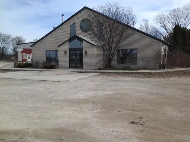
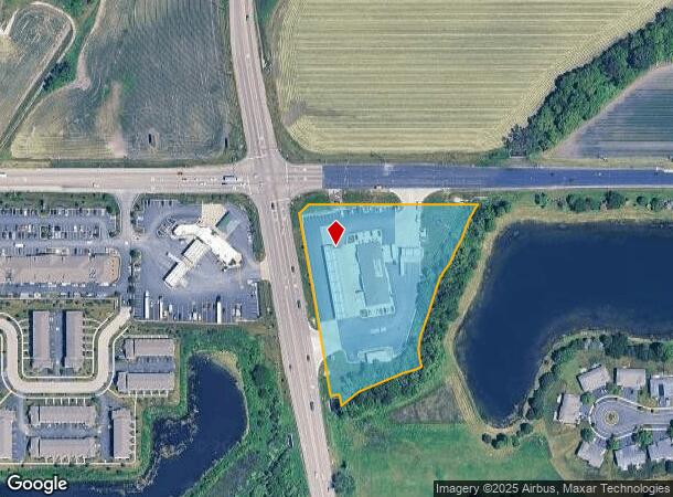
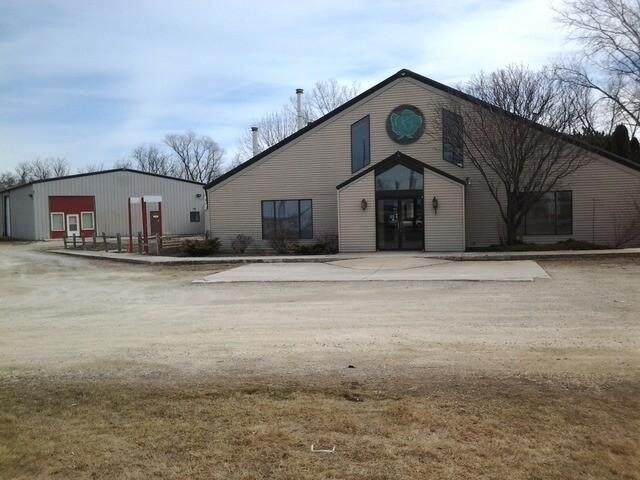
Property Record
15N341 State Route 47, Hampshire, IL 60140
NEARBY LISTINGS FOR SALE OR LEASE
-
-
View all Hampshire listings for sale on LoopNet.com
Property Detail
15N341 State Route 47
02-30-400-040
PART OF THE NE1/4, SE 1/4, 30-42-7 PER 2008K043428 (EX PT FOR ROAD PER 2013K078157)
Commercialnec
Kane
A
Illinois
17089C0130J
3.63 AC
2024
Far Northwest
2024
Chicago
850707
Chicago-Naperville-Elgin, IL-IN
DEMOGRAPHICS near 15N341 State Route 47
1 Mile
3 Mile
5 Mile
2024 Total Population
5,202
15,107
38,960
2029 Population
5,128
14,921
38,733
Pop Growth 2024-2029
(1.42%)
(1.23%)
(0.58%)
Average Age
35
37
45
2024 Total Households
1,704
5,124
15,309
HH Growth 2024-2029
(1.53%)
(1.37%)
(0.65%)
Median Household Inc
$113,013
$110,682
$94,933
Avg Household Size
3.00
2.90
2.50
2024 Avg HH Vehicles
2.00
2.00
2.00
Median Home Value
$289,179
$315,091
$312,926
Median Year Built
2007
2005
2003
Nearby Places
Map Layers
Map Styles
 Street
 Aerial
- Restaurants
- Banks
- Shops
- Fitness
- Groceries
PUBLIC TRANSPORTATION
COMMUTER RAIL
Big Timber Road Station (Milwaukee District West Line - Northeast Illinois Regional Commuter Railroad (Metra))
DRIVE
WALK
Distance
Big Timber Road Station (Milwaukee District West Line - Northeast Illinois Regional Commuter Railroad (Metra))
13 min
8.0 mi
AIRPORT
Chicago O'Hare International
DRIVE
WALK
Distance
Chicago O'Hare International
42 min
36.7 mi
Freight Ports
Port of Baltimore
DRIVE
WALK
Distance
Port of Baltimore
1 min
650.8 mi
Nearby Properties
Address
Land Use
TOTAL SIZE
Lot Size
Zoning
Address
Land Use
TOTAL SIZE
Lot Size
Zoning
57.30 AC
Address
Land Use
TOTAL SIZE
Lot Size
Zoning
Address
Land Use
TOTAL SIZE
Lot Size
Zoning
10.30 AC
Address
Land Use
TOTAL SIZE
Lot Size
Zoning
15.02 AC
Address
Land Use
TOTAL SIZE
Lot Size
Zoning
89,940 SF
8.93 AC
Address
Land Use
TOTAL SIZE
Lot Size
Zoning
Address
Land Use
TOTAL SIZE
Lot Size
Zoning
14.26 AC
Address
Land Use
TOTAL SIZE
Lot Size
Zoning
Address
Land Use
TOTAL SIZE
Lot Size
Zoning
Address
Land Use
TOTAL SIZE
Lot Size
Zoning
Address
Land Use
TOTAL SIZE
Lot Size
Zoning
101,250 SF
17.98 AC
Address
Land Use
TOTAL SIZE
Lot Size
Zoning
58,400 SF
10.26 AC
Address
Land Use
TOTAL SIZE
Lot Size
Zoning
Address
Land Use
TOTAL SIZE
Lot Size
Zoning
Address
Land Use
TOTAL SIZE
Lot Size
Zoning
3.35 AC
Address
Land Use
TOTAL SIZE
Lot Size
Zoning
15.59 AC
Address
Land Use
TOTAL SIZE
Lot Size
Zoning
Address
Land Use
TOTAL SIZE
Lot Size
Zoning
Address
Land Use
TOTAL SIZE
Lot Size
Zoning
16.90 AC
Address
Land Use
TOTAL SIZE
Lot Size
Zoning
1.22 AC
Address
Land Use
TOTAL SIZE
Lot Size
Zoning
20,040 SF
3.96 AC
Address
Land Use
TOTAL SIZE
Lot Size
Zoning
1.51 AC
Address
Land Use
TOTAL SIZE
Lot Size
Zoning
18,000 SF
4.62 AC
Address
Land Use
TOTAL SIZE
Lot Size
Zoning
2.01 AC
Address
Land Use
TOTAL SIZE
Lot Size
Zoning
5.66 AC
Address
Land Use
TOTAL SIZE
Lot Size
Zoning
26,420 SF
4.45 AC
Address
Land Use
TOTAL SIZE
Lot Size
Zoning
220 SF
4.36 AC
The World's #1 Commercial Real Estate Marketplace
Connect with us
© 2026 CoStar Group
The information above has been obtained from sources believed reliable. While we do not doubt its accuracy we have not verified it and make no guarantee, warranty or representation about it. It is your responsibility to independently confirm its accuracy and completeness. Any projections, opinions, assumptions, or estimates used are for example only and do not represent the current or future performance of the property. The value of this transaction to you depends on tax and other factors which should be evaluated by your tax, financial, and legal advisors. You and your advisors should conduct a careful, independent investigation of the property to determine to your satisfaction the suitability of the property for your needs.