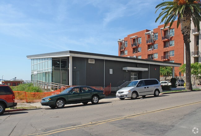
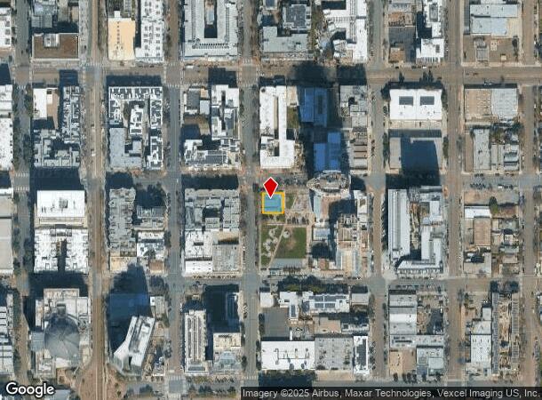
Property Record
15Th St, San Diego, CA 92101
NEARBY LISTINGS FOR SALE OR LEASE
Property Detail
15Th St
535-154-08
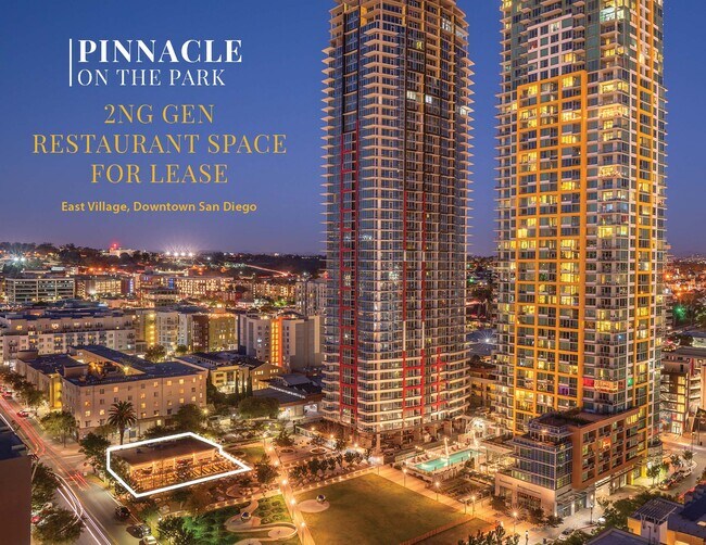
Success Towers Master Condo
Retailwithmorethanonenonretailuse
PAR 1 CAFE MODULE PER DOC12-0410869&UND INT IN TR PM20125
X
San Diego
06073C1884H
California
2024
0.13 AC
2025
Downtown
005302
San Diego
2,998 SF
San Diego-Carlsbad, CA
DEMOGRAPHICS near 15Th St
1 Mile
3 Mile
5 Mile
2024 Total Population
53,931
197,784
482,165
2029 Population
54,454
198,099
481,396
Pop Growth 2024-2029
+ 0.97%
+ 0.16%
(0.16%)
Average Age
41
39
38
2024 Total Households
26,572
87,621
192,352
HH Growth 2024-2029
+ 1.40%
+ 0.35%
(0.02%)
Median Household Inc
$67,243
$79,360
$72,780
Avg Household Size
1.70
2.00
2.30
2024 Avg HH Vehicles
1.00
1.00
2.00
Median Home Value
$742,604
$853,662
$755,786
Median Year Built
2002
1978
1974
Nearby Places
Map Layers
Map Styles
 Street
 Aerial
- Restaurants
- Banks
- Shops
- Fitness
- Groceries
PUBLIC TRANSPORTATION
TRANSIT/SUBWAY
Park And Market (Blue Line - San Diego Metropolitan Transit System Trolley (San Diego Trolley), Orange Line - San Diego Metropolitan Transit System Trolley (San Diego Trolley))
DRIVE
WALK
Distance
Park And Market (Blue Line - San Diego Metropolitan Transit System Trolley (San Diego Trolley), Orange Line - San Diego Metropolitan Transit System Trolley (San Diego Trolley))
1 min
3 min
0.2 mi
12Th & Imperial Transit Center (Blue Line - San Diego Metropolitan Transit System Trolley (San Diego Trolley), Orange Line - San Diego Metropolitan Transit System Trolley (San Diego Trolley))
DRIVE
WALK
Distance
12Th & Imperial Transit Center (Blue Line - San Diego Metropolitan Transit System Trolley (San Diego Trolley), Orange Line - San Diego Metropolitan Transit System Trolley (San Diego Trolley))
2 min
8 min
0.4 mi
City College (Blue Line - San Diego Metropolitan Transit System Trolley (San Diego Trolley), Orange Line - San Diego Metropolitan Transit System Trolley (San Diego Trolley))
DRIVE
WALK
Distance
City College (Blue Line - San Diego Metropolitan Transit System Trolley (San Diego Trolley), Orange Line - San Diego Metropolitan Transit System Trolley (San Diego Trolley))
2 min
10 min
0.5 mi
Gaslamp Quarter (Orange Line - San Diego Metropolitan Transit System Trolley (San Diego Trolley))
DRIVE
WALK
Distance
Gaslamp Quarter (Orange Line - San Diego Metropolitan Transit System Trolley (San Diego Trolley))
3 min
14 min
0.8 mi
5Th Avenue (Blue Line - San Diego Metropolitan Transit System Trolley (San Diego Trolley), Orange Line - San Diego Metropolitan Transit System Trolley (San Diego Trolley))
DRIVE
WALK
Distance
5Th Avenue (Blue Line - San Diego Metropolitan Transit System Trolley (San Diego Trolley), Orange Line - San Diego Metropolitan Transit System Trolley (San Diego Trolley))
3 min
17 min
0.9 mi
COMMUTER RAIL
San Diego (Santa Fe Depot) (Coaster - San Diego North County Transit District (Coaster/Sprinter/Breeze))
DRIVE
WALK
Distance
San Diego (Santa Fe Depot) (Coaster - San Diego North County Transit District (Coaster/Sprinter/Breeze))
4 min
1.7 mi
Old Town Transit Center (Coaster - San Diego North County Transit District (Coaster/Sprinter/Breeze))
DRIVE
WALK
Distance
Old Town Transit Center (Coaster - San Diego North County Transit District (Coaster/Sprinter/Breeze))
8 min
4.8 mi
AIRPORT
San Diego International
DRIVE
WALK
Distance
San Diego International
9 min
4.2 mi
Freight Ports
Port of San Diego
DRIVE
WALK
Distance
Port of San Diego
5 min
1.8 mi
SALE & LEASE HISTORY
LISTING DATE
SALE/LEASE

Oct 15, 2023
For Lease
Feb 26, 2018
For Sale
Feb 13, 2024
For Lease
Nearby Properties
Address
Land Use
TOTAL SIZE
Lot Size
Zoning
Address
Land Use
TOTAL SIZE
Lot Size
Zoning
8.75 AC
60
Address
Land Use
TOTAL SIZE
Lot Size
Zoning
10.72 AC
M
Address
Land Use
TOTAL SIZE
Lot Size
Zoning
12.79 AC
C
Address
Land Use
TOTAL SIZE
Lot Size
Zoning
5.99 AC
C
Address
Land Use
TOTAL SIZE
Lot Size
Zoning
3.24 AC
C
Address
Land Use
TOTAL SIZE
Lot Size
Zoning
0.33 AC
CCPD-NC
Address
Land Use
TOTAL SIZE
Lot Size
Zoning
1.38 AC
CCPD-R
Address
Land Use
TOTAL SIZE
Lot Size
Zoning
125.69 AC
M
Address
Land Use
TOTAL SIZE
Lot Size
Zoning
7.27 AC
HM
Address
Land Use
TOTAL SIZE
Lot Size
Zoning
1.25 AC
CCPD-BP
Address
Land Use
TOTAL SIZE
Lot Size
Zoning
37.33 AC
C
Address
Land Use
TOTAL SIZE
Lot Size
Zoning
9,999 SF
1.18 AC
C
Address
Land Use
TOTAL SIZE
Lot Size
Zoning
107.28 AC
UNZONED
Address
Land Use
TOTAL SIZE
Lot Size
Zoning
17.25 AC
CCPD-BP
Address
Land Use
TOTAL SIZE
Lot Size
Zoning
1.14 AC
CCPD-NC
Address
Land Use
TOTAL SIZE
Lot Size
Zoning
496,552 SF
27.12 AC
M
Address
Land Use
TOTAL SIZE
Lot Size
Zoning
0.21 AC
CCPD-R
Address
Land Use
TOTAL SIZE
Lot Size
Zoning
10,000 SF
0.21 AC
CCPD-NC
Address
Land Use
TOTAL SIZE
Lot Size
Zoning
1.38 AC
CCPD-CORE
Address
Land Use
TOTAL SIZE
Lot Size
Zoning
12.63 AC
R4
Address
Land Use
TOTAL SIZE
Lot Size
Zoning
18.97 AC
C
Address
Land Use
TOTAL SIZE
Lot Size
Zoning
CCPD-ER
Address
Land Use
TOTAL SIZE
Lot Size
Zoning
0.57 AC
CCPD-NC
Address
Land Use
TOTAL SIZE
Lot Size
Zoning
0.77 AC
CCPD-NC
Address
Land Use
TOTAL SIZE
Lot Size
Zoning
1.38 AC
CCPD-R
Address
Land Use
TOTAL SIZE
Lot Size
Zoning
1.10 AC
GQPD-GASLA
Address
Land Use
TOTAL SIZE
Lot Size
Zoning
RM-4-10
Address
Land Use
TOTAL SIZE
Lot Size
Zoning
3.17 AC
U
Address
Land Use
TOTAL SIZE
Lot Size
Zoning
15.37 AC
CC-3-8
Address
Land Use
TOTAL SIZE
Lot Size
Zoning
1.38 AC
CCPD-NC
The World's #1 Commercial Real Estate Marketplace
Connect with us
© 2025 CoStar Group
The information above has been obtained from sources believed reliable. While we do not doubt its accuracy we have not verified it and make no guarantee, warranty or representation about it. It is your responsibility to independently confirm its accuracy and completeness. Any projections, opinions, assumptions, or estimates used are for example only and do not represent the current or future performance of the property. The value of this transaction to you depends on tax and other factors which should be evaluated by your tax, financial, and legal advisors. You and your advisors should conduct a careful, independent investigation of the property to determine to your satisfaction the suitability of the property for your needs.