Property Record
16 16Th St S, Fargo, ND 58103
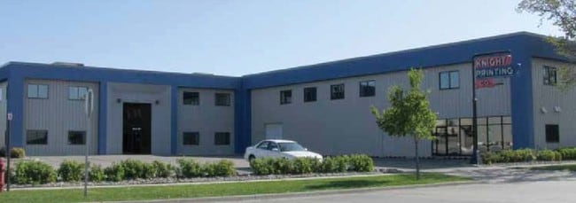

Property Detail
16 16Th St S
01-0980-00147-000
LOT: 3 BLOCK: 2 ADDITION: FULLERS ADDITIONAL: FULLER'S ADDN LOT A3 THRU H3 BLK 2 N 30' OF LOT B4 PT OF LOT C4 LYING N OF A LN
Commercialnec
Cass
LI
North Dakota
C and X Area of minimal flood hazard, usually depicted on FIRMs as above the 500-year flood level.
3
2025
1.54 AC
2025
Jefferson
000602
Other Market Areas
33,468 SF
Fargo, ND-MN
NEARBY LISTINGS FOR SALE OR LEASE
DEMOGRAPHICS near 16 16Th St S
1 mile
3 mile
5 mile
2025 Total Population
16,679
99,574
186,492
2030 Population
17,968
106,099
197,287
Pop Growth 2025-2030
+ 7.73%
+ 6.55%
+ 5.79%
Average Age
37
37
37
2025 Total Households
8,417
44,542
81,207
HH Growth 2025-2030
+ 7.83%
+ 6.92%
+ 6.24%
Median Household Inc
$49,734
$56,017
$63,337
Avg Household Size
1.80
2.00
2.10
2025 Avg HH Vehicles
2.00
2.00
2.00
Median Home Value
$208,586
$239,758
$269,803
Median Year Built
1964
1976
1988
Nearby Places
Map Layers
Map Styles
 Street
 Aerial
Layers
 Traffic
 Biking
Places
Listings with unknown addresses are not visible on the map
- Restaurants
- Banks
- Shops
- Fitness
- Groceries
PUBLIC TRANSPORTATION
COMMUTER RAIL
Fargo Amtrak Station (Empire Builder - Amtrak)
Drive
Walk
Distance
Fargo Amtrak Station (Empire Builder - Amtrak)
4 min
1.5 mi
AIRPORT
Hector International
Drive
Walk
Distance
Hector International
10 min
4.6 mi
Freight Ports
Port Milwaukee
Drive
Walk
Distance
Port Milwaukee
630 min
572.8 mi
Nearby Properties
Address
Land Use
TOTAL SIZE
Lot Size
Zoning
Address
Land Use
TOTAL SIZE
Lot Size
Zoning
40.49 AC
Address
Land Use
TOTAL SIZE
Lot Size
Zoning
30.61 AC
Address
Land Use
TOTAL SIZE
Lot Size
Zoning
17.38 AC
Address
Land Use
TOTAL SIZE
Lot Size
Zoning
21.81 AC
Address
Land Use
TOTAL SIZE
Lot Size
Zoning
53.42 AC
Address
Land Use
TOTAL SIZE
Lot Size
Zoning
32.98 AC
Address
Land Use
TOTAL SIZE
Lot Size
Zoning
408,617 SF
9.33 AC
GC
Address
Land Use
TOTAL SIZE
Lot Size
Zoning
14.53 AC
Address
Land Use
TOTAL SIZE
Lot Size
Zoning
621,097 SF
49.49 AC
LI
Address
Land Use
TOTAL SIZE
Lot Size
Zoning
230,272 SF
21.77 AC
GC
Address
Land Use
TOTAL SIZE
Lot Size
Zoning
121,584 SF
5.64 AC
MR3
Address
Land Use
TOTAL SIZE
Lot Size
Zoning
3.39 AC
Address
Land Use
TOTAL SIZE
Lot Size
Zoning
162,875 SF
12.32 AC
MR3
Address
Land Use
TOTAL SIZE
Lot Size
Zoning
Address
Land Use
TOTAL SIZE
Lot Size
Zoning
107,995 SF
1 AC
DMU
Address
Land Use
TOTAL SIZE
Lot Size
Zoning
5.23 AC
Address
Land Use
TOTAL SIZE
Lot Size
Zoning
2.77 AC
Address
Land Use
TOTAL SIZE
Lot Size
Zoning
0.22 AC
Address
Land Use
TOTAL SIZE
Lot Size
Zoning
999.99 AC
Address
Land Use
TOTAL SIZE
Lot Size
Zoning
3.31 AC
Address
Land Use
TOTAL SIZE
Lot Size
Zoning
0.17 AC
Address
Land Use
TOTAL SIZE
Lot Size
Zoning
303,970 SF
49.72 AC
GI
Address
Land Use
TOTAL SIZE
Lot Size
Zoning
2.91 AC
Address
Land Use
TOTAL SIZE
Lot Size
Zoning
163,398 SF
1.92 AC
LC
Address
Land Use
TOTAL SIZE
Lot Size
Zoning
73.98 AC
Address
Land Use
TOTAL SIZE
Lot Size
Zoning
163,195 SF
11.95 AC
GC
Address
Land Use
TOTAL SIZE
Lot Size
Zoning
109,174 SF
1.25 AC
UMU
Address
Land Use
TOTAL SIZE
Lot Size
Zoning
6.02 AC
Address
Land Use
TOTAL SIZE
Lot Size
Zoning
45.33 AC
GC
Address
Land Use
TOTAL SIZE
Lot Size
Zoning
2.07 AC
The World's #1 Commercial Real Estate Marketplace
Connect with us
© 2026 CoStar Group
The information above has been obtained from sources believed reliable. While we do not doubt its accuracy we have not verified it and make no guarantee, warranty or representation about it. It is your responsibility to independently confirm its accuracy and completeness. Any projections, opinions, assumptions, or estimates used are for example only and do not represent the current or future performance of the property. The value of this transaction to you depends on tax and other factors which should be evaluated by your tax, financial, and legal advisors. You and your advisors should conduct a careful, independent investigation of the property to determine to your satisfaction the suitability of the property for your needs.