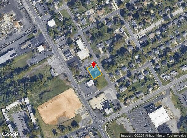
Property Record
16 Dearborne Ave, Blackwood, NJ 08012


NEARBY LISTINGS FOR SALE OR LEASE
Property Detail
16 Dearborne Ave
15-12616-0000-00002
Blackwood Estates
Commercialnec
Camden
X
New Jersey
34015C0116E
2
2024
0.29 AC
2025
South Camden County
611300
Philadelphia
1,586 SF
Philadelphia-Camden-Wilmington, PA-NJ-DE-MD
DEMOGRAPHICS near 16 Dearborne Ave
1 Mile
3 Mile
5 Mile
2024 Total Population
6,760
70,865
203,020
2029 Population
6,815
71,465
204,619
Pop Growth 2024-2029
+ 0.81%
+ 0.85%
+ 0.79%
Average Age
41
40
41
2024 Total Households
2,347
27,492
78,543
HH Growth 2024-2029
+ 0.85%
+ 0.75%
+ 0.72%
Median Household Inc
$91,277
$90,457
$88,101
Avg Household Size
2.70
2.50
2.50
2024 Avg HH Vehicles
2.00
2.00
2.00
Median Home Value
$241,705
$249,129
$241,450
Median Year Built
1964
1976
1975
Nearby Places
Map Layers
Map Styles
 Street
 Aerial
- Restaurants
- Banks
- Shops
- Fitness
- Groceries
PUBLIC TRANSPORTATION
COMMUTER RAIL
Lindenwold (Njt) (Atlantic City Line - NJ Transit Commuter Rail (NJ Transit))
DRIVE
WALK
Distance
Lindenwold (Njt) (Atlantic City Line - NJ Transit Commuter Rail (NJ Transit))
11 min
6.0 mi
AIRPORT
Philadelphia International
DRIVE
WALK
Distance
Philadelphia International
31 min
18.8 mi
Freight Ports
Broadway Terminal - Pier 5
DRIVE
WALK
Distance
Broadway Terminal - Pier 5
16 min
10.2 mi
SALE & LEASE HISTORY
LISTING DATE
SALE/LEASE

Feb 23, 2024
For Sale
Nearby Properties
Address
Land Use
TOTAL SIZE
Lot Size
Zoning
Address
Land Use
TOTAL SIZE
Lot Size
Zoning
Address
Land Use
TOTAL SIZE
Lot Size
Zoning
54.91 AC
Address
Land Use
TOTAL SIZE
Lot Size
Zoning
68.30 AC
Address
Land Use
TOTAL SIZE
Lot Size
Zoning
61.94 AC
R3
Address
Land Use
TOTAL SIZE
Lot Size
Zoning
48 AC
R-3
Address
Land Use
TOTAL SIZE
Lot Size
Zoning
Address
Land Use
TOTAL SIZE
Lot Size
Zoning
49.56 AC
H
Address
Land Use
TOTAL SIZE
Lot Size
Zoning
33.50 AC
INS
Address
Land Use
TOTAL SIZE
Lot Size
Zoning
32.49 AC
Address
Land Use
TOTAL SIZE
Lot Size
Zoning
33.24 AC
INS
Address
Land Use
TOTAL SIZE
Lot Size
Zoning
Address
Land Use
TOTAL SIZE
Lot Size
Zoning
29.87 AC
R-3
Address
Land Use
TOTAL SIZE
Lot Size
Zoning
28.93 AC
Address
Land Use
TOTAL SIZE
Lot Size
Zoning
1,872 SF
180.40 AC
Address
Land Use
TOTAL SIZE
Lot Size
Zoning
20.85 AC
R-3
Address
Land Use
TOTAL SIZE
Lot Size
Zoning
23.61 AC
SC
Address
Land Use
TOTAL SIZE
Lot Size
Zoning
Address
Land Use
TOTAL SIZE
Lot Size
Zoning
11.70 AC
Address
Land Use
TOTAL SIZE
Lot Size
Zoning
17.54 AC
RD
Address
Land Use
TOTAL SIZE
Lot Size
Zoning
17.53 AC
HC
Address
Land Use
TOTAL SIZE
Lot Size
Zoning
Address
Land Use
TOTAL SIZE
Lot Size
Zoning
16.40 AC
COMM
Address
Land Use
TOTAL SIZE
Lot Size
Zoning
31.10 AC
Address
Land Use
TOTAL SIZE
Lot Size
Zoning
17.08 AC
R 3
Address
Land Use
TOTAL SIZE
Lot Size
Zoning
12.78 AC
INS
Address
Land Use
TOTAL SIZE
Lot Size
Zoning
19.15 AC
BC4
Address
Land Use
TOTAL SIZE
Lot Size
Zoning
Address
Land Use
TOTAL SIZE
Lot Size
Zoning
24.78 AC
SC
Address
Land Use
TOTAL SIZE
Lot Size
Zoning
5.23 AC
BC4
Address
Land Use
TOTAL SIZE
Lot Size
Zoning
4.35 AC
CI
The World's #1 Commercial Real Estate Marketplace
Connect with us
© 2025 CoStar Group
The information above has been obtained from sources believed reliable. While we do not doubt its accuracy we have not verified it and make no guarantee, warranty or representation about it. It is your responsibility to independently confirm its accuracy and completeness. Any projections, opinions, assumptions, or estimates used are for example only and do not represent the current or future performance of the property. The value of this transaction to you depends on tax and other factors which should be evaluated by your tax, financial, and legal advisors. You and your advisors should conduct a careful, independent investigation of the property to determine to your satisfaction the suitability of the property for your needs.