Property Record
16 E Washington St, North Attleboro, MA 02760


Property Detail
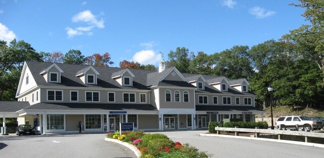
16 E Washington St
Officebuilding
Bristol
C60
Massachusetts
B and X Area of moderate flood hazard, usually the area between the limits of the 100-year and 500-year floods.
1.76 AC
2025
Attleboro/New Bedford
2025
Boston
630400
Providence-Warwick, RI-MA
12,120 SF
NATT-000023-000271
NEARBY LISTINGS FOR SALE OR LEASE
DEMOGRAPHICS near 16 E Washington St
1 mile
3 mile
5 mile
2025 Total Population
8,205
43,511
111,450
2030 Population
8,397
44,393
113,987
Pop Growth 2025-2030
+ 2.34%
+ 2.03%
+ 2.28%
Average Age
42
42
42
2025 Total Households
3,679
17,353
43,522
HH Growth 2025-2030
+ 2.58%
+ 2.06%
+ 2.28%
Median Household Inc
$89,295
$104,084
$102,447
Avg Household Size
2.20
2.50
2.50
2025 Avg HH Vehicles
2.00
2.00
2.00
Median Home Value
$414,304
$503,037
$478,242
Median Year Built
1975
1975
1974
Nearby Places
Map Layers
Map Styles
 Street
 Aerial
Layers
 Traffic
 Biking
Places
Listings with unknown addresses are not visible on the map
- Restaurants
- Banks
- Shops
- Fitness
- Groceries
PUBLIC TRANSPORTATION
COMMUTER RAIL
South Attleboro (Providence/Stoughton Line - Massachusetts Bay Transportation Authority Commuter Rail (Purple Line))
Drive
Walk
Distance
South Attleboro (Providence/Stoughton Line - Massachusetts Bay Transportation Authority Commuter Rail (Purple Line))
10 min
5.2 mi
Mansfield (Foxboro Line (Special Events Only) - Massachusetts Bay Transportation Authority Commuter Rail (Purple Line), Providence/Stoughton Line - Massachusetts Bay Transportation Authority Commuter Rail (Purple Line))
Drive
Walk
Distance
Mansfield (Foxboro Line (Special Events Only) - Massachusetts Bay Transportation Authority Commuter Rail (Purple Line), Providence/Stoughton Line - Massachusetts Bay Transportation Authority Commuter Rail (Purple Line))
19 min
9.0 mi
AIRPORT
Rhode Island Tf Green International
Drive
Walk
Distance
Rhode Island Tf Green International
37 min
20.6 mi
General Edward Lawrence Logan International
Drive
Walk
Distance
General Edward Lawrence Logan International
59 min
35.8 mi
Worcester Regional
Drive
Walk
Distance
Worcester Regional
60 min
43.1 mi
SALE & LEASE HISTORY
LISTING DATE
SALE/LEASE

Sep 25, 2016
For Lease
Feb 25, 2022
For Lease
Aug 17, 2023
For Lease
Nearby Properties
Address
Land Use
TOTAL SIZE
Lot Size
Zoning
Address
Land Use
TOTAL SIZE
Lot Size
Zoning
65.21 AC
Address
Land Use
TOTAL SIZE
Lot Size
Zoning
741,896 SF
27.75 AC
GU
Address
Land Use
TOTAL SIZE
Lot Size
Zoning
98,369 SF
5.53 AC
IC30
Address
Land Use
TOTAL SIZE
Lot Size
Zoning
64.31 AC
C60
Address
Land Use
TOTAL SIZE
Lot Size
Zoning
17,782 SF
25.60 AC
Address
Land Use
TOTAL SIZE
Lot Size
Zoning
Address
Land Use
TOTAL SIZE
Lot Size
Zoning
8,432 SF
46 AC
Address
Land Use
TOTAL SIZE
Lot Size
Zoning
5,059 SF
217.41 AC
Address
Land Use
TOTAL SIZE
Lot Size
Zoning
190,458 SF
16.30 AC
C60
Address
Land Use
TOTAL SIZE
Lot Size
Zoning
112,766 SF
31.06 AC
Address
Land Use
TOTAL SIZE
Lot Size
Zoning
Address
Land Use
TOTAL SIZE
Lot Size
Zoning
105,878 SF
12.05 AC
C60
Address
Land Use
TOTAL SIZE
Lot Size
Zoning
8.29 AC
R10
Address
Land Use
TOTAL SIZE
Lot Size
Zoning
79,322 SF
12.54 AC
R15
Address
Land Use
TOTAL SIZE
Lot Size
Zoning
16.82 AC
C60
Address
Land Use
TOTAL SIZE
Lot Size
Zoning
9.52 AC
C7.5
Address
Land Use
TOTAL SIZE
Lot Size
Zoning
126,073 SF
22.90 AC
C60
Address
Land Use
TOTAL SIZE
Lot Size
Zoning
97,027 SF
12.02 AC
C60
Address
Land Use
TOTAL SIZE
Lot Size
Zoning
12,958 SF
5.50 AC
Address
Land Use
TOTAL SIZE
Lot Size
Zoning
89,242 SF
14.65 AC
C60
Address
Land Use
TOTAL SIZE
Lot Size
Zoning
11.87 AC
C60
Address
Land Use
TOTAL SIZE
Lot Size
Zoning
91,126 SF
9.71 AC
I60
Address
Land Use
TOTAL SIZE
Lot Size
Zoning
36,424 SF
1.18 AC
IC3
Address
Land Use
TOTAL SIZE
Lot Size
Zoning
53,375 SF
10.14 AC
IC30
Address
Land Use
TOTAL SIZE
Lot Size
Zoning
104,003 SF
9.92 AC
I60
Address
Land Use
TOTAL SIZE
Lot Size
Zoning
1,656 SF
4.66 AC
R15
Address
Land Use
TOTAL SIZE
Lot Size
Zoning
7,364 SF
8.60 AC
Address
Land Use
TOTAL SIZE
Lot Size
Zoning
3.59 AC
IC3
Address
Land Use
TOTAL SIZE
Lot Size
Zoning
182,578 SF
8.09 AC
GU
Address
Land Use
TOTAL SIZE
Lot Size
Zoning
7.80 AC
The World's #1 Commercial Real Estate Marketplace
Connect with us
© 2026 CoStar Group
The information above has been obtained from sources believed reliable. While we do not doubt its accuracy we have not verified it and make no guarantee, warranty or representation about it. It is your responsibility to independently confirm its accuracy and completeness. Any projections, opinions, assumptions, or estimates used are for example only and do not represent the current or future performance of the property. The value of this transaction to you depends on tax and other factors which should be evaluated by your tax, financial, and legal advisors. You and your advisors should conduct a careful, independent investigation of the property to determine to your satisfaction the suitability of the property for your needs.