Property Record
16 Exeter Rd, South Hampton, NH 03827


Save to a Folder
{{folder.Name}}
{{folder.ListingIds.length}} Properties
{{folder.ListingIds.length}} Property
Create a New Folder
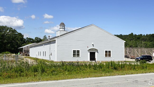
Property Detail
16 Exeter Rd
SHMP-000006-000000-000025
Rockingham
Commercialbuilding
New Hampshire
COMM
25
B and X Area of moderate flood hazard, usually the area between the limits of the 100-year and 500-year floods.
2 AC
2025
Rockingham
2025
Boston
062500
Boston-Cambridge-Newton, MA-NH
12,676 SF
NEARBY LISTINGS FOR SALE OR LEASE
DEMOGRAPHICS near 16 Exeter Rd
1 mile
3 mile
5 mile
2025 Total Population
992
17,875
40,858
2030 Population
1,022
18,277
41,719
Pop Growth 2025-2030
+ 3.02%
+ 2.25%
+ 2.11%
Average Age
44
44
45
2025 Total Households
400
7,463
16,917
HH Growth 2025-2030
+ 3.25%
+ 2.22%
+ 2.10%
Median Household Inc
$87,500
$94,167
$101,234
Avg Household Size
2.50
2.30
2.40
2025 Avg HH Vehicles
2.00
2.00
2.00
Median Home Value
$636,513
$533,893
$556,058
Median Year Built
1988
1974
1978
Nearby Places
Map Layers
Map Styles
 Street
 Aerial
Layers
 Traffic
 Biking
Places
Listings with unknown addresses are not visible on the map
- Restaurants
- Banks
- Shops
- Fitness
- Groceries
PUBLIC TRANSPORTATION
COMMUTER RAIL
Exeter (Downeaster - Amtrak)
Drive
Walk
Distance
Exeter (Downeaster - Amtrak)
14 min
7.2 mi
Newburyport (Newburyport/Rockport Line - MBTA)
Drive
Walk
Distance
Newburyport (Newburyport/Rockport Line - MBTA)
17 min
9.5 mi
AIRPORT
Portsmouth International at Pease
Drive
Walk
Distance
Portsmouth International at Pease
29 min
18.8 mi
Manchester Boston Regional
Drive
Walk
Distance
Manchester Boston Regional
63 min
43.7 mi
Freight Ports
Port of Boston
Drive
Walk
Distance
Port of Boston
62 min
44.2 mi
Nearby Properties
Address
Land Use
TOTAL SIZE
Lot Size
Zoning
Address
Land Use
TOTAL SIZE
Lot Size
Zoning
55,934 SF
35.25 AC
A
Address
Land Use
TOTAL SIZE
Lot Size
Zoning
504,280 SF
80.02 AC
I3
Address
Land Use
TOTAL SIZE
Lot Size
Zoning
120,362 SF
32.29 AC
LA4
Address
Land Use
TOTAL SIZE
Lot Size
Zoning
9.31 AC
R8
Address
Land Use
TOTAL SIZE
Lot Size
Zoning
30,440 SF
17.99 AC
LA4
Address
Land Use
TOTAL SIZE
Lot Size
Zoning
87,374 SF
21.66 AC
LA3
Address
Land Use
TOTAL SIZE
Lot Size
Zoning
7,936 SF
12.80 AC
A
Address
Land Use
TOTAL SIZE
Lot Size
Zoning
134,617 SF
15.89 AC
LA4
Address
Land Use
TOTAL SIZE
Lot Size
Zoning
79,991 SF
2.66 AC
IC
Address
Land Use
TOTAL SIZE
Lot Size
Zoning
2.47 AC
R8
Address
Land Use
TOTAL SIZE
Lot Size
Zoning
101,044 SF
13.24 AC
LA4
Address
Land Use
TOTAL SIZE
Lot Size
Zoning
4.30 AC
R40
Address
Land Use
TOTAL SIZE
Lot Size
Zoning
3.68 AC
R40
Address
Land Use
TOTAL SIZE
Lot Size
Zoning
274,050 SF
29.02 AC
I
Address
Land Use
TOTAL SIZE
Lot Size
Zoning
20,160 SF
4.81 AC
A
Address
Land Use
TOTAL SIZE
Lot Size
Zoning
78,886 SF
75.81 AC
C2
Address
Land Use
TOTAL SIZE
Lot Size
Zoning
11,904 SF
7.83 AC
A
Address
Land Use
TOTAL SIZE
Lot Size
Zoning
1,056 SF
63.40 AC
40
Address
Land Use
TOTAL SIZE
Lot Size
Zoning
61,320 SF
35.32 AC
OSC
Address
Land Use
TOTAL SIZE
Lot Size
Zoning
136,020 SF
8.03 AC
I5
Address
Land Use
TOTAL SIZE
Lot Size
Zoning
126,144 SF
5.41 AC
I
Address
Land Use
TOTAL SIZE
Lot Size
Zoning
11,907 SF
4.03 AC
A
Address
Land Use
TOTAL SIZE
Lot Size
Zoning
48,120 SF
7.15 AC
C2
Address
Land Use
TOTAL SIZE
Lot Size
Zoning
58,391 SF
14.11 AC
OSC
Address
Land Use
TOTAL SIZE
Lot Size
Zoning
5.98 AC
R8
Address
Land Use
TOTAL SIZE
Lot Size
Zoning
37,886 SF
0.78 AC
IC
Address
Land Use
TOTAL SIZE
Lot Size
Zoning
1.18 AC
R8
Address
Land Use
TOTAL SIZE
Lot Size
Zoning
10,944 SF
2.47 AC
LA4
Address
Land Use
TOTAL SIZE
Lot Size
Zoning
2.29 AC
R8
Address
Land Use
TOTAL SIZE
Lot Size
Zoning
110,350 SF
15.86 AC
I3
The World's #1 Commercial Real Estate Marketplace
Connect with us
© 2026 CoStar Group
The information above has been obtained from sources believed reliable. While we do not doubt its accuracy we have not verified it and make no guarantee, warranty or representation about it. It is your responsibility to independently confirm its accuracy and completeness. Any projections, opinions, assumptions, or estimates used are for example only and do not represent the current or future performance of the property. The value of this transaction to you depends on tax and other factors which should be evaluated by your tax, financial, and legal advisors. You and your advisors should conduct a careful, independent investigation of the property to determine to your satisfaction the suitability of the property for your needs.