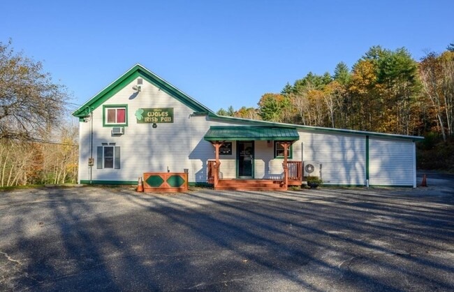
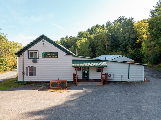
Property Record
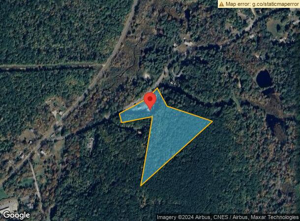
16 Holland Rd, Wales, MA 01081
NEARBY LISTINGS FOR SALE OR LEASE
-
-
View all Wales listings for sale on LoopNet.com
Property Detail
16 Holland Rd
WALE-001000-001770-000016
Hampden
Restaurantbuilding
Massachusetts
X
16-0
25013C0479F
9.70 AC
2025
Hampden County
2025
Hartford
813801
Springfield, MA
2,800 SF
DEMOGRAPHICS near 16 Holland Rd
1 Mile
3 Mile
5 Mile
2024 Total Population
274
4,033
9,641
2029 Population
275
4,035
9,622
Pop Growth 2024-2029
+ 0.36%
+ 0.05%
(0.20%)
Average Age
43
44
44
2024 Total Households
112
1,666
3,981
HH Growth 2024-2029
+ 0.89%
0.00%
(0.20%)
Median Household Inc
$88,020
$85,659
$85,207
Avg Household Size
2.50
2.40
2.40
2024 Avg HH Vehicles
2.00
2.00
2.00
Median Home Value
$267,777
$278,012
$298,478
Median Year Built
1983
1983
1983
Nearby Places
Map Layers
Map Styles
 Street
 Aerial
- Restaurants
- Banks
- Shops
- Fitness
- Groceries
PUBLIC TRANSPORTATION
AIRPORT
Worcester Regional
DRIVE
WALK
Distance
Worcester Regional
51 min
31.3 mi
Bradley International
DRIVE
WALK
Distance
Bradley International
62 min
33.3 mi
Freight Ports
Port of Davisville, RI
DRIVE
WALK
Distance
Port of Davisville, RI
109 min
82.5 mi
SALE & LEASE HISTORY
LISTING DATE
SALE/LEASE

Dec 15, 2021
For Sale
Nearby Properties
Address
Land Use
TOTAL SIZE
Lot Size
Zoning
Address
Land Use
TOTAL SIZE
Lot Size
Zoning
10.65 AC
B
Address
Land Use
TOTAL SIZE
Lot Size
Zoning
19,638 SF
114 AC
R1
Address
Land Use
TOTAL SIZE
Lot Size
Zoning
30,004 SF
9.57 AC
Address
Land Use
TOTAL SIZE
Lot Size
Zoning
5.90 AC
1B
Address
Land Use
TOTAL SIZE
Lot Size
Zoning
29,400 SF
4.63 AC
AR
Address
Land Use
TOTAL SIZE
Lot Size
Zoning
15,136 SF
16.75 AC
Address
Land Use
TOTAL SIZE
Lot Size
Zoning
2,944 SF
15 AC
AR
Address
Land Use
TOTAL SIZE
Lot Size
Zoning
3.38 AC
Address
Land Use
TOTAL SIZE
Lot Size
Zoning
6,320 SF
4.80 AC
Address
Land Use
TOTAL SIZE
Lot Size
Zoning
465.80 AC
AR
Address
Land Use
TOTAL SIZE
Lot Size
Zoning
53.47 AC
AR
Address
Land Use
TOTAL SIZE
Lot Size
Zoning
83 AC
R1
Address
Land Use
TOTAL SIZE
Lot Size
Zoning
208 AC
Address
Land Use
TOTAL SIZE
Lot Size
Zoning
4,580 SF
4.33 AC
Address
Land Use
TOTAL SIZE
Lot Size
Zoning
6,240 SF
31.28 AC
Address
Land Use
TOTAL SIZE
Lot Size
Zoning
1.38 AC
Address
Land Use
TOTAL SIZE
Lot Size
Zoning
8,114 SF
2.04 AC
B
Address
Land Use
TOTAL SIZE
Lot Size
Zoning
0.78 AC
Address
Land Use
TOTAL SIZE
Lot Size
Zoning
360 AC
Address
Land Use
TOTAL SIZE
Lot Size
Zoning
20,218 SF
82 AC
B
Address
Land Use
TOTAL SIZE
Lot Size
Zoning
2,040 SF
7.20 AC
Address
Land Use
TOTAL SIZE
Lot Size
Zoning
9.27 AC
B
Address
Land Use
TOTAL SIZE
Lot Size
Zoning
312 AC
Address
Land Use
TOTAL SIZE
Lot Size
Zoning
9,920 SF
6.03 AC
AR
Address
Land Use
TOTAL SIZE
Lot Size
Zoning
4.60 AC
Address
Land Use
TOTAL SIZE
Lot Size
Zoning
4,256 SF
1.50 AC
B
Address
Land Use
TOTAL SIZE
Lot Size
Zoning
15.20 AC
AR
Address
Land Use
TOTAL SIZE
Lot Size
Zoning
1,794 SF
1.80 AC
B
Address
Land Use
TOTAL SIZE
Lot Size
Zoning
256.03 AC
Address
Land Use
TOTAL SIZE
Lot Size
Zoning
5 AC
AR
The World's #1 Commercial Real Estate Marketplace
Connect with us
© 2025 CoStar Group
The information above has been obtained from sources believed reliable. While we do not doubt its accuracy we have not verified it and make no guarantee, warranty or representation about it. It is your responsibility to independently confirm its accuracy and completeness. Any projections, opinions, assumptions, or estimates used are for example only and do not represent the current or future performance of the property. The value of this transaction to you depends on tax and other factors which should be evaluated by your tax, financial, and legal advisors. You and your advisors should conduct a careful, independent investigation of the property to determine to your satisfaction the suitability of the property for your needs.