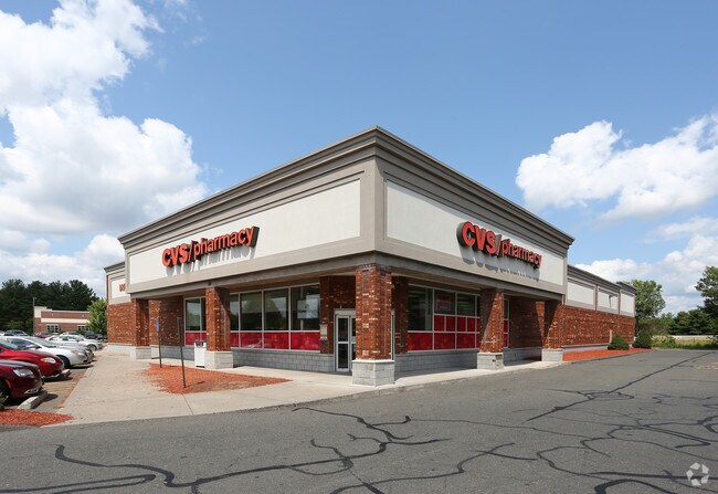
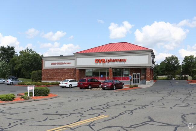
Property Record
16 Main St, Burlington, CT 06013
NEARBY LISTINGS FOR SALE OR LEASE
Property Detail
16 Main St
BURL-000302-000000-000024
Hartford
Sfr
Connecticut
X
24
09003C0455F
0.92 AC
2025
East Hartford
2025
Hartford
410101
Hartford-West Hartford-East Hartford, CT
2,186 SF
DEMOGRAPHICS near 16 Main St
1 mile
3 mile
5 mile
2024 Total Population
8,321
48,538
195,796
2029 Population
8,257
48,295
195,161
Pop Growth 2024-2029
(0.77%)
(0.50%)
(0.32%)
Average Age
42
42
39
2024 Total Households
3,546
20,117
78,554
HH Growth 2024-2029
(0.82%)
(0.55%)
(0.21%)
Median Household Inc
$79,112
$80,537
$64,797
Avg Household Size
2.30
2.40
2.40
2024 Avg HH Vehicles
2.00
2.00
2.00
Median Home Value
$181,216
$237,610
$243,839
Median Year Built
1963
1963
1960
Nearby Places
Map Layers
Map Styles
 Street
 Aerial
Transit
 Traffic
 Biking
Places
Listings with unknown addresses are not visible on the map
- Restaurants
- Banks
- Shops
- Fitness
- Groceries
PUBLIC TRANSPORTATION
AIRPORT
Bradley International
Drive
Walk
Distance
Bradley International
61 min
32.2 mi
Freight Ports
Port of New Haven
Drive
Walk
Distance
Port of New Haven
53 min
34.0 mi
Nearby Properties
Address
Land Use
TOTAL SIZE
Lot Size
Zoning
Address
Land Use
TOTAL SIZE
Lot Size
Zoning
56,184 SF
19.42 AC
BG
Address
Land Use
TOTAL SIZE
Lot Size
Zoning
169,727 SF
23.90 AC
R-25
Address
Land Use
TOTAL SIZE
Lot Size
Zoning
54,904 SF
7.01 AC
A
Address
Land Use
TOTAL SIZE
Lot Size
Zoning
133,673 SF
30.40 AC
R-40
Address
Land Use
TOTAL SIZE
Lot Size
Zoning
4,000 SF
13.78 AC
BG
Address
Land Use
TOTAL SIZE
Lot Size
Zoning
1,700 SF
38.81 AC
A
Address
Land Use
TOTAL SIZE
Lot Size
Zoning
42,516 SF
10.40 AC
BG
Address
Land Use
TOTAL SIZE
Lot Size
Zoning
41,011 SF
8.50 AC
BG
Address
Land Use
TOTAL SIZE
Lot Size
Zoning
118,573 SF
9.75 AC
BG
Address
Land Use
TOTAL SIZE
Lot Size
Zoning
147,132 SF
12.50 AC
BG
Address
Land Use
TOTAL SIZE
Lot Size
Zoning
4,209 SF
14.60 AC
A
Address
Land Use
TOTAL SIZE
Lot Size
Zoning
4.98 AC
R44
Address
Land Use
TOTAL SIZE
Lot Size
Zoning
71,531 SF
23.80 AC
R-15
Address
Land Use
TOTAL SIZE
Lot Size
Zoning
56,245 SF
39.20 AC
R-15
Address
Land Use
TOTAL SIZE
Lot Size
Zoning
85,302 SF
27.94 AC
R44
Address
Land Use
TOTAL SIZE
Lot Size
Zoning
22,022 SF
8 AC
BG
Address
Land Use
TOTAL SIZE
Lot Size
Zoning
7,482 SF
5.80 AC
R-15
Address
Land Use
TOTAL SIZE
Lot Size
Zoning
41,483 SF
16.50 AC
R-15
Address
Land Use
TOTAL SIZE
Lot Size
Zoning
11,735 SF
2.33 AC
BG
Address
Land Use
TOTAL SIZE
Lot Size
Zoning
1,199 SF
17.10 AC
R-15
Address
Land Use
TOTAL SIZE
Lot Size
Zoning
13,906 SF
7.10 AC
A
Address
Land Use
TOTAL SIZE
Lot Size
Zoning
452.94 AC
R44
Address
Land Use
TOTAL SIZE
Lot Size
Zoning
3,072 SF
80.60 AC
R-40
Address
Land Use
TOTAL SIZE
Lot Size
Zoning
6,091 SF
5.46 AC
I
Address
Land Use
TOTAL SIZE
Lot Size
Zoning
0.81 AC
R-25
Address
Land Use
TOTAL SIZE
Lot Size
Zoning
12,132 SF
1.60 AC
BG
Address
Land Use
TOTAL SIZE
Lot Size
Zoning
53,680 SF
2.61 AC
A
Address
Land Use
TOTAL SIZE
Lot Size
Zoning
54,205 SF
5 AC
BG
Address
Land Use
TOTAL SIZE
Lot Size
Zoning
51,316 SF
4.07 AC
R-15
Address
Land Use
TOTAL SIZE
Lot Size
Zoning
36,336 SF
2 AC
BG
The World's #1 Commercial Real Estate Marketplace
Connect with us
© 2026 CoStar Group
The information above has been obtained from sources believed reliable. While we do not doubt its accuracy we have not verified it and make no guarantee, warranty or representation about it. It is your responsibility to independently confirm its accuracy and completeness. Any projections, opinions, assumptions, or estimates used are for example only and do not represent the current or future performance of the property. The value of this transaction to you depends on tax and other factors which should be evaluated by your tax, financial, and legal advisors. You and your advisors should conduct a careful, independent investigation of the property to determine to your satisfaction the suitability of the property for your needs.