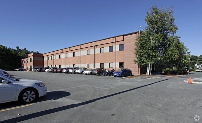
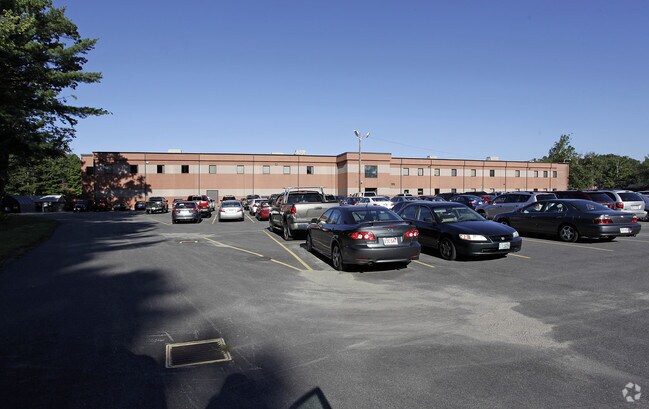
Property Record
16 Maple Rd, Chelmsford, MA 01824
Property Detail
16 Maple Rd
CHEL-000116-000461-000001
Middlesex
Manufacturinglight
Massachusetts
IA
1
B and X Area of moderate flood hazard, usually the area between the limits of the 100-year and 500-year floods.
3.94 AC
2025
Lowell/Chelmsford
2025
Boston
317103
Boston-Cambridge-Newton, MA-NH
80,727 SF
NEARBY LISTINGS FOR SALE OR LEASE
DEMOGRAPHICS near 16 Maple Rd
1 mile
3 mile
5 mile
2025 Total Population
4,333
29,012
101,863
2030 Population
4,502
30,204
106,089
Pop Growth 2025-2030
+ 3.90%
+ 4.11%
+ 4.15%
Average Age
42
43
42
2025 Total Households
1,700
10,833
37,000
HH Growth 2025-2030
+ 3.94%
+ 4.20%
+ 4.31%
Median Household Inc
$130,328
$158,267
$138,194
Avg Household Size
2.50
2.60
2.70
2025 Avg HH Vehicles
2.00
2.00
2.00
Median Home Value
$645,961
$712,434
$678,812
Median Year Built
1978
1971
1971
Nearby Places
Map Layers
Map Styles
 Street
 Aerial
Layers
 Traffic
 Biking
Places
Listings with unknown addresses are not visible on the map
- Restaurants
- Banks
- Shops
- Fitness
- Groceries
PUBLIC TRANSPORTATION
COMMUTER RAIL
Lowell (Lowell Line - Massachusetts Bay Transportation Authority Commuter Rail (Purple Line))
Drive
Walk
Distance
Lowell (Lowell Line - Massachusetts Bay Transportation Authority Commuter Rail (Purple Line))
13 min
6.3 mi
North Billerica (Lowell Line - Massachusetts Bay Transportation Authority Commuter Rail (Purple Line))
Drive
Walk
Distance
North Billerica (Lowell Line - Massachusetts Bay Transportation Authority Commuter Rail (Purple Line))
15 min
7.2 mi
AIRPORT
General Edward Lawrence Logan International
Drive
Walk
Distance
General Edward Lawrence Logan International
50 min
30.9 mi
Manchester Boston Regional
Drive
Walk
Distance
Manchester Boston Regional
49 min
31.9 mi
Worcester Regional
Drive
Walk
Distance
Worcester Regional
56 min
40.1 mi
Freight Ports
Port of Boston
Drive
Walk
Distance
Port of Boston
51 min
30.7 mi
Nearby Properties
Address
Land Use
TOTAL SIZE
Lot Size
Zoning
Address
Land Use
TOTAL SIZE
Lot Size
Zoning
205,340 SF
44.73 AC
RA
Address
Land Use
TOTAL SIZE
Lot Size
Zoning
255,627 SF
82.71 AC
RA
Address
Land Use
TOTAL SIZE
Lot Size
Zoning
174 SF
IA
Address
Land Use
TOTAL SIZE
Lot Size
Zoning
220,257 SF
24.17 AC
CH
Address
Land Use
TOTAL SIZE
Lot Size
Zoning
137,235 SF
12.77 AC
5
Address
Land Use
TOTAL SIZE
Lot Size
Zoning
7.41 AC
CB
Address
Land Use
TOTAL SIZE
Lot Size
Zoning
161,850 SF
18.41 AC
CH
Address
Land Use
TOTAL SIZE
Lot Size
Zoning
85,450 SF
32.07 AC
RA
Address
Land Use
TOTAL SIZE
Lot Size
Zoning
9.48 AC
RB
Address
Land Use
TOTAL SIZE
Lot Size
Zoning
230,037 SF
18.85 AC
IH
Address
Land Use
TOTAL SIZE
Lot Size
Zoning
64,542 SF
4.67 AC
CH
Address
Land Use
TOTAL SIZE
Lot Size
Zoning
73,576 SF
26.14 AC
P
Address
Land Use
TOTAL SIZE
Lot Size
Zoning
95,220 SF
6.31 AC
CC
Address
Land Use
TOTAL SIZE
Lot Size
Zoning
181,578 SF
11.40 AC
IH
Address
Land Use
TOTAL SIZE
Lot Size
Zoning
59,848 SF
6.30 AC
P
Address
Land Use
TOTAL SIZE
Lot Size
Zoning
62,620 SF
13.20 AC
P
Address
Land Use
TOTAL SIZE
Lot Size
Zoning
87,430 SF
9.30 AC
CH
Address
Land Use
TOTAL SIZE
Lot Size
Zoning
130,524 SF
19.74 AC
IH
Address
Land Use
TOTAL SIZE
Lot Size
Zoning
8.54 AC
CB
Address
Land Use
TOTAL SIZE
Lot Size
Zoning
37.75 AC
RMH
Address
Land Use
TOTAL SIZE
Lot Size
Zoning
57,700 SF
8.27 AC
CH
Address
Land Use
TOTAL SIZE
Lot Size
Zoning
43,775 SF
8.69 AC
P
Address
Land Use
TOTAL SIZE
Lot Size
Zoning
72,854 SF
1.96 AC
RM
Address
Land Use
TOTAL SIZE
Lot Size
Zoning
80,974 SF
14.36 AC
CH
Address
Land Use
TOTAL SIZE
Lot Size
Zoning
114,706 SF
7.35 AC
IA
Address
Land Use
TOTAL SIZE
Lot Size
Zoning
6.52 AC
CC
Address
Land Use
TOTAL SIZE
Lot Size
Zoning
24,010 SF
7.49 AC
RA
Address
Land Use
TOTAL SIZE
Lot Size
Zoning
32,700 SF
1.80 AC
CH
Address
Land Use
TOTAL SIZE
Lot Size
Zoning
85,152 SF
12.66 AC
IA
Address
Land Use
TOTAL SIZE
Lot Size
Zoning
57,600 SF
5.34 AC
CC
The World's #1 Commercial Real Estate Marketplace
Connect with us
© 2026 CoStar Group
The information above has been obtained from sources believed reliable. While we do not doubt its accuracy we have not verified it and make no guarantee, warranty or representation about it. It is your responsibility to independently confirm its accuracy and completeness. Any projections, opinions, assumptions, or estimates used are for example only and do not represent the current or future performance of the property. The value of this transaction to you depends on tax and other factors which should be evaluated by your tax, financial, and legal advisors. You and your advisors should conduct a careful, independent investigation of the property to determine to your satisfaction the suitability of the property for your needs.