Property Record
16 Maybrook Rd, Campbell Hall, NY 10916


Save to a Folder
{{folder.Name}}
{{folder.ListingIds.length}} Properties
{{folder.ListingIds.length}} Property
Create a New Folder
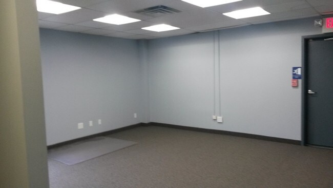
Property Detail
16 Maybrook Rd
333489-004-000-0001-022.100-0000
Orange
Officebuilding
New York
HRC4*
22.10
B and X Area of moderate flood hazard, usually the area between the limits of the 100-year and 500-year floods.
0.92 AC
2024
Middletown
2025
Northern New Jersey
012300
Kiryas Joel-Poughkeepsie-Newburgh, NY
10,608 SF
NEARBY LISTINGS FOR SALE OR LEASE
-
-
View all Campbell Hall listings for lease on LoopNet.com
DEMOGRAPHICS near 16 Maybrook Rd
1 mile
3 mile
5 mile
2025 Total Population
676
6,131
23,732
2030 Population
688
6,237
24,183
Pop Growth 2025-2030
+ 1.78%
+ 1.73%
+ 1.90%
Average Age
43
42
41
2025 Total Households
231
2,076
8,359
HH Growth 2025-2030
+ 1.30%
+ 1.78%
+ 2.02%
Median Household Inc
$118,269
$102,839
$105,440
Avg Household Size
2.90
2.90
2.80
2025 Avg HH Vehicles
3.00
2.00
2.00
Median Home Value
$613,889
$497,522
$442,099
Median Year Built
1976
1976
1978
Nearby Places
Map Layers
Map Styles
 Street
 Aerial
Layers
 Traffic
 Biking
Places
Listings with unknown addresses are not visible on the map
- Restaurants
- Banks
- Shops
- Fitness
- Groceries
PUBLIC TRANSPORTATION
COMMUTER RAIL
Campbell Hall (Bergen County/Port Jervis Line - NJ Transit Commuter Rail (NJ Transit), Main/Port Jervis Line - NJ Transit Commuter Rail (NJ Transit))
Drive
Walk
Distance
Campbell Hall (Bergen County/Port Jervis Line - NJ Transit Commuter Rail (NJ Transit), Main/Port Jervis Line - NJ Transit Commuter Rail (NJ Transit))
5 min
2.4 mi
Middletown New York (Bergen County/Port Jervis Line - NJ Transit Commuter Rail (NJ Transit), Main/Port Jervis Line - NJ Transit Commuter Rail (NJ Transit))
Drive
Walk
Distance
Middletown New York (Bergen County/Port Jervis Line - NJ Transit Commuter Rail (NJ Transit), Main/Port Jervis Line - NJ Transit Commuter Rail (NJ Transit))
17 min
8.0 mi
AIRPORT
New York Stewart International
Drive
Walk
Distance
New York Stewart International
18 min
10.6 mi
Freight Ports
Port Newark Container Terminal
Drive
Walk
Distance
Port Newark Container Terminal
94 min
68.4 mi
SALE & LEASE HISTORY
LISTING DATE
SALE/LEASE

Sep 25, 2016
For Lease
Nearby Properties
Address
Land Use
TOTAL SIZE
Lot Size
Zoning
Address
Land Use
TOTAL SIZE
Lot Size
Zoning
1,040,580 SF
70.80 AC
ID
Address
Land Use
TOTAL SIZE
Lot Size
Zoning
340,782 SF
37 AC
LUI
Address
Land Use
TOTAL SIZE
Lot Size
Zoning
374,356 SF
35.90 AC
LUI
Address
Land Use
TOTAL SIZE
Lot Size
Zoning
760,927 SF
51.60 AC
ID
Address
Land Use
TOTAL SIZE
Lot Size
Zoning
176,246 SF
80.20 AC
LUI
Address
Land Use
TOTAL SIZE
Lot Size
Zoning
366,680 SF
32.10 AC
Address
Land Use
TOTAL SIZE
Lot Size
Zoning
109,481 SF
24.90 AC
ID
Address
Land Use
TOTAL SIZE
Lot Size
Zoning
41.40 AC
R4A
Address
Land Use
TOTAL SIZE
Lot Size
Zoning
330.10 AC
R4A*
Address
Land Use
TOTAL SIZE
Lot Size
Zoning
103,079 SF
30.60 AC
ID
Address
Land Use
TOTAL SIZE
Lot Size
Zoning
4,022 SF
360.50 AC
R4A*
Address
Land Use
TOTAL SIZE
Lot Size
Zoning
55,200 SF
11.80 AC
R3A*
Address
Land Use
TOTAL SIZE
Lot Size
Zoning
10 AC
HRC4*
Address
Land Use
TOTAL SIZE
Lot Size
Zoning
1,240 SF
188 AC
R4A*
Address
Land Use
TOTAL SIZE
Lot Size
Zoning
16,842 SF
136.30 AC
R4A*
Address
Land Use
TOTAL SIZE
Lot Size
Zoning
250 AC
R4A*
Address
Land Use
TOTAL SIZE
Lot Size
Zoning
83,114 SF
5.30 AC
R-SC
Address
Land Use
TOTAL SIZE
Lot Size
Zoning
731,864 SF
43.70 AC
I
Address
Land Use
TOTAL SIZE
Lot Size
Zoning
50,725 SF
2.60 AC
R-SC
Address
Land Use
TOTAL SIZE
Lot Size
Zoning
7,948 SF
115 AC
R4A
Address
Land Use
TOTAL SIZE
Lot Size
Zoning
33,912 SF
4.40 AC
Address
Land Use
TOTAL SIZE
Lot Size
Zoning
6,048 SF
145.80 AC
R4A
Address
Land Use
TOTAL SIZE
Lot Size
Zoning
946 SF
227.80 AC
R4A*
Address
Land Use
TOTAL SIZE
Lot Size
Zoning
60,584 SF
94.80 AC
ID
Address
Land Use
TOTAL SIZE
Lot Size
Zoning
1,100 SF
203.20 AC
R4A*
Address
Land Use
TOTAL SIZE
Lot Size
Zoning
62,770 SF
10.60 AC
IP
Address
Land Use
TOTAL SIZE
Lot Size
Zoning
11,645 SF
84.20 AC
R4A
Address
Land Use
TOTAL SIZE
Lot Size
Zoning
Address
Land Use
TOTAL SIZE
Lot Size
Zoning
26,617 SF
11.40 AC
HRC4*
Address
Land Use
TOTAL SIZE
Lot Size
Zoning
34,151 SF
7.20 AC
ID
The World's #1 Commercial Real Estate Marketplace
Connect with us
© 2026 CoStar Group
The information above has been obtained from sources believed reliable. While we do not doubt its accuracy we have not verified it and make no guarantee, warranty or representation about it. It is your responsibility to independently confirm its accuracy and completeness. Any projections, opinions, assumptions, or estimates used are for example only and do not represent the current or future performance of the property. The value of this transaction to you depends on tax and other factors which should be evaluated by your tax, financial, and legal advisors. You and your advisors should conduct a careful, independent investigation of the property to determine to your satisfaction the suitability of the property for your needs.