Property Record
16 Munson Rd, Farmington, CT 06032


Property Detail
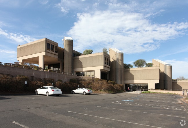
16 Munson Rd
Officebuilding
Capitol
PR
Connecticut
B and X Area of moderate flood hazard, usually the area between the limits of the 100-year and 500-year floods.
19.61 AC
2025
Farmington
2025
Hartford
460100
Hartford-West Hartford-East Hartford, CT
121,775 SF
FARM-000094-000000-000010
NEARBY LISTINGS FOR SALE OR LEASE
DEMOGRAPHICS near 16 Munson Rd
1 mile
3 mile
5 mile
2025 Total Population
3,182
52,638
194,623
2030 Population
3,324
53,551
197,050
Pop Growth 2025-2030
+ 4.46%
+ 1.73%
+ 1.25%
Average Age
46
41
40
2025 Total Households
1,332
20,937
78,748
HH Growth 2025-2030
+ 4.35%
+ 1.80%
+ 1.30%
Median Household Inc
$149,223
$107,448
$83,092
Avg Household Size
2.30
2.30
2.40
2025 Avg HH Vehicles
2.00
2.00
2.00
Median Home Value
$448,888
$337,063
$318,119
Median Year Built
1989
1960
1956
Nearby Places
Map Layers
Map Styles
 Street
 Aerial
Layers
 Traffic
 Biking
Places
Listings with unknown addresses are not visible on the map
- Restaurants
- Banks
- Shops
- Fitness
- Groceries
PUBLIC TRANSPORTATION
COMMUTER RAIL
Hartford (Hartford Line - CONN DOT)
Drive
Walk
Distance
Hartford (Hartford Line - CONN DOT)
13 min
8.1 mi
Hartford Amtrak Station (Amtrak Hartford Line - Amtrak, Northeast Regional - Amtrak, Valley Flyer - Amtrak, Vermonter - Amtrak)
Drive
Walk
Distance
Hartford Amtrak Station (Amtrak Hartford Line - Amtrak, Northeast Regional - Amtrak, Valley Flyer - Amtrak, Vermonter - Amtrak)
14 min
8.3 mi
AIRPORT
Bradley International
Drive
Walk
Distance
Bradley International
45 min
25.7 mi
Freight Ports
Port of New Haven
Drive
Walk
Distance
Port of New Haven
50 min
37.2 mi
Nearby Properties
Address
Land Use
TOTAL SIZE
Lot Size
Zoning
Address
Land Use
TOTAL SIZE
Lot Size
Zoning
61.11 AC
R20
Address
Land Use
TOTAL SIZE
Lot Size
Zoning
284,432 SF
32.12 AC
PL
Address
Land Use
TOTAL SIZE
Lot Size
Zoning
23.64 AC
S3
Address
Land Use
TOTAL SIZE
Lot Size
Zoning
20.61 AC
R-10,S
Address
Land Use
TOTAL SIZE
Lot Size
Zoning
19.60 AC
S2
Address
Land Use
TOTAL SIZE
Lot Size
Zoning
191,718 SF
16 AC
R40
Address
Land Use
TOTAL SIZE
Lot Size
Zoning
23.62 AC
A3
Address
Land Use
TOTAL SIZE
Lot Size
Zoning
28 AC
CR
Address
Land Use
TOTAL SIZE
Lot Size
Zoning
0.01 AC
PR
Address
Land Use
TOTAL SIZE
Lot Size
Zoning
14.68 AC
SIF
Address
Land Use
TOTAL SIZE
Lot Size
Zoning
138,582 SF
23.64 AC
BR
Address
Land Use
TOTAL SIZE
Lot Size
Zoning
162,470 SF
27.10 AC
R40
Address
Land Use
TOTAL SIZE
Lot Size
Zoning
112,304 SF
10.39 AC
S3
Address
Land Use
TOTAL SIZE
Lot Size
Zoning
16.94 AC
C1
Address
Land Use
TOTAL SIZE
Lot Size
Zoning
12 AC
R20
Address
Land Use
TOTAL SIZE
Lot Size
Zoning
215,215 SF
42 AC
R-10,R
Address
Land Use
TOTAL SIZE
Lot Size
Zoning
8.87 AC
BS,R-1
Address
Land Use
TOTAL SIZE
Lot Size
Zoning
14,364 SF
2.72 AC
S3
Address
Land Use
TOTAL SIZE
Lot Size
Zoning
13.13 AC
SDD/BG
Address
Land Use
TOTAL SIZE
Lot Size
Zoning
78,132 SF
11.76 AC
S2
Address
Land Use
TOTAL SIZE
Lot Size
Zoning
173,619 SF
20 AC
SA
Address
Land Use
TOTAL SIZE
Lot Size
Zoning
10.10 AC
RDM
Address
Land Use
TOTAL SIZE
Lot Size
Zoning
190,192 SF
8.60 AC
R-10
Address
Land Use
TOTAL SIZE
Lot Size
Zoning
1,678 AC
R-20,R
Address
Land Use
TOTAL SIZE
Lot Size
Zoning
622,262 SF
47.95 AC
I
Address
Land Use
TOTAL SIZE
Lot Size
Zoning
1,500 SF
32.52 AC
A1
Address
Land Use
TOTAL SIZE
Lot Size
Zoning
8.51 AC
S2
Address
Land Use
TOTAL SIZE
Lot Size
Zoning
25.61 AC
RDM
Address
Land Use
TOTAL SIZE
Lot Size
Zoning
155,962 SF
15.35 AC
B2
The World's #1 Commercial Real Estate Marketplace
Connect with us
© 2026 CoStar Group
The information above has been obtained from sources believed reliable. While we do not doubt its accuracy we have not verified it and make no guarantee, warranty or representation about it. It is your responsibility to independently confirm its accuracy and completeness. Any projections, opinions, assumptions, or estimates used are for example only and do not represent the current or future performance of the property. The value of this transaction to you depends on tax and other factors which should be evaluated by your tax, financial, and legal advisors. You and your advisors should conduct a careful, independent investigation of the property to determine to your satisfaction the suitability of the property for your needs.