Property Record
16 Route 2, Preston, CT 06365
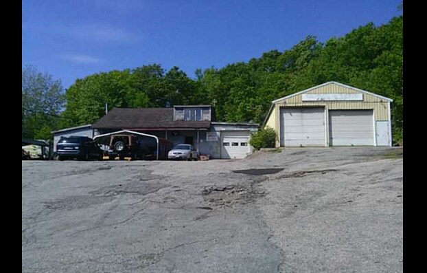

Property Detail
16 Route 2
PRES-000170-000002-000016
Southeastern Ct
Commercialnec
Connecticut
I
16
B and X Area of moderate flood hazard, usually the area between the limits of the 100-year and 500-year floods.
0.84 AC
2024
NE New London/Norwich
2025
Hartford
700100
Norwich-New London-Willimantic, CT
NEARBY LISTINGS FOR SALE OR LEASE
-
-
View all Preston listings for sale on LoopNet.com
DEMOGRAPHICS near 16 Route 2
1 mile
3 mile
5 mile
2025 Total Population
1,798
29,770
53,033
2030 Population
1,806
29,979
53,525
Pop Growth 2025-2030
+ 0.44%
+ 0.70%
+ 0.93%
Average Age
42
40
41
2025 Total Households
849
12,287
21,685
HH Growth 2025-2030
+ 0.24%
+ 0.70%
+ 0.89%
Median Household Inc
$58,874
$61,821
$72,908
Avg Household Size
2.10
2.30
2.40
2025 Avg HH Vehicles
2.00
2.00
2.00
Median Home Value
$249,489
$243,568
$268,884
Median Year Built
1961
1952
1960
Nearby Places
Map Layers
Map Styles
 Street
 Aerial
Layers
 Traffic
 Biking
Places
Listings with unknown addresses are not visible on the map
- Restaurants
- Banks
- Shops
- Fitness
- Groceries
PUBLIC TRANSPORTATION
AIRPORT
Rhode Island Tf Green International
Drive
Walk
Distance
Rhode Island Tf Green International
68 min
49.1 mi
Freight Ports
Port of Davisville, RI
Drive
Walk
Distance
Port of Davisville, RI
70 min
49.3 mi
Nearby Properties
Address
Land Use
TOTAL SIZE
Lot Size
Zoning
Address
Land Use
TOTAL SIZE
Lot Size
Zoning
45.74 AC
PDD
Address
Land Use
TOTAL SIZE
Lot Size
Zoning
242 AC
R20
Address
Land Use
TOTAL SIZE
Lot Size
Zoning
200,847 SF
14.30 AC
R40
Address
Land Use
TOTAL SIZE
Lot Size
Zoning
4.59 AC
TRDD
Address
Land Use
TOTAL SIZE
Lot Size
Zoning
16 AC
ROS
Address
Land Use
TOTAL SIZE
Lot Size
Zoning
Address
Land Use
TOTAL SIZE
Lot Size
Zoning
13.78 AC
R40
Address
Land Use
TOTAL SIZE
Lot Size
Zoning
2,102 SF
110.90 AC
PDD
Address
Land Use
TOTAL SIZE
Lot Size
Zoning
16,551 SF
18.11 AC
MF
Address
Land Use
TOTAL SIZE
Lot Size
Zoning
128,565 SF
18.90 AC
R40
Address
Land Use
TOTAL SIZE
Lot Size
Zoning
129,948 SF
9.70 AC
PC
Address
Land Use
TOTAL SIZE
Lot Size
Zoning
8.78 AC
MF
Address
Land Use
TOTAL SIZE
Lot Size
Zoning
18,401 SF
12.88 AC
MF
Address
Land Use
TOTAL SIZE
Lot Size
Zoning
87,162 SF
30.20 AC
R20/MF
Address
Land Use
TOTAL SIZE
Lot Size
Zoning
79,192 SF
11.90 AC
MF
Address
Land Use
TOTAL SIZE
Lot Size
Zoning
6.39 AC
MF
Address
Land Use
TOTAL SIZE
Lot Size
Zoning
3.76 AC
MF
Address
Land Use
TOTAL SIZE
Lot Size
Zoning
351.80 AC
ROS
Address
Land Use
TOTAL SIZE
Lot Size
Zoning
15,208 SF
205.14 AC
TRDD
Address
Land Use
TOTAL SIZE
Lot Size
Zoning
11.23 AC
MF
Address
Land Use
TOTAL SIZE
Lot Size
Zoning
51,154 SF
0.38 AC
CC
Address
Land Use
TOTAL SIZE
Lot Size
Zoning
42,127 SF
0.63 AC
CC
Address
Land Use
TOTAL SIZE
Lot Size
Zoning
23.24 AC
RSRVT
Address
Land Use
TOTAL SIZE
Lot Size
Zoning
10.95 AC
PC
Address
Land Use
TOTAL SIZE
Lot Size
Zoning
79,686 SF
0.13 AC
WD
Address
Land Use
TOTAL SIZE
Lot Size
Zoning
24.76 AC
R20
Address
Land Use
TOTAL SIZE
Lot Size
Zoning
78,364 SF
4.88 AC
GC
Address
Land Use
TOTAL SIZE
Lot Size
Zoning
4,200 SF
14.98 AC
MF
Address
Land Use
TOTAL SIZE
Lot Size
Zoning
4,000 SF
85.90 AC
ROS
Address
Land Use
TOTAL SIZE
Lot Size
Zoning
37,360 SF
2 AC
R20
The World's #1 Commercial Real Estate Marketplace
Connect with us
© 2026 CoStar Group
The information above has been obtained from sources believed reliable. While we do not doubt its accuracy we have not verified it and make no guarantee, warranty or representation about it. It is your responsibility to independently confirm its accuracy and completeness. Any projections, opinions, assumptions, or estimates used are for example only and do not represent the current or future performance of the property. The value of this transaction to you depends on tax and other factors which should be evaluated by your tax, financial, and legal advisors. You and your advisors should conduct a careful, independent investigation of the property to determine to your satisfaction the suitability of the property for your needs.