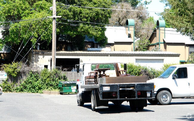
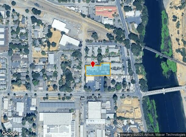
Property Record
16 S University St, Healdsburg, CA 95448

NEARBY LISTINGS FOR SALE OR LEASE
Property Detail
16 S University St
Santa Rosa, CA
Per Tax Bond Est
002-312-018
84 FM 2-312-02 PT TO 19 PER TAX BOND EST
Commercialbuilding
Sonoma
X
California
06097C0551E
15
2024
0.61 AC
2025
Healdsburg/Cloverdale
153902
North Bay/Santa Rosa
3,200 SF
DEMOGRAPHICS near 16 S University St
1 Mile
3 Mile
5 Mile
2024 Total Population
5,534
14,831
29,380
2029 Population
5,551
14,834
29,161
Pop Growth 2024-2029
+ 0.31%
+ 0.02%
(0.75%)
Average Age
47
45
44
2024 Total Households
2,419
5,962
10,949
HH Growth 2024-2029
+ 0.21%
(0.05%)
(0.78%)
Median Household Inc
$102,863
$110,966
$122,384
Avg Household Size
2.20
2.40
2.60
2024 Avg HH Vehicles
2.00
2.00
2.00
Median Home Value
$899,102
$914,856
$828,687
Median Year Built
1974
1978
1985
Nearby Places
Map Layers
Map Styles
 Street
 Aerial
- Restaurants
- Banks
- Shops
- Fitness
- Groceries
PUBLIC TRANSPORTATION
COMMUTER RAIL
Sonoma County Airport Smart (Main Line - Sonoma Marin Area Rail Transit)
DRIVE
WALK
Distance
Sonoma County Airport Smart (Main Line - Sonoma Marin Area Rail Transit)
13 min
8.8 mi
AIRPORT
Charles M Schulz - Sonoma County
DRIVE
WALK
Distance
Charles M Schulz - Sonoma County
14 min
9.8 mi
Freight Ports
Port of Richmond
DRIVE
WALK
Distance
Port of Richmond
79 min
62.6 mi
Nearby Properties
Address
Land Use
TOTAL SIZE
Lot Size
Zoning
Address
Land Use
TOTAL SIZE
Lot Size
Zoning
341,349 SF
63.97 AC
Address
Land Use
TOTAL SIZE
Lot Size
Zoning
82,639 SF
1.87 AC
Address
Land Use
TOTAL SIZE
Lot Size
Zoning
10.26 AC
CITYHE
Address
Land Use
TOTAL SIZE
Lot Size
Zoning
7.25 AC
Address
Land Use
TOTAL SIZE
Lot Size
Zoning
6,770 SF
0.18 AC
LIA60
Address
Land Use
TOTAL SIZE
Lot Size
Zoning
57,500 SF
1.67 AC
Address
Land Use
TOTAL SIZE
Lot Size
Zoning
Address
Land Use
TOTAL SIZE
Lot Size
Zoning
36,242 SF
13.48 AC
LIA40
Address
Land Use
TOTAL SIZE
Lot Size
Zoning
32,540 SF
0.51 AC
CITYHE
Address
Land Use
TOTAL SIZE
Lot Size
Zoning
16.07 AC
Address
Land Use
TOTAL SIZE
Lot Size
Zoning
64,636 SF
3.39 AC
CITYHE
Address
Land Use
TOTAL SIZE
Lot Size
Zoning
59,336 SF
5.98 AC
Address
Land Use
TOTAL SIZE
Lot Size
Zoning
25,439 SF
0.58 AC
Address
Land Use
TOTAL SIZE
Lot Size
Zoning
56,020 SF
6.47 AC
Address
Land Use
TOTAL SIZE
Lot Size
Zoning
23,615 SF
0.09 AC
LIA20
Address
Land Use
TOTAL SIZE
Lot Size
Zoning
16,384 SF
7.92 AC
Address
Land Use
TOTAL SIZE
Lot Size
Zoning
18,061 SF
10.35 AC
Address
Land Use
TOTAL SIZE
Lot Size
Zoning
47,971 SF
0.18 AC
Address
Land Use
TOTAL SIZE
Lot Size
Zoning
17,322 SF
410.90 AC
RRDW100
Address
Land Use
TOTAL SIZE
Lot Size
Zoning
41,048 SF
2 AC
Address
Land Use
TOTAL SIZE
Lot Size
Zoning
102,842 SF
13.35 AC
Address
Land Use
TOTAL SIZE
Lot Size
Zoning
10,614 SF
38.28 AC
Address
Land Use
TOTAL SIZE
Lot Size
Zoning
29,400 SF
3.85 AC
Address
Land Use
TOTAL SIZE
Lot Size
Zoning
7,157 SF
111.66 AC
Address
Land Use
TOTAL SIZE
Lot Size
Zoning
78,307 SF
3.02 AC
CITYHE
Address
Land Use
TOTAL SIZE
Lot Size
Zoning
16,862 SF
27.54 AC
Address
Land Use
TOTAL SIZE
Lot Size
Zoning
25,435 SF
1.36 AC
RRB8FRZN
Address
Land Use
TOTAL SIZE
Lot Size
Zoning
12,445 SF
0.17 AC
Address
Land Use
TOTAL SIZE
Lot Size
Zoning
9,778 SF
0.14 AC
CITYHE
Address
Land Use
TOTAL SIZE
Lot Size
Zoning
10,564 SF
9.19 AC
LIA20
The World's #1 Commercial Real Estate Marketplace
Connect with us
© 2025 CoStar Group
The information above has been obtained from sources believed reliable. While we do not doubt its accuracy we have not verified it and make no guarantee, warranty or representation about it. It is your responsibility to independently confirm its accuracy and completeness. Any projections, opinions, assumptions, or estimates used are for example only and do not represent the current or future performance of the property. The value of this transaction to you depends on tax and other factors which should be evaluated by your tax, financial, and legal advisors. You and your advisors should conduct a careful, independent investigation of the property to determine to your satisfaction the suitability of the property for your needs.