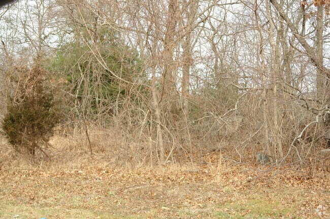
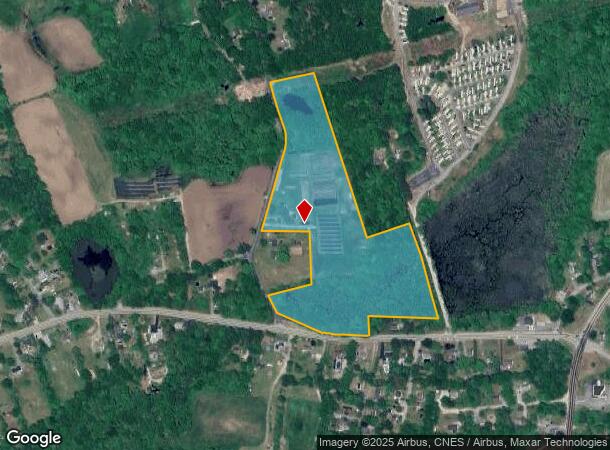
Property Record
16 Tomaquag Rd, Bradford, RI 02808
NEARBY LISTINGS FOR SALE OR LEASE
Property Detail
16 Tomaquag Rd
HOPK-000003-000000-000005
Washington
Industrialgeneral
Rhode Island
A
5
44009C0142J
19.10 AC
2025
Washington County
2025
Providence
050702
Providence-Warwick, RI-MA
1,125 SF
DEMOGRAPHICS near 16 Tomaquag Rd
1 Mile
3 Mile
5 Mile
2024 Total Population
895
6,313
25,767
2029 Population
875
6,199
25,371
Pop Growth 2024-2029
(2.23%)
(1.81%)
(1.54%)
Average Age
40
43
44
2024 Total Households
334
2,446
10,852
HH Growth 2024-2029
(2.40%)
(2.04%)
(1.78%)
Median Household Inc
$70,499
$88,181
$85,402
Avg Household Size
2.60
2.50
2.30
2024 Avg HH Vehicles
2.00
2.00
2.00
Median Home Value
$280,768
$300,753
$350,960
Median Year Built
1948
1961
1970
Nearby Places
Map Layers
Map Styles
 Street
 Aerial
- Restaurants
- Banks
- Shops
- Fitness
- Groceries
PUBLIC TRANSPORTATION
COMMUTER RAIL
Westerly Amtrak Station (Northeast Regional - Amtrak)
DRIVE
WALK
Distance
Westerly Amtrak Station (Northeast Regional - Amtrak)
11 min
6.4 mi
AIRPORT
Rhode Island Tf Green International
DRIVE
WALK
Distance
Rhode Island Tf Green International
50 min
35.4 mi
Freight Ports
Port of Davisville, RI
DRIVE
WALK
Distance
Port of Davisville, RI
51 min
27.6 mi
Nearby Properties
Address
Land Use
TOTAL SIZE
Lot Size
Zoning
Address
Land Use
TOTAL SIZE
Lot Size
Zoning
232,164 SF
41 AC
MFG
Address
Land Use
TOTAL SIZE
Lot Size
Zoning
11.40 AC
RFR8
Address
Land Use
TOTAL SIZE
Lot Size
Zoning
46.61 AC
Address
Land Use
TOTAL SIZE
Lot Size
Zoning
796 AC
OSR
Address
Land Use
TOTAL SIZE
Lot Size
Zoning
13,197 SF
1.96 AC
NB
Address
Land Use
TOTAL SIZE
Lot Size
Zoning
3,200 SF
90.44 AC
Address
Land Use
TOTAL SIZE
Lot Size
Zoning
27,400 SF
5.70 AC
MFG
Address
Land Use
TOTAL SIZE
Lot Size
Zoning
136.84 AC
RFR8
Address
Land Use
TOTAL SIZE
Lot Size
Zoning
1,672 SF
73.01 AC
RFR8
Address
Land Use
TOTAL SIZE
Lot Size
Zoning
3.10 AC
MFG
Address
Land Use
TOTAL SIZE
Lot Size
Zoning
13,171 SF
6.42 AC
CS
Address
Land Use
TOTAL SIZE
Lot Size
Zoning
722.91 AC
Address
Land Use
TOTAL SIZE
Lot Size
Zoning
172,793 SF
94 AC
MFG
Address
Land Use
TOTAL SIZE
Lot Size
Zoning
15,060 SF
16.13 AC
RFR8
Address
Land Use
TOTAL SIZE
Lot Size
Zoning
78.89 AC
CS
Address
Land Use
TOTAL SIZE
Lot Size
Zoning
30.01 AC
RFR8
Address
Land Use
TOTAL SIZE
Lot Size
Zoning
190.09 AC
R200
Address
Land Use
TOTAL SIZE
Lot Size
Zoning
27,154 SF
6.70 AC
RFR8
Address
Land Use
TOTAL SIZE
Lot Size
Zoning
140.50 AC
RFR8
Address
Land Use
TOTAL SIZE
Lot Size
Zoning
1,628 SF
64.36 AC
MFG
Address
Land Use
TOTAL SIZE
Lot Size
Zoning
9.20 AC
RFR8
Address
Land Use
TOTAL SIZE
Lot Size
Zoning
2,574 SF
80 AC
Address
Land Use
TOTAL SIZE
Lot Size
Zoning
8,165 SF
6.20 AC
RFR8
Address
Land Use
TOTAL SIZE
Lot Size
Zoning
20 AC
RFR8
Address
Land Use
TOTAL SIZE
Lot Size
Zoning
274.14 AC
OSR
Address
Land Use
TOTAL SIZE
Lot Size
Zoning
61.25 AC
Address
Land Use
TOTAL SIZE
Lot Size
Zoning
8,956 SF
2.11 AC
HC
Address
Land Use
TOTAL SIZE
Lot Size
Zoning
27.70 AC
C
Address
Land Use
TOTAL SIZE
Lot Size
Zoning
1,668 SF
0.40 AC
NB
Address
Land Use
TOTAL SIZE
Lot Size
Zoning
1.88 AC
RFR8
The World's #1 Commercial Real Estate Marketplace
Connect with us
© 2026 CoStar Group
The information above has been obtained from sources believed reliable. While we do not doubt its accuracy we have not verified it and make no guarantee, warranty or representation about it. It is your responsibility to independently confirm its accuracy and completeness. Any projections, opinions, assumptions, or estimates used are for example only and do not represent the current or future performance of the property. The value of this transaction to you depends on tax and other factors which should be evaluated by your tax, financial, and legal advisors. You and your advisors should conduct a careful, independent investigation of the property to determine to your satisfaction the suitability of the property for your needs.