Property Record
160 Broad St, Nashua, NH 03063
NEARBY LISTINGS FOR SALE OR LEASE
Property Detail
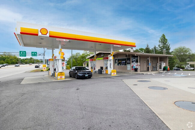
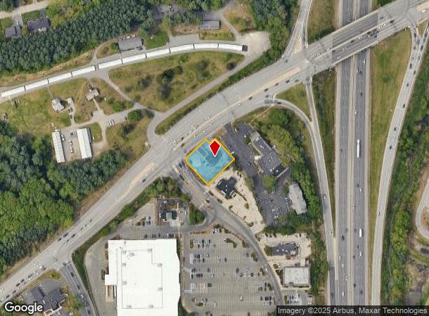
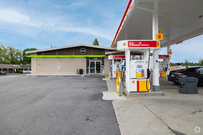
160 Broad St
NASH-000000-000000-000445E
Hillsborough
Servicestation
New Hampshire
X
445
33011C0513D
0.46 AC
2024
Hillsborough
2024
Boston
010302
Manchester-Nashua, NH
1,615 SF
DEMOGRAPHICS near 160 Broad St
1 Mile
3 Mile
5 Mile
2024 Total Population
7,556
75,038
122,880
2029 Population
7,697
76,611
125,520
Pop Growth 2024-2029
+ 1.87%
+ 2.10%
+ 2.15%
Average Age
42
41
42
2024 Total Households
3,054
31,391
50,514
HH Growth 2024-2029
+ 1.90%
+ 2.15%
+ 2.18%
Median Household Inc
$105,543
$82,605
$93,236
Avg Household Size
2.40
2.30
2.40
2024 Avg HH Vehicles
2.00
2.00
2.00
Median Home Value
$349,280
$343,383
$369,202
Median Year Built
1972
1971
1976
Nearby Places
Map Layers
Map Styles
 Street
 Aerial
- Restaurants
- Banks
- Shops
- Fitness
- Groceries
PUBLIC TRANSPORTATION
AIRPORT
Manchester Boston Regional
DRIVE
WALK
Distance
Manchester Boston Regional
21 min
13.8 mi
Freight Ports
Port of Boston
DRIVE
WALK
Distance
Port of Boston
67 min
49.7 mi
Nearby Properties
Address
Land Use
TOTAL SIZE
Lot Size
Zoning
Address
Land Use
TOTAL SIZE
Lot Size
Zoning
19.70 AC
RB
Address
Land Use
TOTAL SIZE
Lot Size
Zoning
28.04 AC
PI
Address
Land Use
TOTAL SIZE
Lot Size
Zoning
325.08 AC
AI
Address
Land Use
TOTAL SIZE
Lot Size
Zoning
60.25 AC
PI
Address
Land Use
TOTAL SIZE
Lot Size
Zoning
220,295 SF
4.34 AC
D1MU
Address
Land Use
TOTAL SIZE
Lot Size
Zoning
26.55 AC
INDUST
Address
Land Use
TOTAL SIZE
Lot Size
Zoning
5.30 AC
GIMU
Address
Land Use
TOTAL SIZE
Lot Size
Zoning
231,216 SF
1.88 AC
GIMU
Address
Land Use
TOTAL SIZE
Lot Size
Zoning
16.12 AC
RC
Address
Land Use
TOTAL SIZE
Lot Size
Zoning
183,432 SF
16.40 AC
GB
Address
Land Use
TOTAL SIZE
Lot Size
Zoning
124,048 SF
23.43 AC
PI
Address
Land Use
TOTAL SIZE
Lot Size
Zoning
37.57 AC
R9
Address
Land Use
TOTAL SIZE
Lot Size
Zoning
8.87 AC
RC
Address
Land Use
TOTAL SIZE
Lot Size
Zoning
66 AC
R18
Address
Land Use
TOTAL SIZE
Lot Size
Zoning
21.16 AC
D3MU
Address
Land Use
TOTAL SIZE
Lot Size
Zoning
74.50 AC
R9
Address
Land Use
TOTAL SIZE
Lot Size
Zoning
471,525 SF
40.78 AC
INDUST
Address
Land Use
TOTAL SIZE
Lot Size
Zoning
326,755 SF
43 AC
INDUST
Address
Land Use
TOTAL SIZE
Lot Size
Zoning
261,381 SF
3.78 AC
GIMU
Address
Land Use
TOTAL SIZE
Lot Size
Zoning
33.81 AC
PI
Address
Land Use
TOTAL SIZE
Lot Size
Zoning
9.50 AC
AI
Address
Land Use
TOTAL SIZE
Lot Size
Zoning
77,276 SF
19.50 AC
PI
Address
Land Use
TOTAL SIZE
Lot Size
Zoning
130,178 SF
11.07 AC
GB
Address
Land Use
TOTAL SIZE
Lot Size
Zoning
142,207 SF
4.72 AC
PI
Address
Land Use
TOTAL SIZE
Lot Size
Zoning
160,329 SF
16.13 AC
RB
Address
Land Use
TOTAL SIZE
Lot Size
Zoning
10.30 AC
RC
Address
Land Use
TOTAL SIZE
Lot Size
Zoning
129,441 SF
18.90 AC
R9
Address
Land Use
TOTAL SIZE
Lot Size
Zoning
141,816 SF
21.33 AC
R18
Address
Land Use
TOTAL SIZE
Lot Size
Zoning
9.01 AC
RC
Address
Land Use
TOTAL SIZE
Lot Size
Zoning
28.33 AC
GI
The World's #1 Commercial Real Estate Marketplace
Connect with us
© 2025 CoStar Group
The information above has been obtained from sources believed reliable. While we do not doubt its accuracy we have not verified it and make no guarantee, warranty or representation about it. It is your responsibility to independently confirm its accuracy and completeness. Any projections, opinions, assumptions, or estimates used are for example only and do not represent the current or future performance of the property. The value of this transaction to you depends on tax and other factors which should be evaluated by your tax, financial, and legal advisors. You and your advisors should conduct a careful, independent investigation of the property to determine to your satisfaction the suitability of the property for your needs.