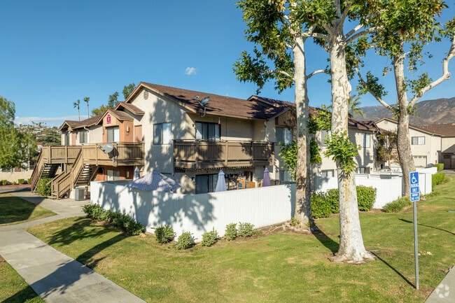
Property Record
160 E Parkdale Dr, San Bernardino, CA 92404


NEARBY LISTINGS FOR SALE OR LEASE
Property Detail
160 E Parkdale Dr
0154-731-13
Arrowhead Suburban Severance Addition #1
Apartment
PARCEL MAP 4315 PARCEL 2
X
San Bernardino
06071C7945H
California
2024
5.44 AC
2025
Arrowhead
005102
Inland Empire (California)
73,864 SF
Riverside-San Bernardino-Ontario, CA
DEMOGRAPHICS near 160 E Parkdale Dr
1 Mile
3 Mile
5 Mile
2024 Total Population
17,623
134,774
258,387
2029 Population
17,817
136,871
262,255
Pop Growth 2024-2029
+ 1.10%
+ 1.56%
+ 1.50%
Average Age
36
34
34
2024 Total Households
5,598
38,693
72,848
HH Growth 2024-2029
+ 1.07%
+ 1.58%
+ 1.57%
Median Household Inc
$63,401
$59,329
$58,463
Avg Household Size
3.10
3.30
3.40
2024 Avg HH Vehicles
2.00
2.00
2.00
Median Home Value
$358,540
$340,761
$340,184
Median Year Built
1957
1962
1967
Nearby Places
Map Layers
Map Styles
 Street
 Aerial
- Restaurants
- Banks
- Shops
- Fitness
- Groceries
PUBLIC TRANSPORTATION
COMMUTER RAIL
San Bernardino (Inland Empire-Orange County Line - Southern California Regional Rail Authority (Metrolink), San Bernardino Line - Southern California Regional Rail Authority (Metrolink))
DRIVE
WALK
Distance
San Bernardino (Inland Empire-Orange County Line - Southern California Regional Rail Authority (Metrolink), San Bernardino Line - Southern California Regional Rail Authority (Metrolink))
9 min
5.4 mi
San Bernardino - Downtown Metrolink Station (Metrolink Inland Empire-Orange County Line - Metrolink Trains, Metrolink San Bernardino Line - Metrolink Trains)
DRIVE
WALK
Distance
San Bernardino - Downtown Metrolink Station (Metrolink Inland Empire-Orange County Line - Metrolink Trains, Metrolink San Bernardino Line - Metrolink Trains)
10 min
5.8 mi
AIRPORT
Ontario International
DRIVE
WALK
Distance
Ontario International
33 min
23.8 mi
Freight Ports
Port of Long Beach
DRIVE
WALK
Distance
Port of Long Beach
90 min
71.2 mi
Nearby Properties
Address
Land Use
TOTAL SIZE
Lot Size
Zoning
Address
Land Use
TOTAL SIZE
Lot Size
Zoning
778,653 SF
19.31 AC
Address
Land Use
TOTAL SIZE
Lot Size
Zoning
379,299 SF
19.97 AC
Address
Land Use
TOTAL SIZE
Lot Size
Zoning
801,377 SF
20.81 AC
Address
Land Use
TOTAL SIZE
Lot Size
Zoning
214,534 SF
17.98 AC
Address
Land Use
TOTAL SIZE
Lot Size
Zoning
277,822 SF
13.65 AC
Address
Land Use
TOTAL SIZE
Lot Size
Zoning
354,108 SF
16.93 AC
Address
Land Use
TOTAL SIZE
Lot Size
Zoning
248,368 SF
19.34 AC
Address
Land Use
TOTAL SIZE
Lot Size
Zoning
Address
Land Use
TOTAL SIZE
Lot Size
Zoning
152,714 SF
9.99 AC
Address
Land Use
TOTAL SIZE
Lot Size
Zoning
448,460 SF
24.10 AC
Address
Land Use
TOTAL SIZE
Lot Size
Zoning
173,958 SF
4.88 AC
Address
Land Use
TOTAL SIZE
Lot Size
Zoning
217,418 SF
7.45 AC
Address
Land Use
TOTAL SIZE
Lot Size
Zoning
148,639 SF
12.12 AC
Address
Land Use
TOTAL SIZE
Lot Size
Zoning
212,970 SF
11.05 AC
Address
Land Use
TOTAL SIZE
Lot Size
Zoning
173,958 SF
4.20 AC
Address
Land Use
TOTAL SIZE
Lot Size
Zoning
173,958 SF
3.39 AC
Address
Land Use
TOTAL SIZE
Lot Size
Zoning
66,180 SF
3.07 AC
Address
Land Use
TOTAL SIZE
Lot Size
Zoning
91,086 SF
4.16 AC
Address
Land Use
TOTAL SIZE
Lot Size
Zoning
129,620 SF
7.92 AC
Address
Land Use
TOTAL SIZE
Lot Size
Zoning
94,904 SF
8.11 AC
Address
Land Use
TOTAL SIZE
Lot Size
Zoning
70,342 SF
5.45 AC
Address
Land Use
TOTAL SIZE
Lot Size
Zoning
30,927 SF
3.78 AC
Address
Land Use
TOTAL SIZE
Lot Size
Zoning
84,710 SF
1.48 AC
Address
Land Use
TOTAL SIZE
Lot Size
Zoning
30,371 SF
1.78 AC
Address
Land Use
TOTAL SIZE
Lot Size
Zoning
83,844 SF
2.55 AC
Address
Land Use
TOTAL SIZE
Lot Size
Zoning
47,016 SF
2.18 AC
Address
Land Use
TOTAL SIZE
Lot Size
Zoning
69,440 SF
6.07 AC
Address
Land Use
TOTAL SIZE
Lot Size
Zoning
43,197 SF
1.38 AC
Address
Land Use
TOTAL SIZE
Lot Size
Zoning
74,922 SF
2.46 AC
The World's #1 Commercial Real Estate Marketplace
Connect with us
© 2026 CoStar Group
The information above has been obtained from sources believed reliable. While we do not doubt its accuracy we have not verified it and make no guarantee, warranty or representation about it. It is your responsibility to independently confirm its accuracy and completeness. Any projections, opinions, assumptions, or estimates used are for example only and do not represent the current or future performance of the property. The value of this transaction to you depends on tax and other factors which should be evaluated by your tax, financial, and legal advisors. You and your advisors should conduct a careful, independent investigation of the property to determine to your satisfaction the suitability of the property for your needs.