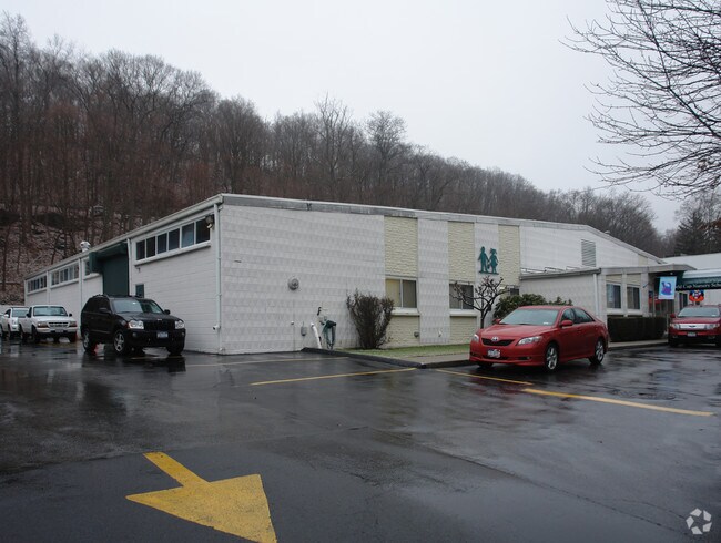
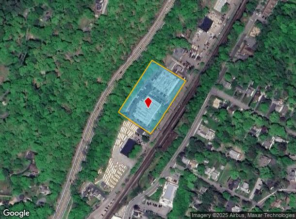
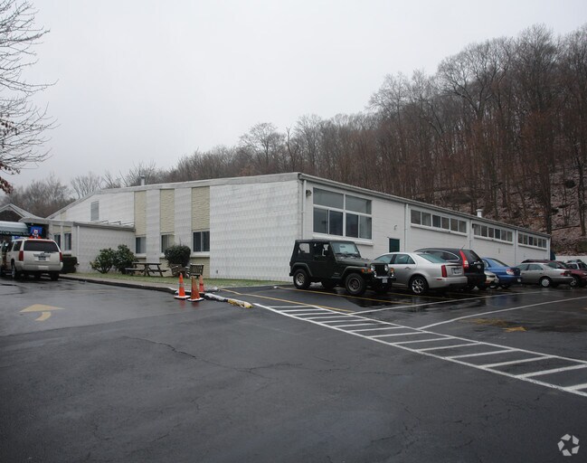
Property Record
160 Joan Corwin Way, Chappaqua, NY 10514

NEARBY LISTINGS FOR SALE OR LEASE
Property Detail
160 Joan Corwin Way
3600-100-007-00002-000-0007
Subdivision Prepared For R J Ostrander
Privateschool
Westchester
X
New York
36119C0142F
7.000
2025
2 AC
2024
North
013104
Westchester/So Connecticut
1,149 SF
New York-Jersey City-White Plains, NY-NJ
DEMOGRAPHICS near 160 Joan Corwin Way
1 Mile
3 Mile
5 Mile
2024 Total Population
5,889
35,143
95,783
2029 Population
5,786
34,347
93,413
Pop Growth 2024-2029
(1.75%)
(2.27%)
(2.47%)
Average Age
41
41
41
2024 Total Households
1,970
11,370
32,553
HH Growth 2024-2029
(1.88%)
(2.57%)
(2.70%)
Median Household Inc
$229,315
$203,677
$146,273
Avg Household Size
3.00
2.90
2.80
2024 Avg HH Vehicles
2.00
2.00
2.00
Median Home Value
$822,304
$808,551
$720,735
Median Year Built
1958
1959
1961
Nearby Places
Map Layers
Map Styles
 Street
 Aerial
- Restaurants
- Banks
- Shops
- Fitness
- Groceries
PUBLIC TRANSPORTATION
COMMUTER RAIL
Chappaqua Station (Harlem Line - Metro-North Commuter Railroad Company (Metro-North))
DRIVE
WALK
Distance
Chappaqua Station (Harlem Line - Metro-North Commuter Railroad Company (Metro-North))
3 min
13 min
0.7 mi
Pleasantville Station (Harlem Line - Metro-North Commuter Railroad Company (Metro-North))
DRIVE
WALK
Distance
Pleasantville Station (Harlem Line - Metro-North Commuter Railroad Company (Metro-North))
6 min
2.6 mi
AIRPORT
Westchester County
DRIVE
WALK
Distance
Westchester County
18 min
8.9 mi
LaGuardia
DRIVE
WALK
Distance
LaGuardia
54 min
34.7 mi
New York Stewart International
DRIVE
WALK
Distance
New York Stewart International
72 min
42.1 mi
Freight Ports
NY - Red Hook Container Terminal
DRIVE
WALK
Distance
NY - Red Hook Container Terminal
67 min
42.9 mi
Nearby Properties
Address
Land Use
TOTAL SIZE
Lot Size
Zoning
Address
Land Use
TOTAL SIZE
Lot Size
Zoning
11.11 AC
Address
Land Use
TOTAL SIZE
Lot Size
Zoning
Address
Land Use
TOTAL SIZE
Lot Size
Zoning
20.54 AC
Address
Land Use
TOTAL SIZE
Lot Size
Zoning
Address
Land Use
TOTAL SIZE
Lot Size
Zoning
2,100 SF
1.50 AC
Address
Land Use
TOTAL SIZE
Lot Size
Zoning
Address
Land Use
TOTAL SIZE
Lot Size
Zoning
55.22 AC
Address
Land Use
TOTAL SIZE
Lot Size
Zoning
450,000 SF
59.25 AC
Address
Land Use
TOTAL SIZE
Lot Size
Zoning
Address
Land Use
TOTAL SIZE
Lot Size
Zoning
147.27 AC
R1
Address
Land Use
TOTAL SIZE
Lot Size
Zoning
Address
Land Use
TOTAL SIZE
Lot Size
Zoning
Address
Land Use
TOTAL SIZE
Lot Size
Zoning
Address
Land Use
TOTAL SIZE
Lot Size
Zoning
46.35 AC
R1
Address
Land Use
TOTAL SIZE
Lot Size
Zoning
7.18 AC
R2
Address
Land Use
TOTAL SIZE
Lot Size
Zoning
Address
Land Use
TOTAL SIZE
Lot Size
Zoning
Address
Land Use
TOTAL SIZE
Lot Size
Zoning
Address
Land Use
TOTAL SIZE
Lot Size
Zoning
Address
Land Use
TOTAL SIZE
Lot Size
Zoning
53.90 AC
Address
Land Use
TOTAL SIZE
Lot Size
Zoning
Address
Land Use
TOTAL SIZE
Lot Size
Zoning
2.09 AC
Address
Land Use
TOTAL SIZE
Lot Size
Zoning
2,494 SF
1.75 AC
Address
Land Use
TOTAL SIZE
Lot Size
Zoning
Address
Land Use
TOTAL SIZE
Lot Size
Zoning
12.34 AC
R-1A
Address
Land Use
TOTAL SIZE
Lot Size
Zoning
25 AC
R-1A
Address
Land Use
TOTAL SIZE
Lot Size
Zoning
8,340 SF
0.91 AC
Address
Land Use
TOTAL SIZE
Lot Size
Zoning
Address
Land Use
TOTAL SIZE
Lot Size
Zoning
100,000 SF
0.79 AC
Address
Land Use
TOTAL SIZE
Lot Size
Zoning
0.76 AC
The World's #1 Commercial Real Estate Marketplace
Connect with us
© 2026 CoStar Group
The information above has been obtained from sources believed reliable. While we do not doubt its accuracy we have not verified it and make no guarantee, warranty or representation about it. It is your responsibility to independently confirm its accuracy and completeness. Any projections, opinions, assumptions, or estimates used are for example only and do not represent the current or future performance of the property. The value of this transaction to you depends on tax and other factors which should be evaluated by your tax, financial, and legal advisors. You and your advisors should conduct a careful, independent investigation of the property to determine to your satisfaction the suitability of the property for your needs.