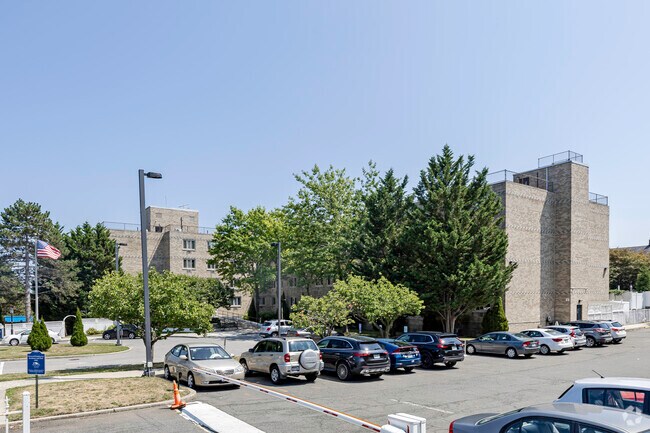
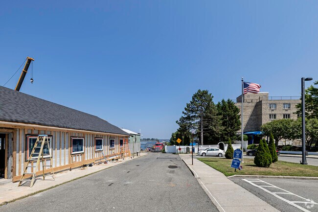
Property Record
160 Pilot St, Bronx, NY 10464

Property Detail
160 Pilot St
05640-0018
Bronx
Apartment
New York
C3
18
AE The base floodplain where base flood elevations are provided. AE Zones are now used on new format FIRMs instead of A1-A30 Zones.
5.21 AC
0
City Island
2025
Westchester/So Connecticut
051601
New York-Jersey City-White Plains, NY-NJ
97,013 SF
NEARBY LISTINGS FOR SALE OR LEASE
DEMOGRAPHICS near 160 Pilot St
1 mile
3 mile
5 mile
2025 Total Population
3,773
75,848
624,123
2030 Population
3,653
71,182
600,475
Pop Growth 2025-2030
(3.18%)
(6.15%)
(3.79%)
Average Age
48
42
41
2025 Total Households
1,738
28,424
225,402
HH Growth 2025-2030
(3.62%)
(6.94%)
(4.04%)
Median Household Inc
$95,734
$76,863
$69,612
Avg Household Size
2.10
2.50
2.60
2025 Avg HH Vehicles
2.00
1.00
1.00
Median Home Value
$785,876
$652,937
$681,098
Median Year Built
1948
1958
1956
Nearby Places
Map Layers
Map Styles
 Street
 Aerial
Layers
 Traffic
 Biking
Places
Listings with unknown addresses are not visible on the map
- Restaurants
- Banks
- Shops
- Fitness
- Groceries
PUBLIC TRANSPORTATION
COMMUTER RAIL
New Rochelle Station (New Haven Line - Metro-North Commuter Railroad Company (Metro-North))
Drive
Walk
Distance
New Rochelle Station (New Haven Line - Metro-North Commuter Railroad Company (Metro-North))
14 min
6.8 mi
AIRPORT
LaGuardia
Drive
Walk
Distance
LaGuardia
26 min
13.5 mi
John F Kennedy International
Drive
Walk
Distance
John F Kennedy International
32 min
21.0 mi
Westchester County
Drive
Walk
Distance
Westchester County
35 min
22.0 mi
Freight Ports
NY - Red Hook Container Terminal
Drive
Walk
Distance
NY - Red Hook Container Terminal
41 min
24.0 mi
Nearby Properties
Address
Land Use
TOTAL SIZE
Lot Size
Zoning
Address
Land Use
TOTAL SIZE
Lot Size
Zoning
550,000 SF
8.75 AC
M1-1
Address
Land Use
TOTAL SIZE
Lot Size
Zoning
119,980 SF
1,704.55 AC
PARK
Address
Land Use
TOTAL SIZE
Lot Size
Zoning
5,000 SF
363.58 AC
PARK
Address
Land Use
TOTAL SIZE
Lot Size
Zoning
703,265 SF
83.45 AC
R4
Address
Land Use
TOTAL SIZE
Lot Size
Zoning
537,208 SF
4.73 AC
C4-3
Address
Land Use
TOTAL SIZE
Lot Size
Zoning
545,388 SF
29.07 AC
C4-3
Address
Land Use
TOTAL SIZE
Lot Size
Zoning
510 SF
68.73 AC
PARK
Address
Land Use
TOTAL SIZE
Lot Size
Zoning
450,879 SF
9.10 AC
M1-1
Address
Land Use
TOTAL SIZE
Lot Size
Zoning
450,000 SF
5.59 AC
R6
Address
Land Use
TOTAL SIZE
Lot Size
Zoning
12,150 SF
482.09 AC
PARK
Address
Land Use
TOTAL SIZE
Lot Size
Zoning
1,172,800 SF
19.66 AC
R4
Address
Land Use
TOTAL SIZE
Lot Size
Zoning
138,305 SF
3.18 AC
R6
Address
Land Use
TOTAL SIZE
Lot Size
Zoning
158,282 SF
2.38 AC
R4A
Address
Land Use
TOTAL SIZE
Lot Size
Zoning
188,760 SF
1.95 AC
R6
Address
Land Use
TOTAL SIZE
Lot Size
Zoning
170,513 SF
3.86 AC
C4-3
Address
Land Use
TOTAL SIZE
Lot Size
Zoning
146,100 SF
2.99 AC
R4
Address
Land Use
TOTAL SIZE
Lot Size
Zoning
159,856 SF
1.38 AC
C4-3
Address
Land Use
TOTAL SIZE
Lot Size
Zoning
132,200 SF
10.75 AC
C4-1
Address
Land Use
TOTAL SIZE
Lot Size
Zoning
321,300 SF
11.55 AC
R4
Address
Land Use
TOTAL SIZE
Lot Size
Zoning
419,742 SF
2.43 AC
C4-3
Address
Land Use
TOTAL SIZE
Lot Size
Zoning
396,938 SF
10.47 AC
R4
Address
Land Use
TOTAL SIZE
Lot Size
Zoning
112,800 SF
2.64 AC
R6
Address
Land Use
TOTAL SIZE
Lot Size
Zoning
363,140 SF
2.36 AC
C4-3
Address
Land Use
TOTAL SIZE
Lot Size
Zoning
103,712 SF
3.75 AC
R4-1
Address
Land Use
TOTAL SIZE
Lot Size
Zoning
158,840 SF
10.92 AC
R2
Address
Land Use
TOTAL SIZE
Lot Size
Zoning
179,960 SF
1.65 AC
R4
Address
Land Use
TOTAL SIZE
Lot Size
Zoning
87,878 SF
0.40 AC
R7-1
Address
Land Use
TOTAL SIZE
Lot Size
Zoning
311,000 SF
16.84 AC
R6
Address
Land Use
TOTAL SIZE
Lot Size
Zoning
326,000 SF
2.95 AC
R7-1
Address
Land Use
TOTAL SIZE
Lot Size
Zoning
28,000 SF
67.40 AC
R4
The World's #1 Commercial Real Estate Marketplace
Connect with us
© 2026 CoStar Group
The information above has been obtained from sources believed reliable. While we do not doubt its accuracy we have not verified it and make no guarantee, warranty or representation about it. It is your responsibility to independently confirm its accuracy and completeness. Any projections, opinions, assumptions, or estimates used are for example only and do not represent the current or future performance of the property. The value of this transaction to you depends on tax and other factors which should be evaluated by your tax, financial, and legal advisors. You and your advisors should conduct a careful, independent investigation of the property to determine to your satisfaction the suitability of the property for your needs.