Property Record
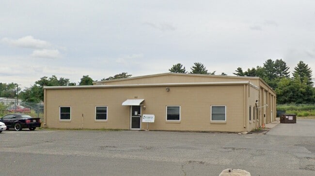
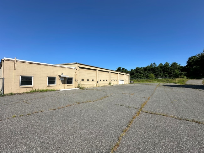
160 Rocus St, Springfield, MA 01104

Property Detail
160 Rocus St
Autorepair
Hampden
I2
Massachusetts
B and X Area of moderate flood hazard, usually the area between the limits of the 100-year and 500-year floods.
5.21 AC
2025
Hampden County
2025
Hartford
800202
Springfield, MA
7,920 SF
SPRI-010330-000000-000037
NEARBY LISTINGS FOR SALE OR LEASE
DEMOGRAPHICS near 160 Rocus St
1 mile
3 mile
5 mile
2024 Total Population
3,478
89,382
237,124
2029 Population
3,419
87,908
232,830
Pop Growth 2024-2029
(1.70%)
(1.65%)
(1.81%)
Average Age
39
39
39
2024 Total Households
1,389
33,628
93,339
HH Growth 2024-2029
(1.66%)
(1.73%)
(1.85%)
Median Household Inc
$44,535
$51,672
$49,366
Avg Household Size
2.50
2.50
2.40
2024 Avg HH Vehicles
2.00
1.00
1.00
Median Home Value
$161,831
$194,500
$221,269
Median Year Built
1956
1955
1953
Nearby Places
Map Layers
Map Styles
 Street
 Aerial
Transit
 Traffic
 Biking
Places
Listings with unknown addresses are not visible on the map
- Restaurants
- Banks
- Shops
- Fitness
- Groceries
PUBLIC TRANSPORTATION
COMMUTER RAIL
Springfield (Hartford Line - CONN DOT)
Drive
Walk
Distance
Springfield (Hartford Line - CONN DOT)
8 min
5.2 mi
Holyoke Amtrak (Valley Flyer - Amtrak, Vermonter - Amtrak)
Drive
Walk
Distance
Holyoke Amtrak (Valley Flyer - Amtrak, Vermonter - Amtrak)
12 min
6.8 mi
AIRPORT
Bradley International
Drive
Walk
Distance
Bradley International
39 min
18.5 mi
Freight Ports
Port of New Haven
Drive
Walk
Distance
Port of New Haven
90 min
69.7 mi
SALE & LEASE HISTORY
LISTING DATE
SALE/LEASE

Jul 29, 2024
For Lease
Dec 06, 2023
For Lease
Aug 02, 2024
For Lease
Nearby Properties
Address
Land Use
TOTAL SIZE
Lot Size
Zoning
Address
Land Use
TOTAL SIZE
Lot Size
Zoning
263,462 SF
21.65 AC
R2
Address
Land Use
TOTAL SIZE
Lot Size
Zoning
178,132 SF
15.60 AC
B1
Address
Land Use
TOTAL SIZE
Lot Size
Zoning
51,808 SF
11.01 AC
SR2B1
Address
Land Use
TOTAL SIZE
Lot Size
Zoning
48,924 SF
40.03 AC
I2
Address
Land Use
TOTAL SIZE
Lot Size
Zoning
431,476 SF
88.64 AC
SC2B1
Address
Land Use
TOTAL SIZE
Lot Size
Zoning
141,970 SF
4.34 AC
S
Address
Land Use
TOTAL SIZE
Lot Size
Zoning
56,576 SF
62.84 AC
SR1R4
Address
Land Use
TOTAL SIZE
Lot Size
Zoning
286,624 SF
17.40 AC
102
Address
Land Use
TOTAL SIZE
Lot Size
Zoning
7.41 AC
I2
Address
Land Use
TOTAL SIZE
Lot Size
Zoning
1.89 AC
SR2I2
Address
Land Use
TOTAL SIZE
Lot Size
Zoning
131,942 SF
40.30 AC
R1
Address
Land Use
TOTAL SIZE
Lot Size
Zoning
153,742 SF
22.34 AC
R1
Address
Land Use
TOTAL SIZE
Lot Size
Zoning
181,000 SF
34.48 AC
I1
Address
Land Use
TOTAL SIZE
Lot Size
Zoning
219,521 SF
7.50 AC
R2
Address
Land Use
TOTAL SIZE
Lot Size
Zoning
39,776 SF
8.16 AC
R2
Address
Land Use
TOTAL SIZE
Lot Size
Zoning
22.77 AC
111A
Address
Land Use
TOTAL SIZE
Lot Size
Zoning
2,555 SF
166.42 AC
RB
Address
Land Use
TOTAL SIZE
Lot Size
Zoning
105,000 SF
17.59 AC
SR1R3
Address
Land Use
TOTAL SIZE
Lot Size
Zoning
762,340 SF
76.18 AC
SR1R2I
Address
Land Use
TOTAL SIZE
Lot Size
Zoning
29,464 SF
10.89 AC
R2
Address
Land Use
TOTAL SIZE
Lot Size
Zoning
99,792 SF
123.26 AC
S
Address
Land Use
TOTAL SIZE
Lot Size
Zoning
30.45 AC
106
Address
Land Use
TOTAL SIZE
Lot Size
Zoning
181,008 SF
10 AC
102
Address
Land Use
TOTAL SIZE
Lot Size
Zoning
215,776 SF
28.52 AC
I1
Address
Land Use
TOTAL SIZE
Lot Size
Zoning
37,040 SF
4.50 AC
B1
Address
Land Use
TOTAL SIZE
Lot Size
Zoning
223,390 SF
13.83 AC
111A
Address
Land Use
TOTAL SIZE
Lot Size
Zoning
141,475 SF
31.69 AC
S
Address
Land Use
TOTAL SIZE
Lot Size
Zoning
11,115 SF
57.72 AC
R1
Address
Land Use
TOTAL SIZE
Lot Size
Zoning
62,115 SF
1.69 AC
R1
Address
Land Use
TOTAL SIZE
Lot Size
Zoning
257,179 SF
22.84 AC
110
The World's #1 Commercial Real Estate Marketplace
Connect with us
© 2026 CoStar Group
The information above has been obtained from sources believed reliable. While we do not doubt its accuracy we have not verified it and make no guarantee, warranty or representation about it. It is your responsibility to independently confirm its accuracy and completeness. Any projections, opinions, assumptions, or estimates used are for example only and do not represent the current or future performance of the property. The value of this transaction to you depends on tax and other factors which should be evaluated by your tax, financial, and legal advisors. You and your advisors should conduct a careful, independent investigation of the property to determine to your satisfaction the suitability of the property for your needs.