Property Record
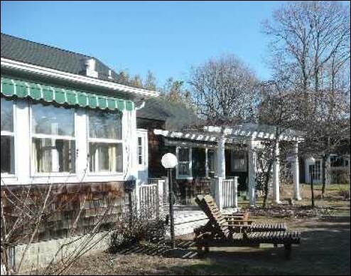
160 S Country Rd, Bellport, NY 11713


NEARBY LISTINGS FOR SALE OR LEASE
Property Detail
160 S Country Rd
Nassau County-Suffolk County, NY
Smith Hlse & Smith
0202-008-00-03-00-017-002
SMTH HLSE&SMT 378 ALL 10 & W PT 11
Transientlodging
Suffolk
X
New York
36103C0714H
17
2024
0.47 AC
2024
Central Suffolk
159300
Long Island (New York)
DEMOGRAPHICS near 160 S Country Rd
1 Mile
3 Mile
5 Mile
2024 Total Population
4,777
27,477
94,194
2029 Population
4,801
27,341
93,395
Pop Growth 2024-2029
+ 0.50%
(0.49%)
(0.85%)
Average Age
46
42
40
2024 Total Households
1,774
9,315
32,313
HH Growth 2024-2029
+ 0.45%
(0.85%)
(1.12%)
Median Household Inc
$109,795
$102,171
$96,696
Avg Household Size
2.50
2.70
2.80
2024 Avg HH Vehicles
2.00
2.00
2.00
Median Home Value
$573,619
$451,722
$395,240
Median Year Built
1963
1973
1973
Nearby Places
Map Layers
Map Styles
 Street
 Aerial
- Restaurants
- Banks
- Shops
- Fitness
- Groceries
PUBLIC TRANSPORTATION
COMMUTER RAIL
Bellport Station (Montauk Branch - Long Island Rail Road)
DRIVE
WALK
Distance
Bellport Station (Montauk Branch - Long Island Rail Road)
4 min
1.3 mi
Patchogue Station (Montauk Branch - Long Island Rail Road)
DRIVE
WALK
Distance
Patchogue Station (Montauk Branch - Long Island Rail Road)
9 min
4.7 mi
AIRPORT
Long Island MacArthur
DRIVE
WALK
Distance
Long Island MacArthur
21 min
10.8 mi
Nearby Properties
Address
Land Use
TOTAL SIZE
Lot Size
Zoning
Address
Land Use
TOTAL SIZE
Lot Size
Zoning
8,802 SF
2.74 AC
R80
Address
Land Use
TOTAL SIZE
Lot Size
Zoning
2,946 SF
1.04 AC
R20
Address
Land Use
TOTAL SIZE
Lot Size
Zoning
32.04 AC
Address
Land Use
TOTAL SIZE
Lot Size
Zoning
19.01 AC
Address
Land Use
TOTAL SIZE
Lot Size
Zoning
32.52 AC
Address
Land Use
TOTAL SIZE
Lot Size
Zoning
0.02 AC
R40
Address
Land Use
TOTAL SIZE
Lot Size
Zoning
Address
Land Use
TOTAL SIZE
Lot Size
Zoning
21.19 AC
Address
Land Use
TOTAL SIZE
Lot Size
Zoning
37.51 AC
Address
Land Use
TOTAL SIZE
Lot Size
Zoning
65.86 AC
Address
Land Use
TOTAL SIZE
Lot Size
Zoning
23.66 AC
Address
Land Use
TOTAL SIZE
Lot Size
Zoning
49.68 AC
Address
Land Use
TOTAL SIZE
Lot Size
Zoning
Address
Land Use
TOTAL SIZE
Lot Size
Zoning
Address
Land Use
TOTAL SIZE
Lot Size
Zoning
27.87 AC
Address
Land Use
TOTAL SIZE
Lot Size
Zoning
32.24 AC
Address
Land Use
TOTAL SIZE
Lot Size
Zoning
Address
Land Use
TOTAL SIZE
Lot Size
Zoning
13.98 AC
Address
Land Use
TOTAL SIZE
Lot Size
Zoning
10.20 AC
Address
Land Use
TOTAL SIZE
Lot Size
Zoning
0.60 AC
Address
Land Use
TOTAL SIZE
Lot Size
Zoning
Address
Land Use
TOTAL SIZE
Lot Size
Zoning
39.78 AC
Address
Land Use
TOTAL SIZE
Lot Size
Zoning
12.32 AC
Address
Land Use
TOTAL SIZE
Lot Size
Zoning
0.86 AC
Address
Land Use
TOTAL SIZE
Lot Size
Zoning
5.45 AC
Address
Land Use
TOTAL SIZE
Lot Size
Zoning
Address
Land Use
TOTAL SIZE
Lot Size
Zoning
4.99 AC
Address
Land Use
TOTAL SIZE
Lot Size
Zoning
Address
Land Use
TOTAL SIZE
Lot Size
Zoning
Address
Land Use
TOTAL SIZE
Lot Size
Zoning
The World's #1 Commercial Real Estate Marketplace
Connect with us
© 2026 CoStar Group
The information above has been obtained from sources believed reliable. While we do not doubt its accuracy we have not verified it and make no guarantee, warranty or representation about it. It is your responsibility to independently confirm its accuracy and completeness. Any projections, opinions, assumptions, or estimates used are for example only and do not represent the current or future performance of the property. The value of this transaction to you depends on tax and other factors which should be evaluated by your tax, financial, and legal advisors. You and your advisors should conduct a careful, independent investigation of the property to determine to your satisfaction the suitability of the property for your needs.