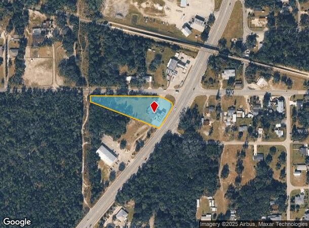
Property Record
160 N State Road 415, Osteen, FL 32764
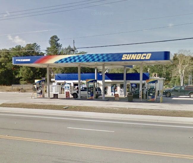
This Property Is For Sale
NEARBY LISTINGS FOR SALE OR LEASE
Property Detail
160 N State Road 415
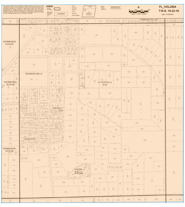
9218-06-12-0012
Enterprise
Storemultistory
W 572 FT MEAS ON ENTERPRISE OSTEEN RD & W OF SR 415 BEING 495.7 FT ON S/L & 27.4 FT ON W/L BLK 12 OSTEEN PER OR 0048 PG 0467 PER OR 0748 PG 0064 PER OR 3067 PG 0257 PER OR 5824 PGS 4138-4140 INC
X
Volusia
12127C0760K
Florida
2025
1.61 AC
2025
SE Volusia County
091029
Deltona/Daytona Beach
5,514 SF
Deltona-Daytona Beach-Ormond Beach, FL
DEMOGRAPHICS near 160 N State Road 415
1 Mile
3 Mile
5 Mile
2024 Total Population
1,448
10,012
35,124
2029 Population
1,612
11,184
38,629
Pop Growth 2024-2029
+ 11.33%
+ 11.71%
+ 9.98%
Average Age
46
41
41
2024 Total Households
567
3,507
12,443
HH Growth 2024-2029
+ 11.46%
+ 11.83%
+ 10.12%
Median Household Inc
$72,691
$71,671
$68,445
Avg Household Size
2.40
2.80
2.80
2024 Avg HH Vehicles
2.00
2.00
2.00
Median Home Value
$328,985
$237,231
$230,779
Median Year Built
1989
1991
1988
Nearby Places
- Restaurants
- Banks
- Shops
- Fitness
- Groceries
PUBLIC TRANSPORTATION
AIRPORT
Orlando Sanford International
DRIVE
WALK
Distance
Orlando Sanford International
16 min
10.2 mi
Daytona Beach International
DRIVE
WALK
Distance
Daytona Beach International
42 min
26.2 mi
Freight Ports
Port Canaveral
DRIVE
WALK
Distance
Port Canaveral
87 min
61.7 mi
Nearby Properties
Address
Land Use
TOTAL SIZE
Lot Size
Zoning
Address
Land Use
TOTAL SIZE
Lot Size
Zoning
318,438 SF
78.41 AC
A1
Address
Land Use
TOTAL SIZE
Lot Size
Zoning
224,577 SF
24.64 AC
RR
Address
Land Use
TOTAL SIZE
Lot Size
Zoning
104,514 SF
33.32 AC
P
Address
Land Use
TOTAL SIZE
Lot Size
Zoning
105,535 SF
13.05 AC
P
Address
Land Use
TOTAL SIZE
Lot Size
Zoning
56,243 SF
7.57 AC
C1
Address
Land Use
TOTAL SIZE
Lot Size
Zoning
8,046 SF
269.35 AC
A1
Address
Land Use
TOTAL SIZE
Lot Size
Zoning
38,144 SF
52 AC
A3
Address
Land Use
TOTAL SIZE
Lot Size
Zoning
25,531 SF
14.76 AC
01A3
Address
Land Use
TOTAL SIZE
Lot Size
Zoning
48 AC
A2
Address
Land Use
TOTAL SIZE
Lot Size
Zoning
641 AC
RC
Address
Land Use
TOTAL SIZE
Lot Size
Zoning
640 AC
C
Address
Land Use
TOTAL SIZE
Lot Size
Zoning
578.80 AC
RC
Address
Land Use
TOTAL SIZE
Lot Size
Zoning
516 AC
FR
Address
Land Use
TOTAL SIZE
Lot Size
Zoning
546.75 AC
C
Address
Land Use
TOTAL SIZE
Lot Size
Zoning
545 AC
C
Address
Land Use
TOTAL SIZE
Lot Size
Zoning
5,000 SF
481.25 AC
MH3
Address
Land Use
TOTAL SIZE
Lot Size
Zoning
12,136 SF
118.54 AC
RR
Address
Land Use
TOTAL SIZE
Lot Size
Zoning
19,846 SF
5.07 AC
Address
Land Use
TOTAL SIZE
Lot Size
Zoning
13,581 SF
5.41 AC
01A1
Address
Land Use
TOTAL SIZE
Lot Size
Zoning
31,970 SF
7.58 AC
A3
Address
Land Use
TOTAL SIZE
Lot Size
Zoning
362.30 AC
A1
Address
Land Use
TOTAL SIZE
Lot Size
Zoning
358.56 AC
A1
Address
Land Use
TOTAL SIZE
Lot Size
Zoning
11.59 AC
01A1
Address
Land Use
TOTAL SIZE
Lot Size
Zoning
16,162 SF
1.76 AC
C1
Address
Land Use
TOTAL SIZE
Lot Size
Zoning
25.82 AC
A3
Address
Land Use
TOTAL SIZE
Lot Size
Zoning
6,272 SF
1.64 AC
C1
Address
Land Use
TOTAL SIZE
Lot Size
Zoning
45 AC
C
Address
Land Use
TOTAL SIZE
Lot Size
Zoning
8,866 SF
0.98 AC
BPUD
Address
Land Use
TOTAL SIZE
Lot Size
Zoning
14,762 SF
1.80 AC
R5
Address
Land Use
TOTAL SIZE
Lot Size
Zoning
16,562 SF
6.59 AC
01B5
The World's #1 Commercial Real Estate Marketplace
Connect with us
© 2025 CoStar Group
The information above has been obtained from sources believed reliable. While we do not doubt its accuracy we have not verified it and make no guarantee, warranty or representation about it. It is your responsibility to independently confirm its accuracy and completeness. Any projections, opinions, assumptions, or estimates used are for example only and do not represent the current or future performance of the property. The value of this transaction to you depends on tax and other factors which should be evaluated by your tax, financial, and legal advisors. You and your advisors should conduct a careful, independent investigation of the property to determine to your satisfaction the suitability of the property for your needs.