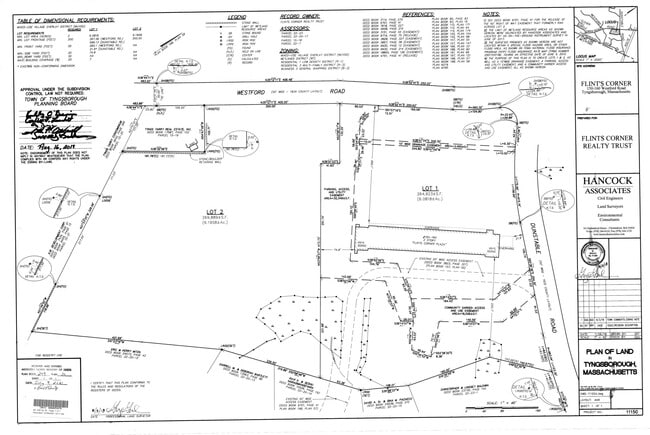
Property Record
160 Westford Rd, Tyngsboro, MA 01879
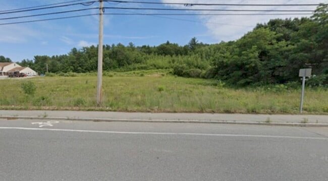
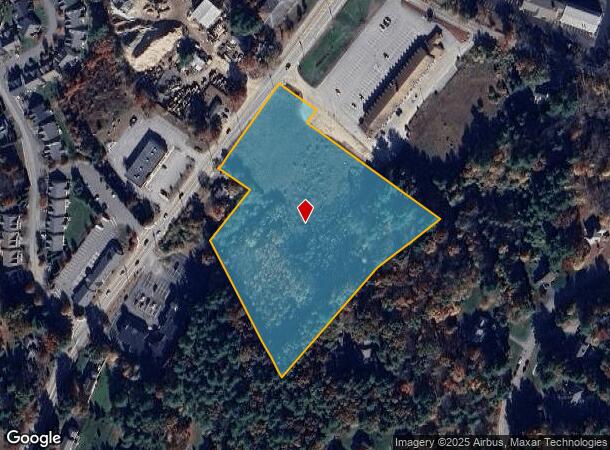
This Property Is For Sale
NEARBY LISTINGS FOR SALE OR LEASE
Property Detail
160 Westford Rd
TYNG-000015-000018
Middlesex
Commercialacreage
Massachusetts
X
6.20 AC
25017C0118F
Groton/Townsend
2025
Boston
2025
Boston-Cambridge-Newton, MA-NH
313101
DEMOGRAPHICS near 160 Westford Rd
1 Mile
3 Mile
5 Mile
2024 Total Population
2,739
26,309
96,842
2029 Population
2,882
27,565
100,180
Pop Growth 2024-2029
+ 5.22%
+ 4.77%
+ 3.45%
Average Age
42
42
42
2024 Total Households
940
9,898
36,781
HH Growth 2024-2029
+ 5.43%
+ 4.81%
+ 3.43%
Median Household Inc
$174,324
$129,009
$120,004
Avg Household Size
2.80
2.60
2.60
2024 Avg HH Vehicles
2.00
2.00
2.00
Median Home Value
$713,660
$612,965
$595,424
Median Year Built
1995
1985
1981
Nearby Places
Map Layers
Map Styles
 Street
 Aerial
- Restaurants
- Banks
- Shops
- Fitness
- Groceries
PUBLIC TRANSPORTATION
COMMUTER RAIL
Lowell (Lowell Line - Massachusetts Bay Transportation Authority Commuter Rail (Purple Line))
DRIVE
WALK
Distance
Lowell (Lowell Line - Massachusetts Bay Transportation Authority Commuter Rail (Purple Line))
14 min
8.3 mi
AIRPORT
Manchester Boston Regional
DRIVE
WALK
Distance
Manchester Boston Regional
35 min
23.9 mi
General Edward Lawrence Logan International
DRIVE
WALK
Distance
General Edward Lawrence Logan International
55 min
41.4 mi
Freight Ports
Port of Boston
DRIVE
WALK
Distance
Port of Boston
56 min
41.1 mi
Nearby Properties
Address
Land Use
TOTAL SIZE
Lot Size
Zoning
Address
Land Use
TOTAL SIZE
Lot Size
Zoning
23,251 SF
18.20 AC
SMF
Address
Land Use
TOTAL SIZE
Lot Size
Zoning
68.15 AC
R1
Address
Land Use
TOTAL SIZE
Lot Size
Zoning
199.97 AC
B2
Address
Land Use
TOTAL SIZE
Lot Size
Zoning
8.30 AC
B3
Address
Land Use
TOTAL SIZE
Lot Size
Zoning
135,324 SF
70.07 AC
R1
Address
Land Use
TOTAL SIZE
Lot Size
Zoning
90,463 SF
8.56 AC
RA
Address
Land Use
TOTAL SIZE
Lot Size
Zoning
177.27 AC
R1
Address
Land Use
TOTAL SIZE
Lot Size
Zoning
12.26 AC
P
Address
Land Use
TOTAL SIZE
Lot Size
Zoning
50,000 SF
33.40 AC
IA
Address
Land Use
TOTAL SIZE
Lot Size
Zoning
15.86 AC
B3
Address
Land Use
TOTAL SIZE
Lot Size
Zoning
17.86 AC
I1
Address
Land Use
TOTAL SIZE
Lot Size
Zoning
42,354 SF
19.95 AC
I1
Address
Land Use
TOTAL SIZE
Lot Size
Zoning
83,000 SF
2.78 AC
R1
Address
Land Use
TOTAL SIZE
Lot Size
Zoning
1.91 AC
RC
Address
Land Use
TOTAL SIZE
Lot Size
Zoning
2.59 AC
I1
Address
Land Use
TOTAL SIZE
Lot Size
Zoning
5.03 AC
B2
Address
Land Use
TOTAL SIZE
Lot Size
Zoning
92,440 SF
B3
Address
Land Use
TOTAL SIZE
Lot Size
Zoning
177.88 AC
R1
Address
Land Use
TOTAL SIZE
Lot Size
Zoning
900 SF
4.41 AC
I1
Address
Land Use
TOTAL SIZE
Lot Size
Zoning
121,916 SF
7.78 AC
CD
Address
Land Use
TOTAL SIZE
Lot Size
Zoning
100,572 SF
17.70 AC
I1
Address
Land Use
TOTAL SIZE
Lot Size
Zoning
98,118 SF
9.20 AC
B3
Address
Land Use
TOTAL SIZE
Lot Size
Zoning
68,097 SF
11.96 AC
IA
Address
Land Use
TOTAL SIZE
Lot Size
Zoning
25 AC
I1
Address
Land Use
TOTAL SIZE
Lot Size
Zoning
7.77 AC
R1
Address
Land Use
TOTAL SIZE
Lot Size
Zoning
80,500 SF
I1
Address
Land Use
TOTAL SIZE
Lot Size
Zoning
183,008 SF
6.10 AC
IA
Address
Land Use
TOTAL SIZE
Lot Size
Zoning
27,477 SF
6.87 AC
RB
Address
Land Use
TOTAL SIZE
Lot Size
Zoning
59,392 SF
7.30 AC
I1
Address
Land Use
TOTAL SIZE
Lot Size
Zoning
17,103 SF
102.08 AC
IA
The World's #1 Commercial Real Estate Marketplace
Connect with us
© 2026 CoStar Group
The information above has been obtained from sources believed reliable. While we do not doubt its accuracy we have not verified it and make no guarantee, warranty or representation about it. It is your responsibility to independently confirm its accuracy and completeness. Any projections, opinions, assumptions, or estimates used are for example only and do not represent the current or future performance of the property. The value of this transaction to you depends on tax and other factors which should be evaluated by your tax, financial, and legal advisors. You and your advisors should conduct a careful, independent investigation of the property to determine to your satisfaction the suitability of the property for your needs.