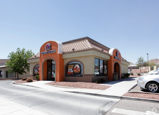
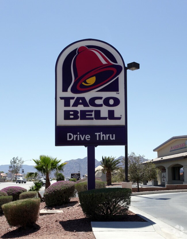
Property Record
1600 Boulder City Pky, Boulder City, NV 89005


NEARBY LISTINGS FOR SALE OR LEASE
Property Detail
1600 Boulder City Pky
Las Vegas-Henderson-North Las Vegas, NV
Parcel Map File 44 Page 79
186-08-310-009
PARCEL MAP FILE 44 PAGE 79 LOT 3A
Restaurantbuilding
Clark
X
Nevada
32003C2980E
3a
2025
0.80 AC
2025
Southeast Las Vegas
005501
Las Vegas
2,246 SF
DEMOGRAPHICS near 1600 Boulder City Pky
1 Mile
3 Mile
5 Mile
2024 Total Population
3,863
15,435
23,616
2029 Population
4,202
16,659
25,517
Pop Growth 2024-2029
+ 8.78%
+ 7.93%
+ 8.05%
Average Age
50
49
46
2024 Total Households
1,815
6,887
10,067
HH Growth 2024-2029
+ 8.65%
+ 7.90%
+ 8.01%
Median Household Inc
$52,091
$68,698
$68,709
Avg Household Size
2.10
2.20
2.30
2024 Avg HH Vehicles
2.00
2.00
2.00
Median Home Value
$376,922
$426,412
$445,313
Median Year Built
1977
1980
1988
Nearby Places
Map Layers
Map Styles
 Street
 Aerial
- Restaurants
- Banks
- Shops
- Fitness
- Groceries
PUBLIC TRANSPORTATION
AIRPORT
Boulder City Municipal
DRIVE
WALK
Distance
Boulder City Municipal
6 min
2.2 mi
Harry Reid International
DRIVE
WALK
Distance
Harry Reid International
29 min
22.3 mi
SALE & LEASE HISTORY
LISTING DATE
SALE/LEASE

Mar 06, 2019
For Sale
Nearby Properties
Address
Land Use
TOTAL SIZE
Lot Size
Zoning
Address
Land Use
TOTAL SIZE
Lot Size
Zoning
252,513 SF
490.45 AC
S
Address
Land Use
TOTAL SIZE
Lot Size
Zoning
30.74 AC
H
Address
Land Use
TOTAL SIZE
Lot Size
Zoning
36.90 AC
GM
Address
Land Use
TOTAL SIZE
Lot Size
Zoning
51,777 SF
261.30 AC
SR
Address
Land Use
TOTAL SIZE
Lot Size
Zoning
43.62 AC
Address
Land Use
TOTAL SIZE
Lot Size
Zoning
29.94 AC
S
Address
Land Use
TOTAL SIZE
Lot Size
Zoning
73,468 SF
11.34 AC
H
Address
Land Use
TOTAL SIZE
Lot Size
Zoning
22.31 AC
GM
Address
Land Use
TOTAL SIZE
Lot Size
Zoning
89,666 SF
38.65 AC
R18
Address
Land Use
TOTAL SIZE
Lot Size
Zoning
61,720 SF
6.39 AC
H
Address
Land Use
TOTAL SIZE
Lot Size
Zoning
51,423 SF
4.01 AC
Address
Land Use
TOTAL SIZE
Lot Size
Zoning
150.88 AC
S
Address
Land Use
TOTAL SIZE
Lot Size
Zoning
53,578 SF
1.35 AC
C2
Address
Land Use
TOTAL SIZE
Lot Size
Zoning
79.22 AC
GM
Address
Land Use
TOTAL SIZE
Lot Size
Zoning
48,033 SF
4.89 AC
C2
Address
Land Use
TOTAL SIZE
Lot Size
Zoning
18,592 SF
8.76 AC
R17
Address
Land Use
TOTAL SIZE
Lot Size
Zoning
5,238 SF
5.97 AC
C2
Address
Land Use
TOTAL SIZE
Lot Size
Zoning
61,972 SF
3.85 AC
C2
Address
Land Use
TOTAL SIZE
Lot Size
Zoning
94,810 SF
3.65 AC
C2
Address
Land Use
TOTAL SIZE
Lot Size
Zoning
Address
Land Use
TOTAL SIZE
Lot Size
Zoning
9.93 AC
GP
Address
Land Use
TOTAL SIZE
Lot Size
Zoning
3,268 SF
0.65 AC
C2
Address
Land Use
TOTAL SIZE
Lot Size
Zoning
13.88 AC
CM
Address
Land Use
TOTAL SIZE
Lot Size
Zoning
4,806 SF
11.86 AC
RV
Address
Land Use
TOTAL SIZE
Lot Size
Zoning
12.90 AC
CM
Address
Land Use
TOTAL SIZE
Lot Size
Zoning
46.04 AC
BC
Address
Land Use
TOTAL SIZE
Lot Size
Zoning
9,600 SF
4.37 AC
GM
Address
Land Use
TOTAL SIZE
Lot Size
Zoning
46,668 SF
2.96 AC
C2
Address
Land Use
TOTAL SIZE
Lot Size
Zoning
23,589 SF
5.46 AC
R17
Address
Land Use
TOTAL SIZE
Lot Size
Zoning
16,846 SF
2.06 AC
C2
The World's #1 Commercial Real Estate Marketplace
Connect with us
© 2026 CoStar Group
The information above has been obtained from sources believed reliable. While we do not doubt its accuracy we have not verified it and make no guarantee, warranty or representation about it. It is your responsibility to independently confirm its accuracy and completeness. Any projections, opinions, assumptions, or estimates used are for example only and do not represent the current or future performance of the property. The value of this transaction to you depends on tax and other factors which should be evaluated by your tax, financial, and legal advisors. You and your advisors should conduct a careful, independent investigation of the property to determine to your satisfaction the suitability of the property for your needs.