Property Record
1600 Dave Ward Dr, Conway, AR 72034
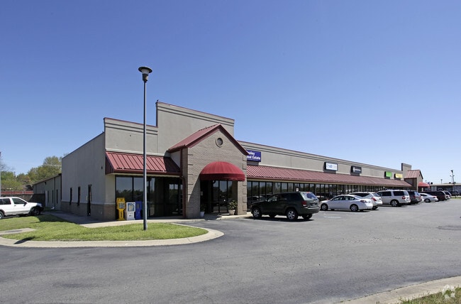


Property Detail
1600 Dave Ward Dr
Little Rock-North Little Rock-Conway, AR
PT LOT 4AGENERATION REPLAT
710-08535-022
Faulkner
Regionalshoppingcenterormallwithanchorstore
Arkansas
B and X Area of moderate flood hazard, usually the area between the limits of the 100-year and 500-year floods.
4
2025
1.70 AC
2025
Faulkner County
030900
Little Rock/N Little Rock
16,250 SF
NEARBY LISTINGS FOR SALE OR LEASE
DEMOGRAPHICS near 1600 Dave Ward Dr
1 mile
3 mile
5 mile
2025 Total Population
10,910
49,681
77,291
2030 Population
11,434
52,379
81,395
Pop Growth 2025-2030
+ 4.80%
+ 5.43%
+ 5.31%
Average Age
31
35
36
2025 Total Households
3,673
19,467
30,537
HH Growth 2025-2030
+ 5.80%
+ 5.85%
+ 5.67%
Median Household Inc
$47,331
$60,364
$65,082
Avg Household Size
2.20
2.30
2.30
2025 Avg HH Vehicles
2.00
2.00
2.00
Median Home Value
$225,342
$235,461
$257,626
Median Year Built
1995
1994
1997
Nearby Places
Map Layers
Map Styles
 Street
 Aerial
Layers
 Traffic
 Biking
Places
Listings with unknown addresses are not visible on the map
- Restaurants
- Banks
- Shops
- Fitness
- Groceries
PUBLIC TRANSPORTATION
AIRPORT
Bill and Hillary Clinton Ntl/Adams Field
Drive
Walk
Distance
Bill and Hillary Clinton Ntl/Adams Field
40 min
32.9 mi
SALE & LEASE HISTORY
LISTING DATE
SALE/LEASE

Mar 13, 2019
For Lease
Jun 04, 2019
For Lease
Aug 09, 2021
For Sale
Nearby Properties
Address
Land Use
TOTAL SIZE
Lot Size
Zoning
Address
Land Use
TOTAL SIZE
Lot Size
Zoning
158,289 SF
28.42 AC
Address
Land Use
TOTAL SIZE
Lot Size
Zoning
214,622 SF
38.85 AC
Address
Land Use
TOTAL SIZE
Lot Size
Zoning
123,032 SF
9.59 AC
Address
Land Use
TOTAL SIZE
Lot Size
Zoning
94,854 SF
10.40 AC
Address
Land Use
TOTAL SIZE
Lot Size
Zoning
89,037 SF
11.30 AC
Address
Land Use
TOTAL SIZE
Lot Size
Zoning
164,655 SF
10.36 AC
Address
Land Use
TOTAL SIZE
Lot Size
Zoning
26,928 SF
2.37 AC
Address
Land Use
TOTAL SIZE
Lot Size
Zoning
26,608 SF
17.40 AC
Address
Land Use
TOTAL SIZE
Lot Size
Zoning
107,636 SF
Address
Land Use
TOTAL SIZE
Lot Size
Zoning
1,215,537 SF
67.98 AC
Address
Land Use
TOTAL SIZE
Lot Size
Zoning
38,442 SF
30.57 AC
Address
Land Use
TOTAL SIZE
Lot Size
Zoning
134,686 SF
22.29 AC
Address
Land Use
TOTAL SIZE
Lot Size
Zoning
21,204 SF
65.01 AC
Address
Land Use
TOTAL SIZE
Lot Size
Zoning
77,129 SF
12.84 AC
Address
Land Use
TOTAL SIZE
Lot Size
Zoning
69,791 SF
10.04 AC
Address
Land Use
TOTAL SIZE
Lot Size
Zoning
85,354 SF
5.61 AC
Address
Land Use
TOTAL SIZE
Lot Size
Zoning
77,061 SF
3.07 AC
Address
Land Use
TOTAL SIZE
Lot Size
Zoning
30,312 SF
7.24 AC
Address
Land Use
TOTAL SIZE
Lot Size
Zoning
43,340 SF
28.77 AC
Address
Land Use
TOTAL SIZE
Lot Size
Zoning
171,059 SF
13.34 AC
Address
Land Use
TOTAL SIZE
Lot Size
Zoning
34,086 SF
9.77 AC
Address
Land Use
TOTAL SIZE
Lot Size
Zoning
32,900 SF
21.54 AC
Address
Land Use
TOTAL SIZE
Lot Size
Zoning
58,561 SF
47.36 AC
Address
Land Use
TOTAL SIZE
Lot Size
Zoning
98,915 SF
2.77 AC
Address
Land Use
TOTAL SIZE
Lot Size
Zoning
138,840 SF
15.46 AC
Address
Land Use
TOTAL SIZE
Lot Size
Zoning
1,811 SF
23.47 AC
Address
Land Use
TOTAL SIZE
Lot Size
Zoning
31,584 SF
8.60 AC
Address
Land Use
TOTAL SIZE
Lot Size
Zoning
12,419 SF
1.56 AC
Address
Land Use
TOTAL SIZE
Lot Size
Zoning
21,511 SF
20 AC
Address
Land Use
TOTAL SIZE
Lot Size
Zoning
28,167 SF
6.85 AC
The World's #1 Commercial Real Estate Marketplace
Connect with us
© 2026 CoStar Group
The information above has been obtained from sources believed reliable. While we do not doubt its accuracy we have not verified it and make no guarantee, warranty or representation about it. It is your responsibility to independently confirm its accuracy and completeness. Any projections, opinions, assumptions, or estimates used are for example only and do not represent the current or future performance of the property. The value of this transaction to you depends on tax and other factors which should be evaluated by your tax, financial, and legal advisors. You and your advisors should conduct a careful, independent investigation of the property to determine to your satisfaction the suitability of the property for your needs.