Property Record
1600 Industrial Dr, Bismarck, ND 58501

NEARBY LISTINGS FOR SALE OR LEASE
Property Detail
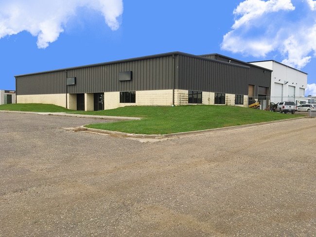
1600 Industrial Dr
Bismarck, ND
Miriam Industrial Park Second
0776-000-018
MIRIAM INDUSTRIAL PARK 2ND SOUTH 320' OF E600' OF L2 AND LESSPARCEL NO. 2-6 TAKEN FOR ST R/W MIRIAM INDUSTRIAL PARK 2ND
Lightindustrial
Burleigh
X
North Dakota
38015C0805E
18
2024
4.41 AC
2024
East Bismarck
010900
Other Market Areas
19,163 SF
DEMOGRAPHICS near 1600 Industrial Dr
1 Mile
3 Mile
5 Mile
2024 Total Population
4,281
40,606
86,053
2029 Population
4,384
41,880
88,607
Pop Growth 2024-2029
+ 2.41%
+ 3.14%
+ 2.97%
Average Age
43
41
40
2024 Total Households
1,837
18,001
36,250
HH Growth 2024-2029
+ 2.40%
+ 3.16%
+ 3.02%
Median Household Inc
$71,428
$59,490
$66,993
Avg Household Size
2.20
2.10
2.30
2024 Avg HH Vehicles
2.00
2.00
2.00
Median Home Value
$237,991
$237,805
$266,002
Median Year Built
1991
1979
1987
Nearby Places
Map Layers
Map Styles
 Street
 Aerial
- Restaurants
- Banks
- Shops
- Fitness
- Groceries
PUBLIC TRANSPORTATION
AIRPORT
Bismarck Municipal
DRIVE
WALK
Distance
Bismarck Municipal
15 min
4.7 mi
Freight Ports
Port Milwaukee
DRIVE
WALK
Distance
Port Milwaukee
819 min
762.0 mi
SALE & LEASE HISTORY
LISTING DATE
SALE/LEASE

Oct 24, 2017
For Lease
Nearby Properties
Address
Land Use
TOTAL SIZE
Lot Size
Zoning
Address
Land Use
TOTAL SIZE
Lot Size
Zoning
26.42 AC
MA
Address
Land Use
TOTAL SIZE
Lot Size
Zoning
76,233 SF
14.71 AC
RM20
Address
Land Use
TOTAL SIZE
Lot Size
Zoning
93,860 SF
1.44 AC
HM
Address
Land Use
TOTAL SIZE
Lot Size
Zoning
35.42 AC
MA
Address
Land Use
TOTAL SIZE
Lot Size
Zoning
Address
Land Use
TOTAL SIZE
Lot Size
Zoning
18.70 AC
RM15
Address
Land Use
TOTAL SIZE
Lot Size
Zoning
70,182 SF
3.83 AC
PUD
Address
Land Use
TOTAL SIZE
Lot Size
Zoning
81,092 SF
4.17 AC
HM
Address
Land Use
TOTAL SIZE
Lot Size
Zoning
20.41 AC
MA
Address
Land Use
TOTAL SIZE
Lot Size
Zoning
7.67 AC
CG
Address
Land Use
TOTAL SIZE
Lot Size
Zoning
16.12 AC
CG
Address
Land Use
TOTAL SIZE
Lot Size
Zoning
38,275 SF
10.53 AC
RM30
Address
Land Use
TOTAL SIZE
Lot Size
Zoning
39,771 SF
9.65 AC
CG
Address
Land Use
TOTAL SIZE
Lot Size
Zoning
7.83 AC
RM20
Address
Land Use
TOTAL SIZE
Lot Size
Zoning
52,710 SF
7.13 AC
RM30
Address
Land Use
TOTAL SIZE
Lot Size
Zoning
52,718 SF
2.67 AC
RM15
Address
Land Use
TOTAL SIZE
Lot Size
Zoning
51,723 SF
1.69 AC
HM
Address
Land Use
TOTAL SIZE
Lot Size
Zoning
14.22 AC
MA
Address
Land Use
TOTAL SIZE
Lot Size
Zoning
14.70 AC
MA
Address
Land Use
TOTAL SIZE
Lot Size
Zoning
7,288 SF
7.50 AC
CG
Address
Land Use
TOTAL SIZE
Lot Size
Zoning
62,652 SF
2.34 AC
HM
Address
Land Use
TOTAL SIZE
Lot Size
Zoning
42,908 SF
12.44 AC
MA
Address
Land Use
TOTAL SIZE
Lot Size
Zoning
99,684 SF
2.33 AC
MA
Address
Land Use
TOTAL SIZE
Lot Size
Zoning
74,250 SF
5.63 AC
PUD
Address
Land Use
TOTAL SIZE
Lot Size
Zoning
15,656 SF
8.98 AC
RM30
Address
Land Use
TOTAL SIZE
Lot Size
Zoning
25.59 AC
CG
Address
Land Use
TOTAL SIZE
Lot Size
Zoning
7,560 SF
4.39 AC
PUD
Address
Land Use
TOTAL SIZE
Lot Size
Zoning
84,342 SF
11.63 AC
MA
Address
Land Use
TOTAL SIZE
Lot Size
Zoning
6.86 AC
CG
Address
Land Use
TOTAL SIZE
Lot Size
Zoning
4.18 AC
RT
The World's #1 Commercial Real Estate Marketplace
Connect with us
© 2026 CoStar Group
The information above has been obtained from sources believed reliable. While we do not doubt its accuracy we have not verified it and make no guarantee, warranty or representation about it. It is your responsibility to independently confirm its accuracy and completeness. Any projections, opinions, assumptions, or estimates used are for example only and do not represent the current or future performance of the property. The value of this transaction to you depends on tax and other factors which should be evaluated by your tax, financial, and legal advisors. You and your advisors should conduct a careful, independent investigation of the property to determine to your satisfaction the suitability of the property for your needs.