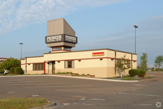
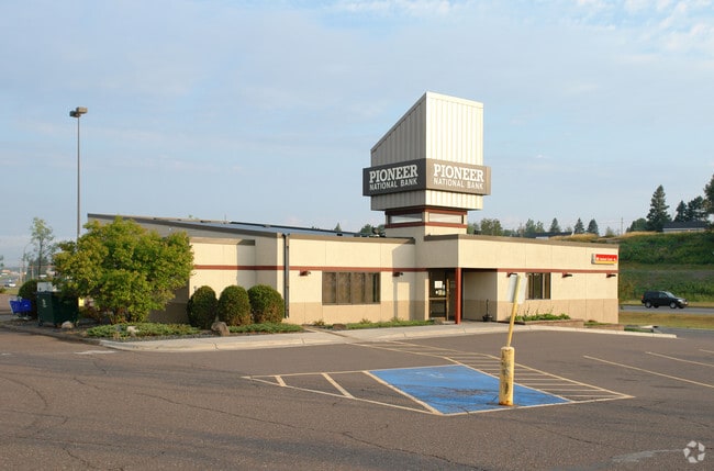
Property Record
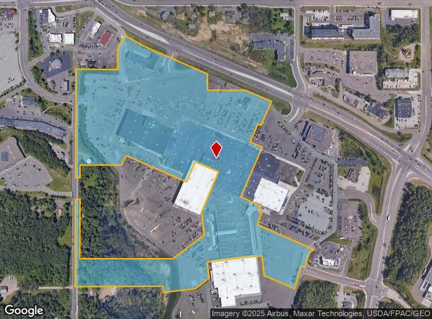
1600 Miller Trunk Hwy, Duluth, MN 55811
NEARBY LISTINGS FOR SALE OR LEASE
Property Detail
1600 Miller Trunk Hwy
010392700020
TRACT B SERIAL #
Commercialnec
St Louis
AE
Minnesota
27137C3766E
38.23 AC
2024
Miller Hill/Airpark
2024
Duluth
000301
Duluth, MN-WI
524,275 SF
DEMOGRAPHICS near 1600 Miller Trunk Hwy
1 Mile
3 Mile
5 Mile
2024 Total Population
3,084
30,213
72,746
2029 Population
3,033
29,840
71,780
Pop Growth 2024-2029
(1.65%)
(1.23%)
(1.33%)
Average Age
46
40
38
2024 Total Households
1,429
12,944
30,622
HH Growth 2024-2029
(1.75%)
(1.42%)
(1.40%)
Median Household Inc
$60,484
$58,348
$58,315
Avg Household Size
2.00
2.10
2.10
2024 Avg HH Vehicles
2.00
2.00
2.00
Median Home Value
$237,859
$231,424
$225,610
Median Year Built
1979
1968
1955
Nearby Places
Map Layers
Map Styles
 Street
 Aerial
- Restaurants
- Banks
- Shops
- Fitness
- Groceries
PUBLIC TRANSPORTATION
AIRPORT
Duluth International
DRIVE
WALK
Distance
Duluth International
14 min
5.0 mi
Freight Ports
Port Milwaukee
DRIVE
WALK
Distance
Port Milwaukee
457 min
401.3 mi
Nearby Properties
Address
Land Use
TOTAL SIZE
Lot Size
Zoning
Address
Land Use
TOTAL SIZE
Lot Size
Zoning
391,335 SF
53.53 AC
Address
Land Use
TOTAL SIZE
Lot Size
Zoning
195,455 SF
54.06 AC
Address
Land Use
TOTAL SIZE
Lot Size
Zoning
143,132 SF
41.55 AC
Address
Land Use
TOTAL SIZE
Lot Size
Zoning
6,500 SF
3.31 AC
R3
Address
Land Use
TOTAL SIZE
Lot Size
Zoning
32,824 SF
117.72 AC
Address
Land Use
TOTAL SIZE
Lot Size
Zoning
97,552 SF
1.29 AC
Address
Land Use
TOTAL SIZE
Lot Size
Zoning
178,184 SF
20 AC
Address
Land Use
TOTAL SIZE
Lot Size
Zoning
20,388 SF
20 AC
Address
Land Use
TOTAL SIZE
Lot Size
Zoning
100,246 SF
12.24 AC
Address
Land Use
TOTAL SIZE
Lot Size
Zoning
126,349 SF
8.35 AC
Address
Land Use
TOTAL SIZE
Lot Size
Zoning
82,119 SF
5.21 AC
Address
Land Use
TOTAL SIZE
Lot Size
Zoning
113,615 SF
0.32 AC
R4
Address
Land Use
TOTAL SIZE
Lot Size
Zoning
118,418 SF
13.62 AC
Address
Land Use
TOTAL SIZE
Lot Size
Zoning
7,300 SF
19.85 AC
Address
Land Use
TOTAL SIZE
Lot Size
Zoning
113,448 SF
10 AC
Address
Land Use
TOTAL SIZE
Lot Size
Zoning
62,634 SF
4.32 AC
Address
Land Use
TOTAL SIZE
Lot Size
Zoning
97,157 SF
1.61 AC
Address
Land Use
TOTAL SIZE
Lot Size
Zoning
144,408 SF
1.29 AC
Address
Land Use
TOTAL SIZE
Lot Size
Zoning
72,980 SF
2.85 AC
R1B
Address
Land Use
TOTAL SIZE
Lot Size
Zoning
141,049 SF
0.50 AC
Address
Land Use
TOTAL SIZE
Lot Size
Zoning
109,021 SF
10.01 AC
Address
Land Use
TOTAL SIZE
Lot Size
Zoning
98,994 SF
185.96 AC
Address
Land Use
TOTAL SIZE
Lot Size
Zoning
158,240 SF
0.13 AC
Address
Land Use
TOTAL SIZE
Lot Size
Zoning
183,097 SF
27.58 AC
Address
Land Use
TOTAL SIZE
Lot Size
Zoning
174,964 SF
41.97 AC
Address
Land Use
TOTAL SIZE
Lot Size
Zoning
81,316 SF
1.89 AC
Address
Land Use
TOTAL SIZE
Lot Size
Zoning
176,840 SF
27.50 AC
Address
Land Use
TOTAL SIZE
Lot Size
Zoning
161,568 SF
20.87 AC
Address
Land Use
TOTAL SIZE
Lot Size
Zoning
125,495 SF
1.03 AC
C4
The World's #1 Commercial Real Estate Marketplace
Connect with us
© 2026 CoStar Group
The information above has been obtained from sources believed reliable. While we do not doubt its accuracy we have not verified it and make no guarantee, warranty or representation about it. It is your responsibility to independently confirm its accuracy and completeness. Any projections, opinions, assumptions, or estimates used are for example only and do not represent the current or future performance of the property. The value of this transaction to you depends on tax and other factors which should be evaluated by your tax, financial, and legal advisors. You and your advisors should conduct a careful, independent investigation of the property to determine to your satisfaction the suitability of the property for your needs.