Property Record
1600 N 32Nd St, Muskogee, OK 74401
NEARBY LISTINGS FOR SALE OR LEASE
Property Detail
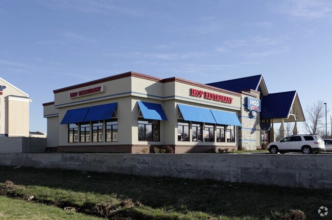
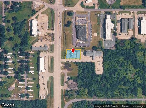
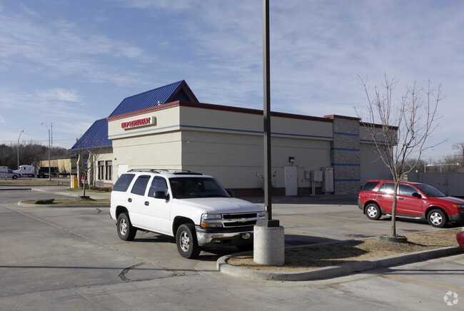
1600 N 32Nd St
Muskogee, OK
Home Acres 2Nd
10512
HOME ACRES 2ND TRACT IN LOTS 29 & 30 BEG ON THE EASTERLY ROW HWY 69 ON NORTH LINE LOT 30 E191.62 S122.98 W201.37 N02?4240E 12
Restaurantbuilding
Muskogee
X
Oklahoma
40145C0475H
29,30
2025
0.55 AC
2025
Muskogee County
000200
Tulsa
5,139 SF
DEMOGRAPHICS near 1600 N 32Nd St
1 Mile
3 Mile
5 Mile
2024 Total Population
4,013
18,519
40,072
2029 Population
4,070
18,864
40,486
Pop Growth 2024-2029
+ 1.42%
+ 1.86%
+ 1.03%
Average Age
39
38
39
2024 Total Households
1,669
7,527
16,277
HH Growth 2024-2029
+ 1.32%
+ 1.85%
+ 1.00%
Median Household Inc
$36,214
$35,492
$41,455
Avg Household Size
2.20
2.30
2.30
2024 Avg HH Vehicles
2.00
2.00
2.00
Median Home Value
$93,533
$80,177
$101,666
Median Year Built
1963
1964
1971
Nearby Places
Map Layers
Map Styles
 Street
 Aerial
- Restaurants
- Banks
- Shops
- Fitness
- Groceries
Nearby Properties
Address
Land Use
TOTAL SIZE
Lot Size
Zoning
Address
Land Use
TOTAL SIZE
Lot Size
Zoning
49,127 SF
17.48 AC
Address
Land Use
TOTAL SIZE
Lot Size
Zoning
1,760 SF
21.64 AC
Address
Land Use
TOTAL SIZE
Lot Size
Zoning
35,682 SF
1.75 AC
F
Address
Land Use
TOTAL SIZE
Lot Size
Zoning
59,306 SF
0.74 AC
MI
Address
Land Use
TOTAL SIZE
Lot Size
Zoning
69,776 SF
20.13 AC
Address
Land Use
TOTAL SIZE
Lot Size
Zoning
52,964 SF
4.86 AC
MI
Address
Land Use
TOTAL SIZE
Lot Size
Zoning
43,002 SF
1.09 AC
MI
Address
Land Use
TOTAL SIZE
Lot Size
Zoning
19,548 SF
3.77 AC
B
Address
Land Use
TOTAL SIZE
Lot Size
Zoning
20,962 SF
1.51 AC
MI
Address
Land Use
TOTAL SIZE
Lot Size
Zoning
8,796 SF
17.35 AC
Address
Land Use
TOTAL SIZE
Lot Size
Zoning
14,488 SF
0.11 AC
E1
Address
Land Use
TOTAL SIZE
Lot Size
Zoning
43,440 SF
2.79 AC
E1
Address
Land Use
TOTAL SIZE
Lot Size
Zoning
17,000 SF
30.60 AC
Address
Land Use
TOTAL SIZE
Lot Size
Zoning
51,616 SF
2.98 AC
PP
Address
Land Use
TOTAL SIZE
Lot Size
Zoning
6,000 SF
1.39 AC
Address
Land Use
TOTAL SIZE
Lot Size
Zoning
30,594 SF
0.85 AC
E1
Address
Land Use
TOTAL SIZE
Lot Size
Zoning
11,200 SF
8.72 AC
Address
Land Use
TOTAL SIZE
Lot Size
Zoning
12,552 SF
0.88 AC
B
Address
Land Use
TOTAL SIZE
Lot Size
Zoning
4,752 SF
2.58 AC
B
Address
Land Use
TOTAL SIZE
Lot Size
Zoning
2,080 SF
0.46 AC
MI
Address
Land Use
TOTAL SIZE
Lot Size
Zoning
20.13 AC
A
Address
Land Use
TOTAL SIZE
Lot Size
Zoning
1,500 SF
10 AC
Address
Land Use
TOTAL SIZE
Lot Size
Zoning
34,070 SF
2.33 AC
PP
Address
Land Use
TOTAL SIZE
Lot Size
Zoning
90,709 SF
11.61 AC
Address
Land Use
TOTAL SIZE
Lot Size
Zoning
576 SF
10.80 AC
Address
Land Use
TOTAL SIZE
Lot Size
Zoning
212,283 SF
26.18 AC
Address
Land Use
TOTAL SIZE
Lot Size
Zoning
48,656 SF
4 AC
Address
Land Use
TOTAL SIZE
Lot Size
Zoning
18,510 SF
1.04 AC
MI
Address
Land Use
TOTAL SIZE
Lot Size
Zoning
25,820 SF
14.63 AC
A
The World's #1 Commercial Real Estate Marketplace
Connect with us
© 2025 CoStar Group
The information above has been obtained from sources believed reliable. While we do not doubt its accuracy we have not verified it and make no guarantee, warranty or representation about it. It is your responsibility to independently confirm its accuracy and completeness. Any projections, opinions, assumptions, or estimates used are for example only and do not represent the current or future performance of the property. The value of this transaction to you depends on tax and other factors which should be evaluated by your tax, financial, and legal advisors. You and your advisors should conduct a careful, independent investigation of the property to determine to your satisfaction the suitability of the property for your needs.