Property Record
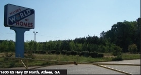
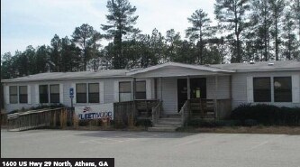
1600 N Highway 29 Hwy N, Athens, GA 30601
NEARBY LISTINGS FOR SALE OR LEASE
Property Detail
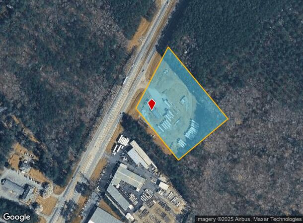
1600 N Highway 29 Hwy N
Athens-Clarke County, GA
Com-St-040->03-06
212-003-Q
DEEDED ACS: 5.000
Commercialacreage
Clarke
X
Georgia
13195C0225D
5 AC
2025
East Athens
2025
Other Market Areas
030102
DEMOGRAPHICS near 1600 N Highway 29 Hwy N
1 Mile
3 Mile
5 Mile
2024 Total Population
2,600
11,569
36,079
2029 Population
2,669
12,247
37,392
Pop Growth 2024-2029
+ 2.65%
+ 5.86%
+ 3.64%
Average Age
38
38
36
2024 Total Households
955
4,156
13,832
HH Growth 2024-2029
+ 2.83%
+ 5.85%
+ 3.31%
Median Household Inc
$57,249
$49,316
$45,213
Avg Household Size
2.70
2.70
2.50
2024 Avg HH Vehicles
2.00
2.00
2.00
Median Home Value
$91,470
$143,057
$168,739
Median Year Built
1988
1991
1990
Nearby Places
Map Layers
Map Styles
 Street
 Aerial
- Restaurants
- Banks
- Shops
- Fitness
- Groceries
Nearby Properties
Address
Land Use
TOTAL SIZE
Lot Size
Zoning
Address
Land Use
TOTAL SIZE
Lot Size
Zoning
1,403 SF
21.64 AC
C-G
Address
Land Use
TOTAL SIZE
Lot Size
Zoning
3.16 AC
E-I
Address
Land Use
TOTAL SIZE
Lot Size
Zoning
2,856 SF
39.78 AC
C-G
Address
Land Use
TOTAL SIZE
Lot Size
Zoning
124,959 SF
20.54 AC
E-I
Address
Land Use
TOTAL SIZE
Lot Size
Zoning
2,880 SF
36.84 AC
RM-1
Address
Land Use
TOTAL SIZE
Lot Size
Zoning
140,375 SF
26.15 AC
E-I
Address
Land Use
TOTAL SIZE
Lot Size
Zoning
46.26 AC
G
Address
Land Use
TOTAL SIZE
Lot Size
Zoning
Address
Land Use
TOTAL SIZE
Lot Size
Zoning
4,392 SF
11.79 AC
C-G
Address
Land Use
TOTAL SIZE
Lot Size
Zoning
26,100 SF
18.59 AC
C-G
Address
Land Use
TOTAL SIZE
Lot Size
Zoning
71,472 SF
43.36 AC
E-I
Address
Land Use
TOTAL SIZE
Lot Size
Zoning
262,387 SF
16.45 AC
E-I
Address
Land Use
TOTAL SIZE
Lot Size
Zoning
47,928 SF
80.47 AC
E-I
Address
Land Use
TOTAL SIZE
Lot Size
Zoning
124,136 SF
19.82 AC
C-G (PD)
Address
Land Use
TOTAL SIZE
Lot Size
Zoning
18.38 AC
G
Address
Land Use
TOTAL SIZE
Lot Size
Zoning
258,200 SF
16.49 AC
E-I
Address
Land Use
TOTAL SIZE
Lot Size
Zoning
16.63 AC
G
Address
Land Use
TOTAL SIZE
Lot Size
Zoning
327,319 SF
24.46 AC
E-I
Address
Land Use
TOTAL SIZE
Lot Size
Zoning
8,664 SF
103.89 AC
E-I
Address
Land Use
TOTAL SIZE
Lot Size
Zoning
222,180 SF
17.08 AC
E-I
Address
Land Use
TOTAL SIZE
Lot Size
Zoning
16.17 AC
G
Address
Land Use
TOTAL SIZE
Lot Size
Zoning
13,320 SF
60.89 AC
C-G
Address
Land Use
TOTAL SIZE
Lot Size
Zoning
197,738 SF
60.92 AC
E-I
Address
Land Use
TOTAL SIZE
Lot Size
Zoning
69,310 SF
18.55 AC
E-I
Address
Land Use
TOTAL SIZE
Lot Size
Zoning
139,916 SF
21.30 AC
E-I
Address
Land Use
TOTAL SIZE
Lot Size
Zoning
39,384 SF
3.47 AC
G
Address
Land Use
TOTAL SIZE
Lot Size
Zoning
11,994 SF
3.87 AC
C-G (PD)
Address
Land Use
TOTAL SIZE
Lot Size
Zoning
30,646 SF
17.46 AC
E-I
Address
Land Use
TOTAL SIZE
Lot Size
Zoning
197,108 SF
20 AC
E-I
Address
Land Use
TOTAL SIZE
Lot Size
Zoning
120,000 SF
8.92 AC
E-I
The World's #1 Commercial Real Estate Marketplace
Connect with us
© 2025 CoStar Group
The information above has been obtained from sources believed reliable. While we do not doubt its accuracy we have not verified it and make no guarantee, warranty or representation about it. It is your responsibility to independently confirm its accuracy and completeness. Any projections, opinions, assumptions, or estimates used are for example only and do not represent the current or future performance of the property. The value of this transaction to you depends on tax and other factors which should be evaluated by your tax, financial, and legal advisors. You and your advisors should conduct a careful, independent investigation of the property to determine to your satisfaction the suitability of the property for your needs.