Property Record
1600 N Kingshighway Memorial Blvd, Saint Louis, MO 63113


NEARBY LISTINGS FOR SALE OR LEASE
Property Detail
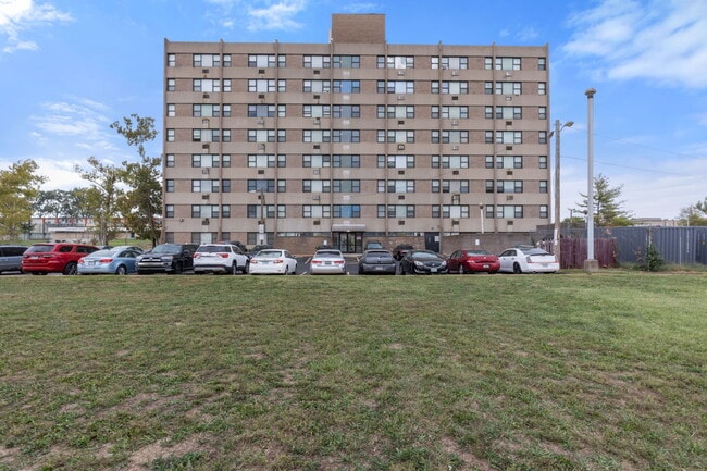
1600 N Kingshighway Memorial Blvd
St. Louis, MO-IL
Cote Brilliante Addn
4489-06-0200-0
C. B. 4489S ALDINE PLACE 0.767 ACS COTE BRILLIANTE ADDN LOT PT 28 BND W KINGSHIGHWAY
Multifamilydwelling
St. Louis City
X
Missouri
29189C0217K
28
2024
0.77 AC
2025
Kingsway
111300
St. Louis
116,064 SF
DEMOGRAPHICS near 1600 N Kingshighway Memorial Blvd
1 Mile
3 Mile
5 Mile
2024 Total Population
18,495
137,037
320,603
2029 Population
18,492
134,805
311,634
Pop Growth 2024-2029
(0.02%)
(1.63%)
(2.80%)
Average Age
41
39
39
2024 Total Households
7,954
60,636
148,484
HH Growth 2024-2029
+ 0.08%
(1.94%)
(3.06%)
Median Household Inc
$37,720
$38,379
$49,554
Avg Household Size
2.20
2.00
2.00
2024 Avg HH Vehicles
1.00
1.00
1.00
Median Home Value
$86,140
$99,667
$176,648
Median Year Built
1946
1948
1948
Nearby Places
Map Layers
Map Styles
 Street
 Aerial
- Restaurants
- Banks
- Shops
- Fitness
- Groceries
PUBLIC TRANSPORTATION
COMMUTER RAIL
Central West End (Lambert Airport Shiloh-Scott - St. Louis MetroLink (MetroLink), Shrewsbury-Lansdowne I-44 Emerson Park - St. Louis MetroLink (MetroLink))
DRIVE
WALK
Distance
Central West End (Lambert Airport Shiloh-Scott - St. Louis MetroLink (MetroLink), Shrewsbury-Lansdowne I-44 Emerson Park - St. Louis MetroLink (MetroLink))
7 min
2.4 mi
Delmar Loop (Lambert Airport Shiloh-Scott - St. Louis MetroLink (MetroLink))
DRIVE
WALK
Distance
Delmar Loop (Lambert Airport Shiloh-Scott - St. Louis MetroLink (MetroLink))
6 min
2.7 mi
AIRPORT
St Louis Lambert International
DRIVE
WALK
Distance
St Louis Lambert International
17 min
9.5 mi
Scott AFB/Midamerica St Louis
DRIVE
WALK
Distance
Scott AFB/Midamerica St Louis
48 min
30.7 mi
SALE & LEASE HISTORY
LISTING DATE
SALE/LEASE

Sep 10, 2020
For Sale
Dec 30, 2024
For Sale
Dec 19, 2024
For Sale
Nearby Properties
Address
Land Use
TOTAL SIZE
Lot Size
Zoning
Address
Land Use
TOTAL SIZE
Lot Size
Zoning
684,846 SF
90.65 AC
R6
Address
Land Use
TOTAL SIZE
Lot Size
Zoning
Address
Land Use
TOTAL SIZE
Lot Size
Zoning
136.92 AC
AI
Address
Land Use
TOTAL SIZE
Lot Size
Zoning
124.96 AC
J
Address
Land Use
TOTAL SIZE
Lot Size
Zoning
152.07 AC
L
Address
Land Use
TOTAL SIZE
Lot Size
Zoning
1,361,485 SF
5.45 AC
E
Address
Land Use
TOTAL SIZE
Lot Size
Zoning
390,010 SF
13.25 AC
R6
Address
Land Use
TOTAL SIZE
Lot Size
Zoning
624,049 SF
20.78 AC
K
Address
Land Use
TOTAL SIZE
Lot Size
Zoning
7.94 AC
D
Address
Land Use
TOTAL SIZE
Lot Size
Zoning
246,345 SF
4.17 AC
J
Address
Land Use
TOTAL SIZE
Lot Size
Zoning
Address
Land Use
TOTAL SIZE
Lot Size
Zoning
6.05 AC
J
Address
Land Use
TOTAL SIZE
Lot Size
Zoning
423,303 SF
9.97 AC
H
Address
Land Use
TOTAL SIZE
Lot Size
Zoning
306,459 SF
4.79 AC
H
Address
Land Use
TOTAL SIZE
Lot Size
Zoning
225,920 SF
2.02 AC
H
Address
Land Use
TOTAL SIZE
Lot Size
Zoning
15.27 AC
A
Address
Land Use
TOTAL SIZE
Lot Size
Zoning
358,243 SF
3.02 AC
H
Address
Land Use
TOTAL SIZE
Lot Size
Zoning
248,809 SF
3.23 AC
H
Address
Land Use
TOTAL SIZE
Lot Size
Zoning
189,841 SF
4.18 AC
K
Address
Land Use
TOTAL SIZE
Lot Size
Zoning
309,734 SF
3.41 AC
E
Address
Land Use
TOTAL SIZE
Lot Size
Zoning
8.54 AC
H
Address
Land Use
TOTAL SIZE
Lot Size
Zoning
191,584 SF
1.76 AC
K
Address
Land Use
TOTAL SIZE
Lot Size
Zoning
191,352 SF
4.41 AC
K
Address
Land Use
TOTAL SIZE
Lot Size
Zoning
112,656 SF
3.55 AC
HK
Address
Land Use
TOTAL SIZE
Lot Size
Zoning
98,308 SF
97.62 AC
H
Address
Land Use
TOTAL SIZE
Lot Size
Zoning
256,400 SF
3.67 AC
H
Address
Land Use
TOTAL SIZE
Lot Size
Zoning
177,974 SF
2.29 AC
J
Address
Land Use
TOTAL SIZE
Lot Size
Zoning
184,183 SF
1.96 AC
J
Address
Land Use
TOTAL SIZE
Lot Size
Zoning
269,300 SF
4.92 AC
H
Address
Land Use
TOTAL SIZE
Lot Size
Zoning
101,200 SF
1.10 AC
E
The World's #1 Commercial Real Estate Marketplace
Connect with us
© 2026 CoStar Group
The information above has been obtained from sources believed reliable. While we do not doubt its accuracy we have not verified it and make no guarantee, warranty or representation about it. It is your responsibility to independently confirm its accuracy and completeness. Any projections, opinions, assumptions, or estimates used are for example only and do not represent the current or future performance of the property. The value of this transaction to you depends on tax and other factors which should be evaluated by your tax, financial, and legal advisors. You and your advisors should conduct a careful, independent investigation of the property to determine to your satisfaction the suitability of the property for your needs.