Property Record
1600 Smith Rd, Austin, TX 78721


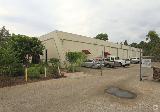
Property Detail
1600 Smith Rd
Austin-Round Rock-San Marcos, TX
LOTS 9-10 CAPITOL BUSINESS PARK
190299
Travis
Industrialgeneral
Texas
AE The base floodplain where base flood elevations are provided. AE Zones are now used on new format FIRMs instead of A1-A30 Zones.
9-10
0
2.50 AC
2025
East
002111
Austin
26,640 SF
NEARBY LISTINGS FOR SALE OR LEASE
DEMOGRAPHICS near 1600 Smith Rd
1 mile
3 mile
5 mile
2024 Total Population
6,152
87,143
280,933
2029 Population
6,713
92,742
297,456
Pop Growth 2024-2029
+ 9.12%
+ 6.43%
+ 5.88%
Average Age
37
36
35
2024 Total Households
2,422
36,176
122,952
HH Growth 2024-2029
+ 9.87%
+ 7.23%
+ 6.68%
Median Household Inc
$122,747
$89,120
$82,406
Avg Household Size
2.50
2.30
2.10
2024 Avg HH Vehicles
2.00
2.00
2.00
Median Home Value
$613,467
$622,358
$633,351
Median Year Built
2010
2005
2000
Nearby Places
Map Layers
Map Styles
 Street
 Aerial
Transit
 Traffic
 Biking
Places
Listings with unknown addresses are not visible on the map
- Restaurants
- Banks
- Shops
- Fitness
- Groceries
PUBLIC TRANSPORTATION
COMMUTER RAIL
Austin (Texas Eagle - Amtrak)
Drive
Walk
Distance
Austin (Texas Eagle - Amtrak)
12 min
5.9 mi
AIRPORT
Austin-Bergstrom International
Drive
Walk
Distance
Austin-Bergstrom International
18 min
9.1 mi
Freight Ports
Calhoun Port
Drive
Walk
Distance
Calhoun Port
183 min
152.6 mi
Nearby Properties
Address
Land Use
TOTAL SIZE
Lot Size
Zoning
Address
Land Use
TOTAL SIZE
Lot Size
Zoning
9,768 SF
386.80 AC
Address
Land Use
TOTAL SIZE
Lot Size
Zoning
999,200 SF
25 AC
Address
Land Use
TOTAL SIZE
Lot Size
Zoning
832,892 SF
30.12 AC
Address
Land Use
TOTAL SIZE
Lot Size
Zoning
91,836 SF
19.80 AC
Address
Land Use
TOTAL SIZE
Lot Size
Zoning
19,284 SF
178.26 AC
Address
Land Use
TOTAL SIZE
Lot Size
Zoning
17.37 AC
Address
Land Use
TOTAL SIZE
Lot Size
Zoning
307,610 SF
8.95 AC
Address
Land Use
TOTAL SIZE
Lot Size
Zoning
387,267 SF
3.25 AC
Address
Land Use
TOTAL SIZE
Lot Size
Zoning
300,883 SF
3.47 AC
Address
Land Use
TOTAL SIZE
Lot Size
Zoning
91,639 SF
35.97 AC
Address
Land Use
TOTAL SIZE
Lot Size
Zoning
558,324 SF
45.12 AC
Address
Land Use
TOTAL SIZE
Lot Size
Zoning
4,944 SF
25.09 AC
Address
Land Use
TOTAL SIZE
Lot Size
Zoning
283,800 SF
4.05 AC
Address
Land Use
TOTAL SIZE
Lot Size
Zoning
288,750 SF
4.81 AC
Address
Land Use
TOTAL SIZE
Lot Size
Zoning
190,546 SF
5.85 AC
Address
Land Use
TOTAL SIZE
Lot Size
Zoning
301,125 SF
5.23 AC
Address
Land Use
TOTAL SIZE
Lot Size
Zoning
31,357 SF
37.73 AC
Address
Land Use
TOTAL SIZE
Lot Size
Zoning
126.15 AC
Address
Land Use
TOTAL SIZE
Lot Size
Zoning
255,790 SF
4.34 AC
Address
Land Use
TOTAL SIZE
Lot Size
Zoning
302,967 SF
8.31 AC
Address
Land Use
TOTAL SIZE
Lot Size
Zoning
236,503 SF
6.86 AC
Address
Land Use
TOTAL SIZE
Lot Size
Zoning
19.76 AC
Address
Land Use
TOTAL SIZE
Lot Size
Zoning
272,084 SF
3.87 AC
Address
Land Use
TOTAL SIZE
Lot Size
Zoning
300,300 SF
3.72 AC
Address
Land Use
TOTAL SIZE
Lot Size
Zoning
304,015 SF
1.74 AC
Address
Land Use
TOTAL SIZE
Lot Size
Zoning
250,800 SF
12.41 AC
Address
Land Use
TOTAL SIZE
Lot Size
Zoning
17.89 AC
Address
Land Use
TOTAL SIZE
Lot Size
Zoning
84,920 SF
74.13 AC
Address
Land Use
TOTAL SIZE
Lot Size
Zoning
215,109 SF
4.09 AC
Address
Land Use
TOTAL SIZE
Lot Size
Zoning
306,658 SF
9.49 AC
The World's #1 Commercial Real Estate Marketplace
Connect with us
© 2026 CoStar Group
The information above has been obtained from sources believed reliable. While we do not doubt its accuracy we have not verified it and make no guarantee, warranty or representation about it. It is your responsibility to independently confirm its accuracy and completeness. Any projections, opinions, assumptions, or estimates used are for example only and do not represent the current or future performance of the property. The value of this transaction to you depends on tax and other factors which should be evaluated by your tax, financial, and legal advisors. You and your advisors should conduct a careful, independent investigation of the property to determine to your satisfaction the suitability of the property for your needs.