Property Record
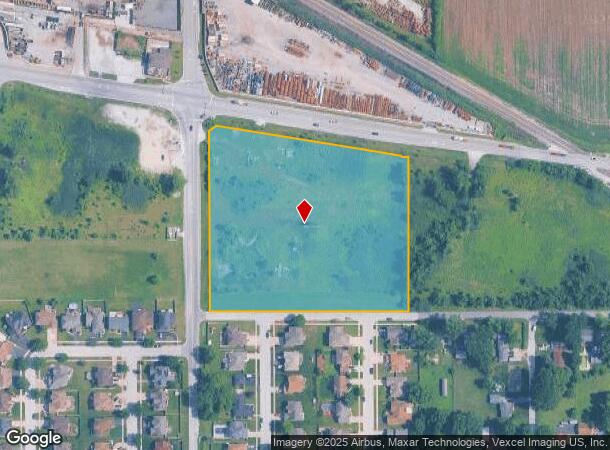
1600 Thornton Lansing Rd, Lansing, IL 60438
NEARBY LISTINGS FOR SALE OR LEASE
Property Detail
1600 Thornton Lansing Rd
29-36-100-009-0000
Thornton
Taxexempt
Cook
X
Illinois
17031C0754J
7.60 AC
2021
Near South Cook
2024
Chicago
828201
Chicago-Naperville-Elgin, IL-IN-WI
DEMOGRAPHICS near 1600 Thornton Lansing Rd
1 Mile
3 Mile
5 Mile
2024 Total Population
5,633
72,004
235,507
2029 Population
5,496
70,064
231,298
Pop Growth 2024-2029
(2.43%)
(2.69%)
(1.79%)
Average Age
41
42
40
2024 Total Households
2,154
27,633
87,944
HH Growth 2024-2029
(2.74%)
(3.03%)
(2.07%)
Median Household Inc
$67,409
$65,091
$59,463
Avg Household Size
2.50
2.50
2.60
2024 Avg HH Vehicles
2.00
2.00
2.00
Median Home Value
$182,117
$155,879
$151,687
Median Year Built
1973
1967
1964
Nearby Places
Map Layers
Map Styles
 Street
 Aerial
- Restaurants
- Banks
- Shops
- Fitness
- Groceries
PUBLIC TRANSPORTATION
COMMUTER RAIL
Harvey Station (Metra Electric Line - Northeast Illinois Regional Commuter Railroad (Metra))
DRIVE
WALK
Distance
Harvey Station (Metra Electric Line - Northeast Illinois Regional Commuter Railroad (Metra))
15 min
6.2 mi
Hazel Crest Station (Metra Electric Line - Northeast Illinois Regional Commuter Railroad (Metra))
DRIVE
WALK
Distance
Hazel Crest Station (Metra Electric Line - Northeast Illinois Regional Commuter Railroad (Metra))
14 min
7.6 mi
AIRPORT
Chicago Midway International
DRIVE
WALK
Distance
Chicago Midway International
38 min
24.8 mi
Freight Ports
Port Milwaukee
DRIVE
WALK
Distance
Port Milwaukee
142 min
111.4 mi
Nearby Properties
Address
Land Use
TOTAL SIZE
Lot Size
Zoning
Address
Land Use
TOTAL SIZE
Lot Size
Zoning
24.56 AC
Address
Land Use
TOTAL SIZE
Lot Size
Zoning
5.01 AC
Address
Land Use
TOTAL SIZE
Lot Size
Zoning
Address
Land Use
TOTAL SIZE
Lot Size
Zoning
119,082 SF
11.26 AC
Address
Land Use
TOTAL SIZE
Lot Size
Zoning
30,895 SF
3 AC
R33
Address
Land Use
TOTAL SIZE
Lot Size
Zoning
56,458 SF
2.17 AC
Address
Land Use
TOTAL SIZE
Lot Size
Zoning
231,296 SF
10.91 AC
Address
Land Use
TOTAL SIZE
Lot Size
Zoning
7.31 AC
Address
Land Use
TOTAL SIZE
Lot Size
Zoning
454,999 SF
27.43 AC
Address
Land Use
TOTAL SIZE
Lot Size
Zoning
Address
Land Use
TOTAL SIZE
Lot Size
Zoning
44,274 SF
3 AC
Address
Land Use
TOTAL SIZE
Lot Size
Zoning
450,777 SF
25.25 AC
Address
Land Use
TOTAL SIZE
Lot Size
Zoning
60,864 SF
5.55 AC
Address
Land Use
TOTAL SIZE
Lot Size
Zoning
398,668 SF
13.92 AC
Address
Land Use
TOTAL SIZE
Lot Size
Zoning
28,228 SF
4.63 AC
Address
Land Use
TOTAL SIZE
Lot Size
Zoning
69,894 SF
7.60 AC
Address
Land Use
TOTAL SIZE
Lot Size
Zoning
Address
Land Use
TOTAL SIZE
Lot Size
Zoning
125,535 SF
9.44 AC
Address
Land Use
TOTAL SIZE
Lot Size
Zoning
38,668 SF
0.01 AC
Address
Land Use
TOTAL SIZE
Lot Size
Zoning
89,853 SF
2.68 AC
Address
Land Use
TOTAL SIZE
Lot Size
Zoning
159,145 SF
15.36 AC
Address
Land Use
TOTAL SIZE
Lot Size
Zoning
142,376 SF
24 AC
Address
Land Use
TOTAL SIZE
Lot Size
Zoning
86,780 SF
6.03 AC
Address
Land Use
TOTAL SIZE
Lot Size
Zoning
Address
Land Use
TOTAL SIZE
Lot Size
Zoning
115,250 SF
10.75 AC
Address
Land Use
TOTAL SIZE
Lot Size
Zoning
100,000 SF
18.10 AC
Address
Land Use
TOTAL SIZE
Lot Size
Zoning
233,490 SF
10.19 AC
Address
Land Use
TOTAL SIZE
Lot Size
Zoning
Address
Land Use
TOTAL SIZE
Lot Size
Zoning
51,919 SF
2.90 AC
Address
Land Use
TOTAL SIZE
Lot Size
Zoning
3,500 SF
41.36 AC
The World's #1 Commercial Real Estate Marketplace
Connect with us
© 2025 CoStar Group
The information above has been obtained from sources believed reliable. While we do not doubt its accuracy we have not verified it and make no guarantee, warranty or representation about it. It is your responsibility to independently confirm its accuracy and completeness. Any projections, opinions, assumptions, or estimates used are for example only and do not represent the current or future performance of the property. The value of this transaction to you depends on tax and other factors which should be evaluated by your tax, financial, and legal advisors. You and your advisors should conduct a careful, independent investigation of the property to determine to your satisfaction the suitability of the property for your needs.