Property Record
1600 Woodland Dr, Saline, MI 48176


NEARBY LISTINGS FOR SALE OR LEASE
Property Detail
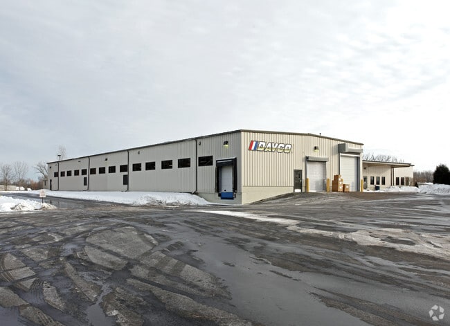
1600 Woodland Dr
Ann Arbor, MI
Edward F Redies Indust Park
12-30-430-024
SC 39-1B (001&002) COM AT CENTER SEC 30, TH S 88-59-43 E 783.51 FT TO POB, TH S 88-59-43 E 653.15 FT, TH S 0-30-57 W 385.51
Industrialgeneral
Washtenaw
X
Michigan
26161C0384E
1-2
2025
5.94 AC
2025
Washtenaw W of 23
423400
Detroit
57,132 SF
DEMOGRAPHICS near 1600 Woodland Dr
1 Mile
3 Mile
5 Mile
2024 Total Population
2,299
23,572
68,086
2029 Population
2,264
23,331
67,533
Pop Growth 2024-2029
(1.52%)
(1.02%)
(0.81%)
Average Age
42
43
41
2024 Total Households
776
9,167
28,116
HH Growth 2024-2029
(1.80%)
(1.10%)
(0.98%)
Median Household Inc
$144,715
$115,346
$95,407
Avg Household Size
2.90
2.50
2.30
2024 Avg HH Vehicles
2.00
2.00
2.00
Median Home Value
$439,867
$418,978
$382,877
Median Year Built
1995
1990
1986
Nearby Places
Map Layers
Map Styles
 Street
 Aerial
- Restaurants
- Banks
- Shops
- Fitness
- Groceries
PUBLIC TRANSPORTATION
COMMUTER RAIL
Ann Arbor Amtrak Station (Wolverine - Amtrak)
DRIVE
WALK
Distance
Ann Arbor Amtrak Station (Wolverine - Amtrak)
17 min
8.3 mi
AIRPORT
Detroit Metro Wayne County
DRIVE
WALK
Distance
Detroit Metro Wayne County
37 min
27.0 mi
Freight Ports
Port of Toledo
DRIVE
WALK
Distance
Port of Toledo
75 min
55.1 mi
Nearby Properties
Address
Land Use
TOTAL SIZE
Lot Size
Zoning
Address
Land Use
TOTAL SIZE
Lot Size
Zoning
140,039 SF
Address
Land Use
TOTAL SIZE
Lot Size
Zoning
253,702 SF
30.23 AC
Address
Land Use
TOTAL SIZE
Lot Size
Zoning
167,294 SF
40.67 AC
Address
Land Use
TOTAL SIZE
Lot Size
Zoning
105,615 SF
26.31 AC
Address
Land Use
TOTAL SIZE
Lot Size
Zoning
283,484 SF
22.64 AC
R-3
Address
Land Use
TOTAL SIZE
Lot Size
Zoning
1,562,480 SF
189.08 AC
I-4
Address
Land Use
TOTAL SIZE
Lot Size
Zoning
191,215 SF
30.23 AC
Address
Land Use
TOTAL SIZE
Lot Size
Zoning
100,136 SF
3.47 AC
C2B
Address
Land Use
TOTAL SIZE
Lot Size
Zoning
99,663 SF
6.89 AC
R-1A
Address
Land Use
TOTAL SIZE
Lot Size
Zoning
19,236 SF
13.13 AC
BI
Address
Land Use
TOTAL SIZE
Lot Size
Zoning
24,000 SF
21.97 AC
Address
Land Use
TOTAL SIZE
Lot Size
Zoning
154,987 SF
17.08 AC
II
Address
Land Use
TOTAL SIZE
Lot Size
Zoning
88,657 SF
14.98 AC
Address
Land Use
TOTAL SIZE
Lot Size
Zoning
255,838 SF
31.64 AC
II
Address
Land Use
TOTAL SIZE
Lot Size
Zoning
99,000 SF
12.22 AC
I-2
Address
Land Use
TOTAL SIZE
Lot Size
Zoning
76,204 SF
12.41 AC
Address
Land Use
TOTAL SIZE
Lot Size
Zoning
60,362 SF
7.69 AC
Address
Land Use
TOTAL SIZE
Lot Size
Zoning
140,284 SF
6.83 AC
I-2
Address
Land Use
TOTAL SIZE
Lot Size
Zoning
54,607 SF
14.17 AC
Address
Land Use
TOTAL SIZE
Lot Size
Zoning
84,415 SF
9.96 AC
II
Address
Land Use
TOTAL SIZE
Lot Size
Zoning
68,866 SF
24.96 AC
II
Address
Land Use
TOTAL SIZE
Lot Size
Zoning
65,899 SF
6.37 AC
R-3
Address
Land Use
TOTAL SIZE
Lot Size
Zoning
60,568 SF
7.69 AC
Address
Land Use
TOTAL SIZE
Lot Size
Zoning
179,324 SF
14.91 AC
I-2
Address
Land Use
TOTAL SIZE
Lot Size
Zoning
105,418 SF
9.47 AC
I-2
Address
Land Use
TOTAL SIZE
Lot Size
Zoning
60,375 SF
6.18 AC
II
Address
Land Use
TOTAL SIZE
Lot Size
Zoning
14,280 SF
20.36 AC
Address
Land Use
TOTAL SIZE
Lot Size
Zoning
86,859 SF
12.33 AC
SPA-1
Address
Land Use
TOTAL SIZE
Lot Size
Zoning
73,074 SF
12.91 AC
BI
Address
Land Use
TOTAL SIZE
Lot Size
Zoning
28,500 SF
8.31 AC
II
The World's #1 Commercial Real Estate Marketplace
Connect with us
© 2026 CoStar Group
The information above has been obtained from sources believed reliable. While we do not doubt its accuracy we have not verified it and make no guarantee, warranty or representation about it. It is your responsibility to independently confirm its accuracy and completeness. Any projections, opinions, assumptions, or estimates used are for example only and do not represent the current or future performance of the property. The value of this transaction to you depends on tax and other factors which should be evaluated by your tax, financial, and legal advisors. You and your advisors should conduct a careful, independent investigation of the property to determine to your satisfaction the suitability of the property for your needs.