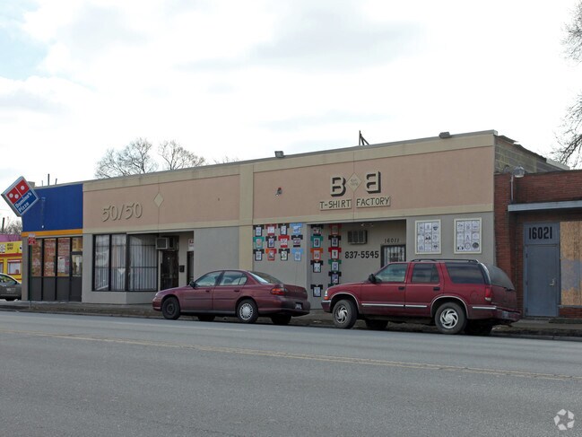
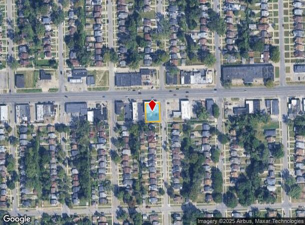
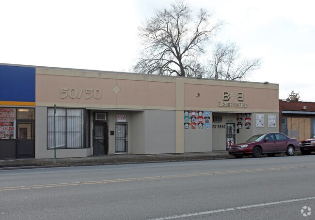
Property Record
16005 W Mcnichols Rd, Detroit, MI 48235
NEARBY LISTINGS FOR SALE OR LEASE
Property Detail
16005 W Mcnichols Rd
22-0130189
Palmer Field
Storebuilding
S--W MC NICHOLS S 105 FT 98&99 PALMER FIELD SUB L37 P7 PLATS, W C R 22/8 81 X 105
X
Wayne
26163C0100E
Michigan
2024
0.20 AC
2025
Detroit W of Woodward
542100
Detroit
5,169 SF
Detroit-Warren-Dearborn, MI
DEMOGRAPHICS near 16005 W Mcnichols Rd
1 Mile
3 Mile
5 Mile
2024 Total Population
21,039
159,403
394,510
2029 Population
20,388
156,242
389,681
Pop Growth 2024-2029
(3.09%)
(1.98%)
(1.22%)
Average Age
40
39
39
2024 Total Households
8,318
62,037
158,432
HH Growth 2024-2029
(3.19%)
(2.07%)
(1.23%)
Median Household Inc
$36,566
$39,714
$42,446
Avg Household Size
2.50
2.50
2.40
2024 Avg HH Vehicles
1.00
1.00
1.00
Median Home Value
$84,224
$84,453
$103,254
Median Year Built
1951
1950
1951
Nearby Places
- Restaurants
- Banks
- Shops
- Fitness
- Groceries
PUBLIC TRANSPORTATION
COMMUTER RAIL
Royal Oak Amtrak (Wolverine - Amtrak)
DRIVE
WALK
Distance
Royal Oak Amtrak (Wolverine - Amtrak)
17 min
8.4 mi
Detroit (Wolverine - Amtrak)
DRIVE
WALK
Distance
Detroit (Wolverine - Amtrak)
15 min
8.7 mi
AIRPORT
Windsor International
DRIVE
WALK
Distance
Windsor International
40 min
21.0 mi
Detroit Metro Wayne County
DRIVE
WALK
Distance
Detroit Metro Wayne County
34 min
21.8 mi
Freight Ports
Port of Toledo
DRIVE
WALK
Distance
Port of Toledo
83 min
63.9 mi
Nearby Properties
Address
Land Use
TOTAL SIZE
Lot Size
Zoning
Address
Land Use
TOTAL SIZE
Lot Size
Zoning
925,367 SF
12.82 AC
R6
Address
Land Use
TOTAL SIZE
Lot Size
Zoning
1,211,148 SF
69.13 AC
M4
Address
Land Use
TOTAL SIZE
Lot Size
Zoning
300,830 SF
54 AC
LI
Address
Land Use
TOTAL SIZE
Lot Size
Zoning
273,000 SF
17.31 AC
LI
Address
Land Use
TOTAL SIZE
Lot Size
Zoning
202,736 SF
20 AC
PD
Address
Land Use
TOTAL SIZE
Lot Size
Zoning
10.32 AC
LI
Address
Land Use
TOTAL SIZE
Lot Size
Zoning
133,544 SF
19.65 AC
ERO
Address
Land Use
TOTAL SIZE
Lot Size
Zoning
143,700 SF
3.27 AC
PD
Address
Land Use
TOTAL SIZE
Lot Size
Zoning
163,661 SF
8.92 AC
PD
Address
Land Use
TOTAL SIZE
Lot Size
Zoning
165,829 SF
5.56 AC
R5
Address
Land Use
TOTAL SIZE
Lot Size
Zoning
97.05 AC
RS
Address
Land Use
TOTAL SIZE
Lot Size
Zoning
200 SF
12.69 AC
RM
Address
Land Use
TOTAL SIZE
Lot Size
Zoning
54,672 SF
1.37 AC
R6
Address
Land Use
TOTAL SIZE
Lot Size
Zoning
104,567 SF
2.14 AC
PD
Address
Land Use
TOTAL SIZE
Lot Size
Zoning
116,790 SF
5.86 AC
R4
Address
Land Use
TOTAL SIZE
Lot Size
Zoning
107,914 SF
6.41 AC
B-2
Address
Land Use
TOTAL SIZE
Lot Size
Zoning
90,958 SF
11.78 AC
R5
Address
Land Use
TOTAL SIZE
Lot Size
Zoning
Address
Land Use
TOTAL SIZE
Lot Size
Zoning
93,329 SF
2.07 AC
ERO
Address
Land Use
TOTAL SIZE
Lot Size
Zoning
Address
Land Use
TOTAL SIZE
Lot Size
Zoning
63,216 SF
2.87 AC
R5
Address
Land Use
TOTAL SIZE
Lot Size
Zoning
66,870 SF
2.77 AC
Address
Land Use
TOTAL SIZE
Lot Size
Zoning
100,373 SF
5.65 AC
R4
Address
Land Use
TOTAL SIZE
Lot Size
Zoning
315,973 SF
12.18 AC
M4
Address
Land Use
TOTAL SIZE
Lot Size
Zoning
81,031 SF
8.15 AC
PD
Address
Land Use
TOTAL SIZE
Lot Size
Zoning
64,566 SF
3.64 AC
PD
Address
Land Use
TOTAL SIZE
Lot Size
Zoning
128,759 SF
8.85 AC
LI
Address
Land Use
TOTAL SIZE
Lot Size
Zoning
65,576 SF
7.84 AC
B3
Address
Land Use
TOTAL SIZE
Lot Size
Zoning
248,737 SF
22.02 AC
AI
Address
Land Use
TOTAL SIZE
Lot Size
Zoning
127,680 SF
3.90 AC
ERO
The World's #1 Commercial Real Estate Marketplace
Connect with us
© 2025 CoStar Group
The information above has been obtained from sources believed reliable. While we do not doubt its accuracy we have not verified it and make no guarantee, warranty or representation about it. It is your responsibility to independently confirm its accuracy and completeness. Any projections, opinions, assumptions, or estimates used are for example only and do not represent the current or future performance of the property. The value of this transaction to you depends on tax and other factors which should be evaluated by your tax, financial, and legal advisors. You and your advisors should conduct a careful, independent investigation of the property to determine to your satisfaction the suitability of the property for your needs.