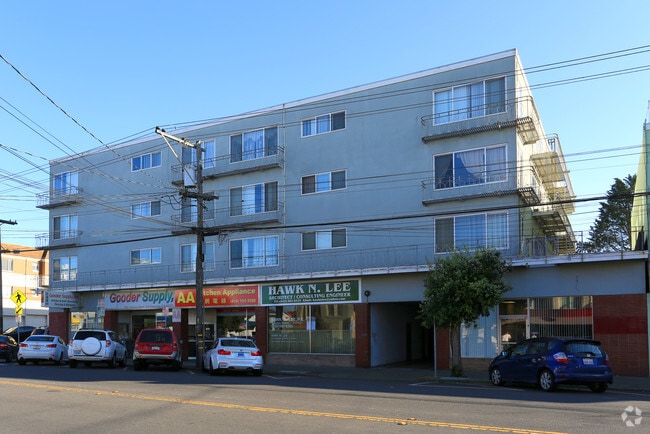
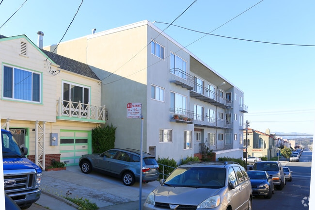
Property Record
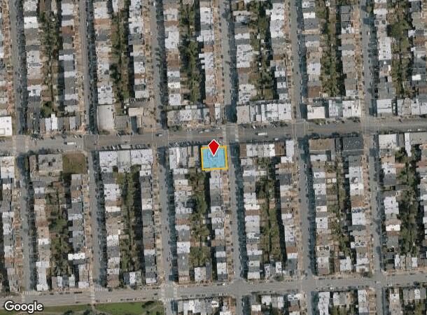
1601 Noriega St, San Francisco, CA 94122
Current Lease Availabilities
NEARBY LISTINGS FOR SALE OR LEASE
Property Detail
1601 Noriega St
San Francisco-Redwood City-South San Francisco, CA
Outside Land Bl 934
2060-051
San Francisco
Retailwithmorethanonenonretailuse
California
2024
51
2025
0.23 AC
032802
Central Sunset
22,675 SF
San Francisco
DEMOGRAPHICS near 1601 Noriega St
1 Mile
3 Mile
5 Mile
2024 Total Population
50,870
316,367
779,674
2029 Population
46,516
291,817
721,753
Pop Growth 2024-2029
(8.56%)
(7.76%)
(7.43%)
Average Age
44
43
43
2024 Total Households
18,836
127,826
322,606
HH Growth 2024-2029
(9.06%)
(8.19%)
(7.81%)
Median Household Inc
$134,331
$142,422
$123,798
Avg Household Size
2.60
2.40
2.30
2024 Avg HH Vehicles
2.00
1.00
1.00
Median Home Value
$1,124,799
$1,116,715
$1,094,939
Median Year Built
1946
1947
1948
Nearby Places
Map Layers
Map Styles
 Street
 Aerial
- Restaurants
- Banks
- Shops
- Fitness
- Groceries
PUBLIC TRANSPORTATION
TRANSIT/SUBWAY
Judah St & 23Rd Ave (JUDAH - San Francisco Municipal Railway (MUNI Metro), N Judah - San Francisco Municipal Railway (MUNI Metro))
DRIVE
WALK
Distance
Judah St & 23Rd Ave (JUDAH - San Francisco Municipal Railway (MUNI Metro), N Judah - San Francisco Municipal Railway (MUNI Metro))
2 min
10 min
0.5 mi
Judah And 22Nd Avenue (JUDAH - San Francisco Municipal Railway (MUNI Metro), N Judah - San Francisco Municipal Railway (MUNI Metro))
DRIVE
WALK
Distance
Judah And 22Nd Avenue (JUDAH - San Francisco Municipal Railway (MUNI Metro), N Judah - San Francisco Municipal Railway (MUNI Metro))
2 min
11 min
0.6 mi
Judah And 25Th Avenue (N Judah - San Francisco Municipal Railway (MUNI Metro))
DRIVE
WALK
Distance
Judah And 25Th Avenue (N Judah - San Francisco Municipal Railway (MUNI Metro))
2 min
12 min
0.6 mi
Judah St & 25Th Ave (JUDAH - San Francisco Municipal Transportation Agency)
DRIVE
WALK
Distance
Judah St & 25Th Ave (JUDAH - San Francisco Municipal Transportation Agency)
2 min
12 min
0.7 mi
Judah And 19Th Avenue (JUDAH - San Francisco Municipal Railway (MUNI Metro), N Judah - San Francisco Municipal Railway (MUNI Metro))
DRIVE
WALK
Distance
Judah And 19Th Avenue (JUDAH - San Francisco Municipal Railway (MUNI Metro), N Judah - San Francisco Municipal Railway (MUNI Metro))
2 min
14 min
0.8 mi
COMMUTER RAIL
22Nd Street Caltrain Station Southbound (Express - Caltrain (Caltrain), Limited - Caltrain (Caltrain), Local Weekday - Caltrain (Caltrain), Local Weekend - Caltrain (Caltrain))
DRIVE
WALK
Distance
22Nd Street Caltrain Station Southbound (Express - Caltrain (Caltrain), Limited - Caltrain (Caltrain), Local Weekday - Caltrain (Caltrain), Local Weekend - Caltrain (Caltrain))
15 min
6.3 mi
22Nd Street (Caltrain - Caltrain (Caltrain))
DRIVE
WALK
Distance
22Nd Street (Caltrain - Caltrain (Caltrain))
15 min
6.3 mi
AIRPORT
San Francisco International
DRIVE
WALK
Distance
San Francisco International
24 min
13.7 mi
Metro Oakland International
DRIVE
WALK
Distance
Metro Oakland International
42 min
25.0 mi
Freight Ports
Port of San Francisco
DRIVE
WALK
Distance
Port of San Francisco
18 min
7.5 mi
Nearby Properties
Address
Land Use
TOTAL SIZE
Lot Size
Zoning
Address
Land Use
TOTAL SIZE
Lot Size
Zoning
411,904 SF
21.74 AC
C2
Address
Land Use
TOTAL SIZE
Lot Size
Zoning
718 SF
18.55 AC
RH2
Address
Land Use
TOTAL SIZE
Lot Size
Zoning
409,895 SF
7.20 AC
RH3
Address
Land Use
TOTAL SIZE
Lot Size
Zoning
2.40 AC
NC3
Address
Land Use
TOTAL SIZE
Lot Size
Zoning
250,843 SF
6.62 AC
NC3
Address
Land Use
TOTAL SIZE
Lot Size
Zoning
17.91 AC
RH-2
Address
Land Use
TOTAL SIZE
Lot Size
Zoning
4.41 AC
RH-3/RM-2
Address
Land Use
TOTAL SIZE
Lot Size
Zoning
905,491 SF
10.27 AC
RM1
Address
Land Use
TOTAL SIZE
Lot Size
Zoning
230,310 SF
0.65 AC
NC3
Address
Land Use
TOTAL SIZE
Lot Size
Zoning
2.03 AC
C2
Address
Land Use
TOTAL SIZE
Lot Size
Zoning
88,900 SF
5.37 AC
NCS
Address
Land Use
TOTAL SIZE
Lot Size
Zoning
11.31 AC
RM2
Address
Land Use
TOTAL SIZE
Lot Size
Zoning
160,983 SF
1.84 AC
NC2
Address
Land Use
TOTAL SIZE
Lot Size
Zoning
90,539 SF
2.28 AC
RH2
Address
Land Use
TOTAL SIZE
Lot Size
Zoning
107,588 SF
1.04 AC
RM1
Address
Land Use
TOTAL SIZE
Lot Size
Zoning
Address
Land Use
TOTAL SIZE
Lot Size
Zoning
70,563 SF
0.42 AC
Address
Land Use
TOTAL SIZE
Lot Size
Zoning
73,491 SF
4.48 AC
C2
Address
Land Use
TOTAL SIZE
Lot Size
Zoning
146,036 SF
0.49 AC
RH3
Address
Land Use
TOTAL SIZE
Lot Size
Zoning
176,000 SF
1.64 AC
C2
Address
Land Use
TOTAL SIZE
Lot Size
Zoning
0.06 AC
UPMKT
Address
Land Use
TOTAL SIZE
Lot Size
Zoning
54,131 SF
1.75 AC
C2
Address
Land Use
TOTAL SIZE
Lot Size
Zoning
50,461 SF
0.43 AC
UPMKT
Address
Land Use
TOTAL SIZE
Lot Size
Zoning
76,000 SF
1.48 AC
RM4
Address
Land Use
TOTAL SIZE
Lot Size
Zoning
1.20 AC
RM1
Address
Land Use
TOTAL SIZE
Lot Size
Zoning
67,500 SF
0.51 AC
Address
Land Use
TOTAL SIZE
Lot Size
Zoning
194,477 SF
11.37 AC
RH1
Address
Land Use
TOTAL SIZE
Lot Size
Zoning
87,525 SF
1.65 AC
RM1
Address
Land Use
TOTAL SIZE
Lot Size
Zoning
205,770 SF
3.37 AC
RM4
Address
Land Use
TOTAL SIZE
Lot Size
Zoning
6.80 AC
RM1
The World's #1 Commercial Real Estate Marketplace
Connect with us
© 2025 CoStar Group
The information above has been obtained from sources believed reliable. While we do not doubt its accuracy we have not verified it and make no guarantee, warranty or representation about it. It is your responsibility to independently confirm its accuracy and completeness. Any projections, opinions, assumptions, or estimates used are for example only and do not represent the current or future performance of the property. The value of this transaction to you depends on tax and other factors which should be evaluated by your tax, financial, and legal advisors. You and your advisors should conduct a careful, independent investigation of the property to determine to your satisfaction the suitability of the property for your needs.