Property Record
1601 E Robur Dr, Sioux Falls, SD 57104


Save to a Folder
{{folder.Name}}
{{folder.ListingIds.length}} Properties
{{folder.ListingIds.length}} Property
Create a New Folder
Property Detail
1601 E Robur Dr
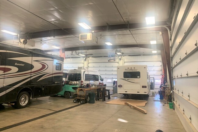
Distributionwarehouseregional
LOCATED ON E443 BLOCK 4 T M JARCS SUBD SW 14 27 102 49 MAPLETON TOWNSHIP BLDGS ON LEASED SITE PARCEL 014530
C;COMMERCI
Minnehaha
C and X Area of minimal flood hazard, usually depicted on FIRMs as above the 500-year flood level.
South Dakota
2025
Sioux Falls
2025
Other Market Areas
010404
Sioux Falls, SD-MN
22,235 SF
15471
NEARBY LISTINGS FOR SALE OR LEASE
-
-
View all Sioux Falls listings for sale on LoopNet.com
DEMOGRAPHICS near 1601 E Robur Dr
1 mile
3 mile
5 mile
2025 Total Population
1,313
5,942
61,139
2030 Population
1,390
6,179
64,394
Pop Growth 2025-2030
+ 5.86%
+ 3.99%
+ 5.32%
Average Age
42
42
38
2025 Total Households
528
2,418
25,326
HH Growth 2025-2030
+ 6.06%
+ 4.05%
+ 5.78%
Median Household Inc
$97,465
$63,738
$62,810
Avg Household Size
2.50
2.40
2.30
2025 Avg HH Vehicles
2.00
2.00
2.00
Median Home Value
$291,984
$217,842
$245,704
Median Year Built
1996
1988
1980
Nearby Places
Map Layers
Map Styles
 Street
 Aerial
Layers
 Traffic
 Biking
Places
Listings with unknown addresses are not visible on the map
- Restaurants
- Banks
- Shops
- Fitness
- Groceries
PUBLIC TRANSPORTATION
AIRPORT
Joe Foss Field
Drive
Walk
Distance
Joe Foss Field
10 min
3.4 mi
SALE & LEASE HISTORY
LISTING DATE
SALE/LEASE

Dec 12, 2019
For Sale
Nearby Properties
Address
Land Use
TOTAL SIZE
Lot Size
Zoning
Address
Land Use
TOTAL SIZE
Lot Size
Zoning
349,950 SF
32.99 AC
Address
Land Use
TOTAL SIZE
Lot Size
Zoning
5,725 SF
77.41 AC
Address
Land Use
TOTAL SIZE
Lot Size
Zoning
227,743 SF
90.58 AC
Address
Land Use
TOTAL SIZE
Lot Size
Zoning
212,076 SF
41.01 AC
FP;FP
Address
Land Use
TOTAL SIZE
Lot Size
Zoning
50,160 SF
24.88 AC
Address
Land Use
TOTAL SIZE
Lot Size
Zoning
Address
Land Use
TOTAL SIZE
Lot Size
Zoning
123,441 SF
14.41 AC
Address
Land Use
TOTAL SIZE
Lot Size
Zoning
15,000 SF
29.88 AC
Address
Land Use
TOTAL SIZE
Lot Size
Zoning
205,572 SF
22.50 AC
Address
Land Use
TOTAL SIZE
Lot Size
Zoning
33,416 SF
9.87 AC
Address
Land Use
TOTAL SIZE
Lot Size
Zoning
173,905 SF
10 AC
Address
Land Use
TOTAL SIZE
Lot Size
Zoning
239,450 SF
21.92 AC
NO;SPECIAL
Address
Land Use
TOTAL SIZE
Lot Size
Zoning
124,103 SF
28.18 AC
Address
Land Use
TOTAL SIZE
Lot Size
Zoning
127,500 SF
13.04 AC
Address
Land Use
TOTAL SIZE
Lot Size
Zoning
85,272 SF
4.83 AC
Address
Land Use
TOTAL SIZE
Lot Size
Zoning
1,806 SF
170.92 AC
FP;FP
Address
Land Use
TOTAL SIZE
Lot Size
Zoning
120,000 SF
13.08 AC
Address
Land Use
TOTAL SIZE
Lot Size
Zoning
133,119 SF
12.89 AC
Address
Land Use
TOTAL SIZE
Lot Size
Zoning
12,454 SF
13.30 AC
Address
Land Use
TOTAL SIZE
Lot Size
Zoning
212,500 SF
12 AC
Address
Land Use
TOTAL SIZE
Lot Size
Zoning
111,105 SF
9.65 AC
NO;SPECIAL
Address
Land Use
TOTAL SIZE
Lot Size
Zoning
95,002 SF
8.32 AC
Address
Land Use
TOTAL SIZE
Lot Size
Zoning
56,000 SF
21.37 AC
Address
Land Use
TOTAL SIZE
Lot Size
Zoning
137,424 SF
13.59 AC
Address
Land Use
TOTAL SIZE
Lot Size
Zoning
120,000 SF
8.99 AC
Address
Land Use
TOTAL SIZE
Lot Size
Zoning
53,836 SF
11.98 AC
Address
Land Use
TOTAL SIZE
Lot Size
Zoning
32,734 SF
7.46 AC
Address
Land Use
TOTAL SIZE
Lot Size
Zoning
60,680 SF
6.29 AC
Address
Land Use
TOTAL SIZE
Lot Size
Zoning
54,043 SF
13.39 AC
Address
Land Use
TOTAL SIZE
Lot Size
Zoning
49,400 SF
4.79 AC
The World's #1 Commercial Real Estate Marketplace
Connect with us
© 2026 CoStar Group
The information above has been obtained from sources believed reliable. While we do not doubt its accuracy we have not verified it and make no guarantee, warranty or representation about it. It is your responsibility to independently confirm its accuracy and completeness. Any projections, opinions, assumptions, or estimates used are for example only and do not represent the current or future performance of the property. The value of this transaction to you depends on tax and other factors which should be evaluated by your tax, financial, and legal advisors. You and your advisors should conduct a careful, independent investigation of the property to determine to your satisfaction the suitability of the property for your needs.