Property Record
1601 Highway 52, Moncks Corner, SC 29461


Property Detail
1601 Highway 52
162-00-01-028
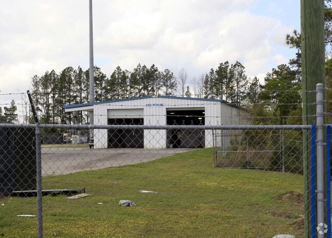
ASSESSMENT DISTRICT: 972CAR DEALERSHIP (OFFICE)SEC14PG29TRACTS A B C & D
Vehiclerentalsvehiclesales
Berkeley
BERKELEY C
South Carolina
B and X Area of moderate flood hazard, usually the area between the limits of the 100-year and 500-year floods.
12.58 AC
2025
Outlying Berkeley County
2025
Charleston/N Charleston
020505
Charleston-North Charleston, SC
20,730 SF
NEARBY LISTINGS FOR SALE OR LEASE
-
-
View all Moncks Corner listings for sale on LoopNet.com
DEMOGRAPHICS near 1601 Highway 52
1 mile
3 mile
5 mile
2025 Total Population
3,698
18,360
38,408
2030 Population
4,169
20,767
43,791
Pop Growth 2025-2030
+ 12.74%
+ 13.11%
+ 14.02%
Average Age
35
38
38
2025 Total Households
1,197
6,560
13,728
HH Growth 2025-2030
+ 13.12%
+ 13.63%
+ 14.40%
Median Household Inc
$87,585
$74,805
$86,940
Avg Household Size
3.00
2.70
2.70
2025 Avg HH Vehicles
2.00
2.00
2.00
Median Home Value
$320,383
$291,437
$342,112
Median Year Built
2006
1999
2005
Nearby Places
Map Layers
Map Styles
 Street
 Aerial
Layers
 Traffic
 Biking
Places
Listings with unknown addresses are not visible on the map
- Restaurants
- Banks
- Shops
- Fitness
- Groceries
PUBLIC TRANSPORTATION
AIRPORT
Charleston AFB/International
Drive
Walk
Distance
Charleston AFB/International
33 min
22.6 mi
Freight Ports
North Charleston Terminal
Drive
Walk
Distance
North Charleston Terminal
27 min
20.9 mi
Nearby Properties
Address
Land Use
TOTAL SIZE
Lot Size
Zoning
Address
Land Use
TOTAL SIZE
Lot Size
Zoning
615,000 SF
85.05 AC
Address
Land Use
TOTAL SIZE
Lot Size
Zoning
96,375 SF
49.17 AC
MONCKS COR
Address
Land Use
TOTAL SIZE
Lot Size
Zoning
93,800 SF
15 AC
BERKELEY C
Address
Land Use
TOTAL SIZE
Lot Size
Zoning
3,000 SF
130.80 AC
Address
Land Use
TOTAL SIZE
Lot Size
Zoning
29,018 SF
4.18 AC
MONCKS COR
Address
Land Use
TOTAL SIZE
Lot Size
Zoning
67,440 SF
6.25 AC
MONCKS COR
Address
Land Use
TOTAL SIZE
Lot Size
Zoning
46,980 SF
10.35 AC
MONCKS COR
Address
Land Use
TOTAL SIZE
Lot Size
Zoning
20,230 SF
27.51 AC
MONCKS COR
Address
Land Use
TOTAL SIZE
Lot Size
Zoning
116,572 SF
12.37 AC
MONCKS COR
Address
Land Use
TOTAL SIZE
Lot Size
Zoning
49,283 SF
3.45 AC
MONCKS COR
Address
Land Use
TOTAL SIZE
Lot Size
Zoning
4,000 SF
12.83 AC
BERKELEY C
Address
Land Use
TOTAL SIZE
Lot Size
Zoning
6,308 SF
6.14 AC
BERKELEY C
Address
Land Use
TOTAL SIZE
Lot Size
Zoning
52,032 SF
7.15 AC
MONCKS COR
Address
Land Use
TOTAL SIZE
Lot Size
Zoning
37,921 SF
6.05 AC
MONCKS COR
Address
Land Use
TOTAL SIZE
Lot Size
Zoning
219.80 AC
BERKELEY C
Address
Land Use
TOTAL SIZE
Lot Size
Zoning
2,976 SF
9.27 AC
MONCKS COR
Address
Land Use
TOTAL SIZE
Lot Size
Zoning
46.46 AC
BERKELEY C
Address
Land Use
TOTAL SIZE
Lot Size
Zoning
21,420 SF
1.99 AC
MONCKS COR
Address
Land Use
TOTAL SIZE
Lot Size
Zoning
1,131 SF
22 AC
Address
Land Use
TOTAL SIZE
Lot Size
Zoning
4,830 SF
1.31 AC
MONCKS COR
Address
Land Use
TOTAL SIZE
Lot Size
Zoning
360 SF
52.22 AC
MONCKS COR
Address
Land Use
TOTAL SIZE
Lot Size
Zoning
28.01 AC
MONCKS COR
Address
Land Use
TOTAL SIZE
Lot Size
Zoning
3,000 SF
154.36 AC
MONCKS COR
Address
Land Use
TOTAL SIZE
Lot Size
Zoning
31,920 SF
9.71 AC
BERKELEY C
Address
Land Use
TOTAL SIZE
Lot Size
Zoning
38,976 SF
18.29 AC
MONCKS COR
Address
Land Use
TOTAL SIZE
Lot Size
Zoning
20,528 SF
5.30 AC
MONCKS COR
Address
Land Use
TOTAL SIZE
Lot Size
Zoning
17.60 AC
MONCKS COR
Address
Land Use
TOTAL SIZE
Lot Size
Zoning
26,740 SF
2.86 AC
MONCKS COR
Address
Land Use
TOTAL SIZE
Lot Size
Zoning
265.88 AC
BERKELEY C
The World's #1 Commercial Real Estate Marketplace
Connect with us
© 2026 CoStar Group
The information above has been obtained from sources believed reliable. While we do not doubt its accuracy we have not verified it and make no guarantee, warranty or representation about it. It is your responsibility to independently confirm its accuracy and completeness. Any projections, opinions, assumptions, or estimates used are for example only and do not represent the current or future performance of the property. The value of this transaction to you depends on tax and other factors which should be evaluated by your tax, financial, and legal advisors. You and your advisors should conduct a careful, independent investigation of the property to determine to your satisfaction the suitability of the property for your needs.